In brief: We’re continuing to track the potential for heavy rainfall in the greater Houston area due to a tropical system in the southern Gulf of Mexico. Whether or not it becomes Tropical Storm Alberto, the effects will be the same for Houston. We now think the period of Tuesday afternoon through the middle of Wednesday will have the highest chance for heavy rainfall.
On Monday afternoon the National Hurricane Center said it would begin issuing forecasts for a “potential tropical cyclone” in the southern Gulf of Mexico. This is the tropical system that we’ve been talking about for several days now. This action indicates that hurricane center forecasters believe the system is likely to become a tropical depression or storm (it would be named Alberto) in the next day, but it has yet to do so.

In truth, this changes virtually nothing about the forecast for elevated easterly winds, higher seas, and heavy rainfall that Houston will experience over the next couple of days. The purpose of this post is to attempt to set some expectations in terms of timing of the worst of the rainfall. Tropical weather is inherently unpredictable, but now that we’re closing in on Tuesday and Wednesday, our confidence is a little bit higher. Emphasis on a little.
Monday evening and overnight
As expected we’ve seen scattered showers and a few thunderstorms today, and generally I expect this pattern to continue this evening and overnight. These storms should pose no threats for flooding risks beyond putting a damper on outdoor activities.
Tuesday
Generally, I expect Tuesday morning will not bring anything too crazy in terms of sustained heavy rain. However, by around noon or shortly after that it appears a deeper slug of tropical moisture will move inland into the upper Texas coast. This is when we expect the development of more widespread showers, especially along and south of Interstate 10. The heaviest rain is likely to fall closer to the coast, because that is the source of the moisture. It is too early to say whether heavy rainfall on Tuesday afternoon and evening will impact commute home, but it’s a distinct possibility.
Tuesday night and Wednesday
Our modeling continues to suggest that the heaviest rainfall will arrive later on Tuesday, and persist through Tuesday night through much of the day on Wednesday. By Wednesday evening or night, it does appear that the the worst of the rains will be exiting to our west.
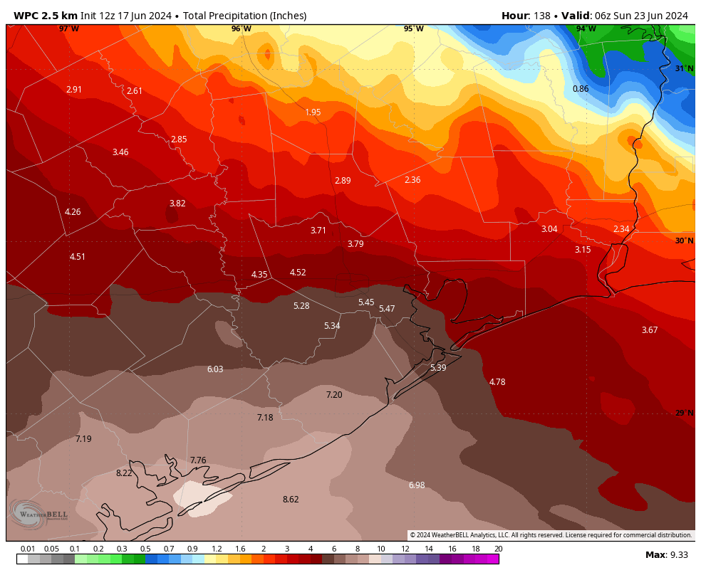
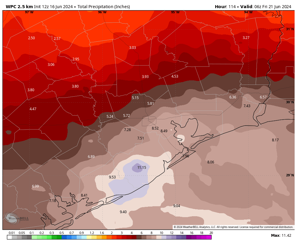
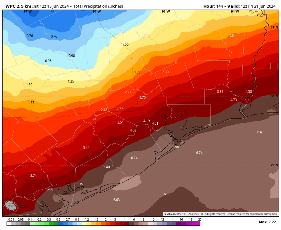
I’m hesitant to speak about accumulations with too much certainty. There continues to be a lot of noise in the models about what to expect. There are some scenarios in which the bulk of the heavy rainfall goes south of Houston (and Galveston) on Tuesday and Wednesday. In this case the region (even coastal regions) might pick up only a handful of inches of rainfall—totally manageable.
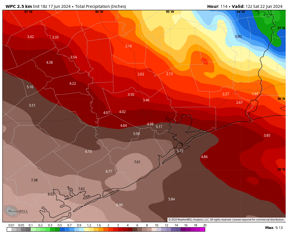
However, I would rate as slightly more likely the possibility that the southern half of the Houston region picks up 4 to 8 inches of rainfall through Wednesday, with higher isolated amounts. This, obviously, would create some flooding issues and is the reason why we’ve instituted (and maintained) a Stage 2 flood alert for the entire region through Wednesday.
The thing with tropical rain is that it comes in bunches. And with this system, we have the very real possibility that at least some portions of our area will see sustained tropical rainfall during the next 48 hours. So please be prepared for that possibility.
Our next update will be posted early on Tuesday morning.