In brief: We’re continuing to follow the possibility of heavy rainfall next week in the greater Houston area, especially for coastal areas. We’re still far from having all of the details, but we know enough to take the threat seriously.
Weekend outlook
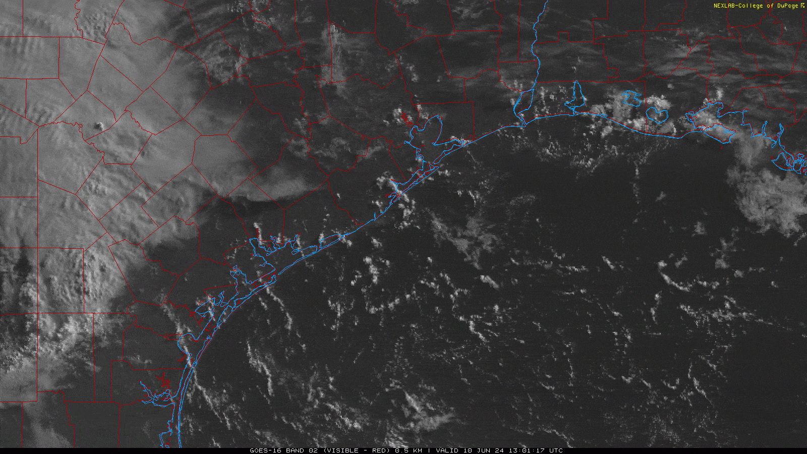
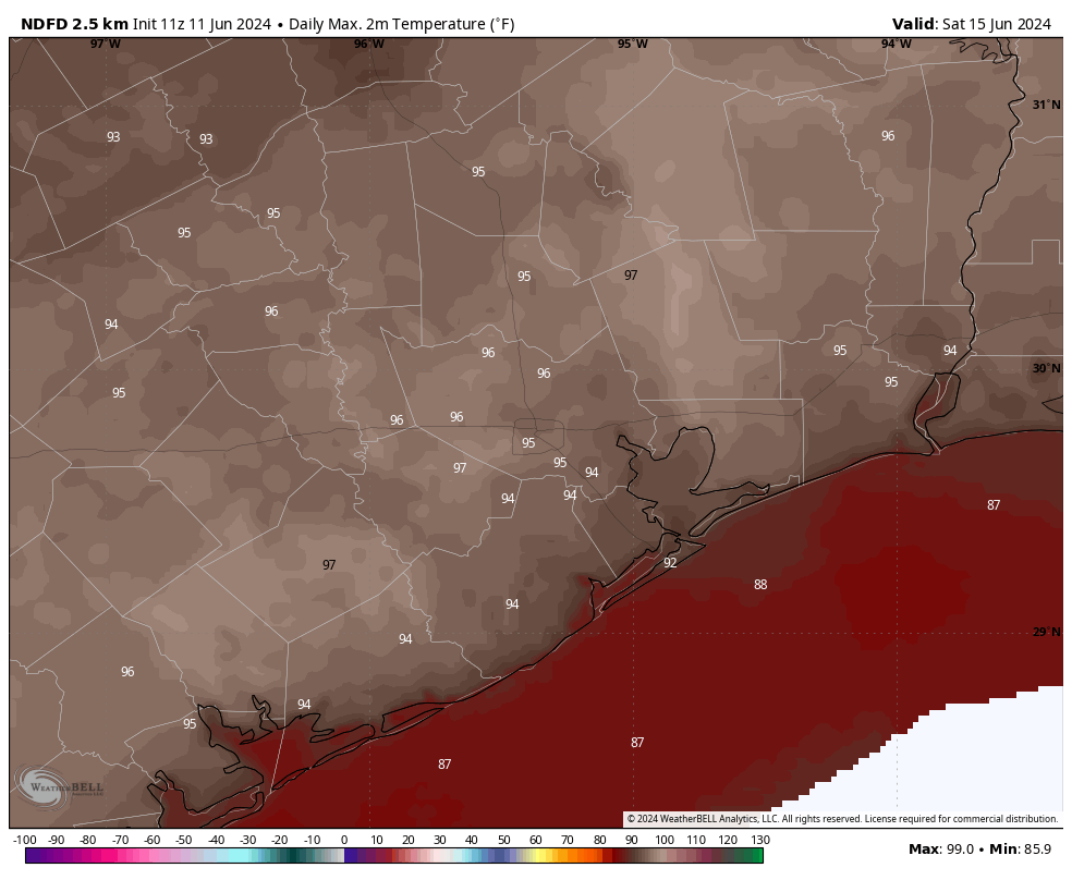
Happy Saturday, everyone. If sunshine and heat are your jam, you’re in luck this weekend. Today, especially, will bring brilliant blue skies and temperatures in the mid-90s. There may be a few clouds tomorrow, but I still expect mostly sunny skies on Sunday, with high temperatures in the low- to mid-90s. It’s possible we’ll see a few isolated showers and thunderstorms during the afternoon and evening hours on Sunday, but most of us will simply be sunny and warm.
And then it won’t be.
Next week
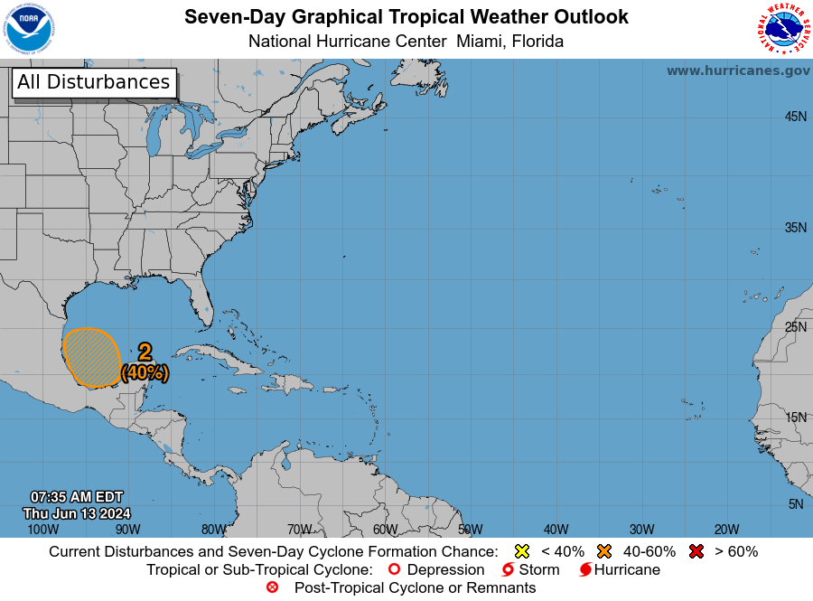
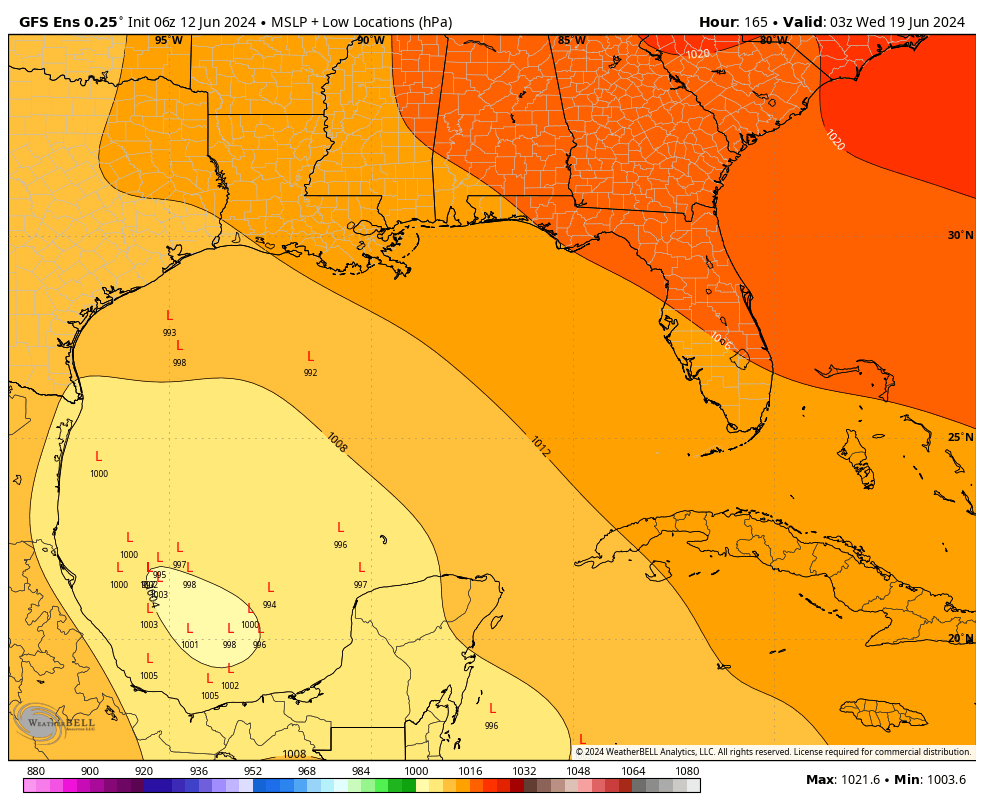
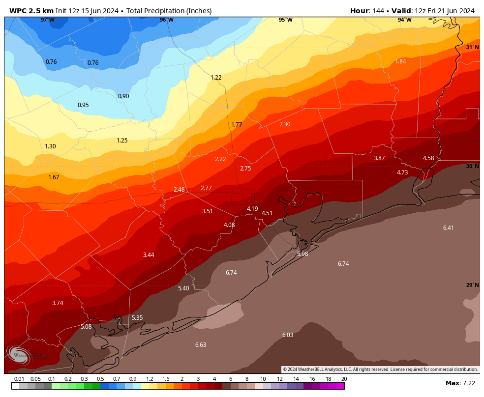
The overall pattern appears unsettled for most of next week, with a very healthy chance of showers each day, and the middle of the week especially concerning. A low pressure system over the southern Gulf of Mexico will help push a large plume of tropical moisture into Texas and Louisiana. This threat of heavy rainfall next week will materialize whether the low in the southern Gulf becomes a tropical depression or storm. In fact, it doesn’t really matter. The table is set, regardless.
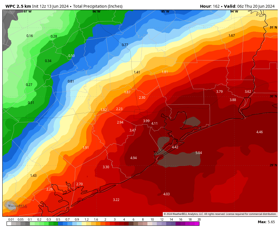
Over the last 24 hours some of our guidance has been showing excessive amounts of rainfall along the Gulf coast, but whether these bullseyes occur over Matagorda Bay, Galveston Bay, Port Arthur, or Southern Louisiana is something we cannot say. In terms of timing, the greatest threat of heavy rainfall likely will come during a period from Tuesday evening through Thursday morning.
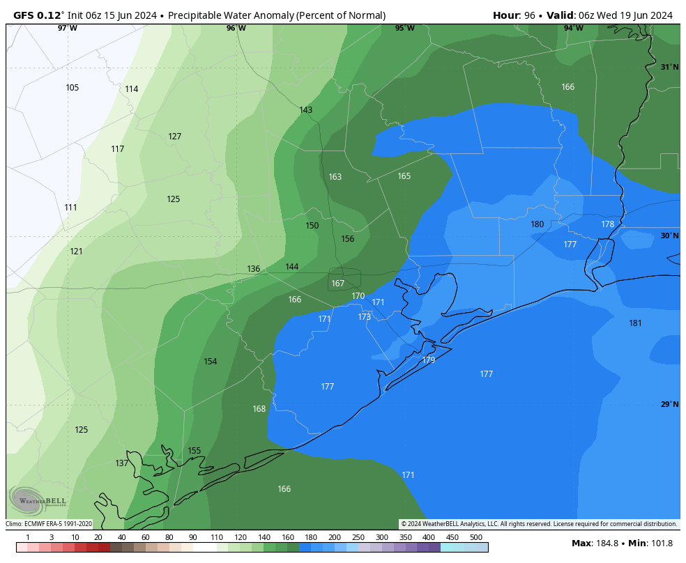
So what does this all mean? If you live inland of Interstate 10, the overall risk is lower. Most of these areas are likely to pick up 2 to 4 inches between Monday and Friday. However, areas along and south of Interstate 10 are likely to see 4 to 6 inches of rainfall next week. Our concern is that some localized areas may see 10 inches or more of rainfall next week given the tropical nature of this rainfall. The expected level of moisture in the atmosphere—a value known as precipitable water—is very high, and such levels are capable of producing high rainfall rates that can quickly flood streets. We don’t know for sure whether this kind of pattern will establish itself over the Houston area, but it is a distinct possibility.
I’m writing all of this on a Saturday morning not to scare you, but rather to prepare you for the possibility of heavy rainfall next week. We will continue to watch this closely, and update this weekend as warranted.