Good morning. Houston will see a brief reprieve from humidity today and tonight as a weak front moves in, stalls, and then moves back across the region. After this we will be warm through Thursday before a stronger front brings substantially colder and drier air into the region. At this vantage point, the weekend looks absolutely sensational.
Monday
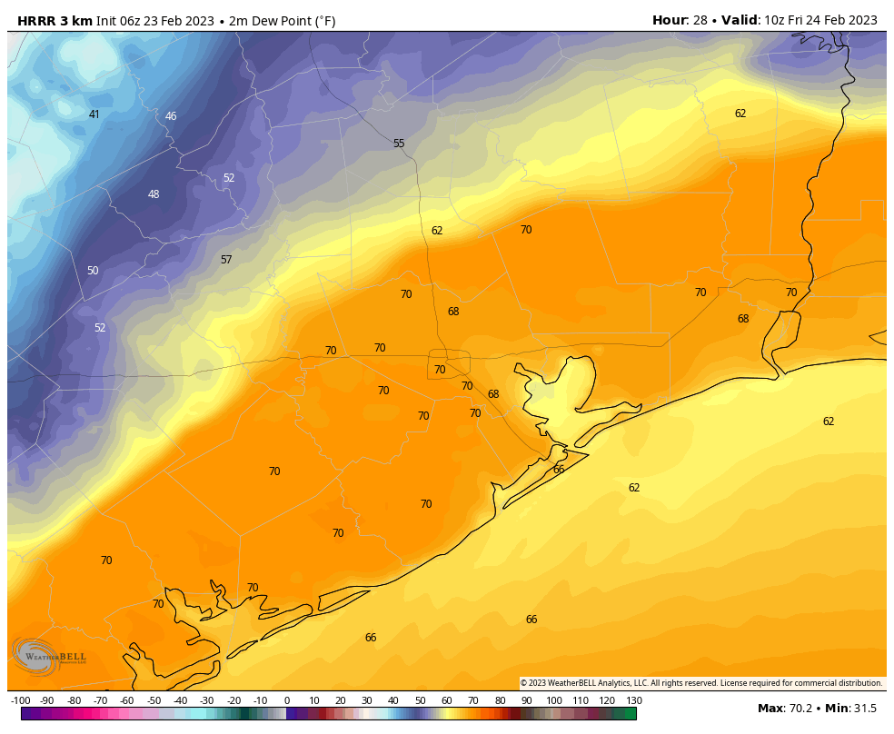
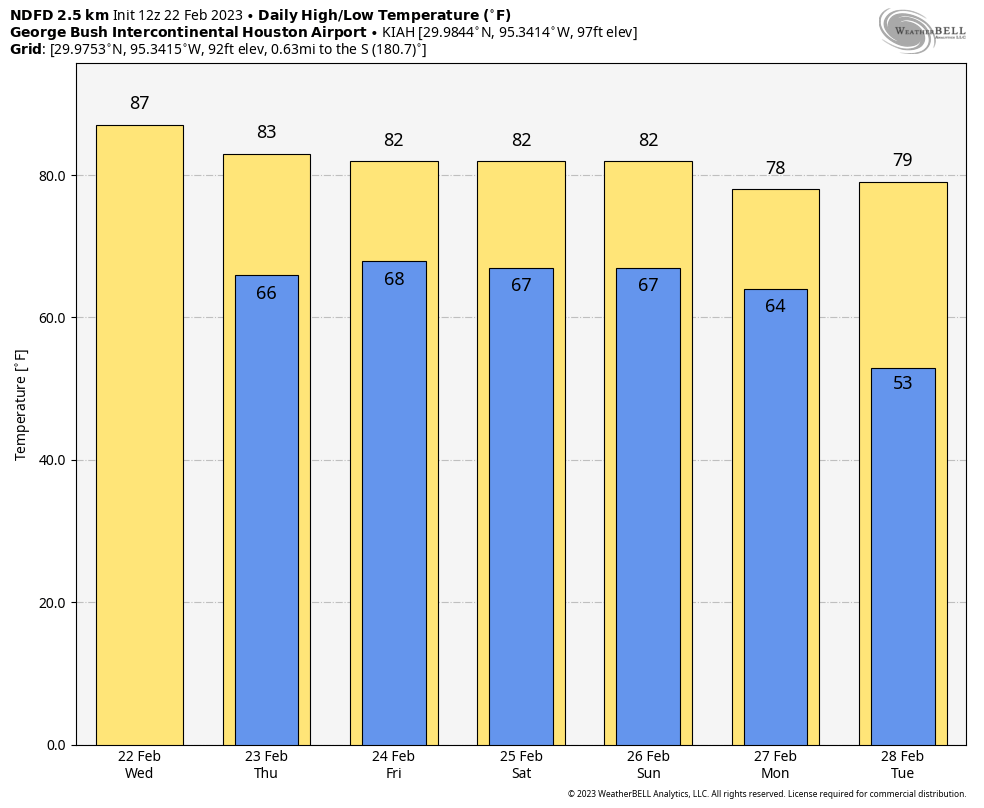
The first front will move down toward the coast by around noon. This front will probably push just offshore, or it may get hung up right along the coast. Either way a very thin line of light showers may accompany the front, and it will usher in some notably drier air—for about 12 hours. That’s because the front will start lifting back north by Monday night or early Tuesday morning. The bottom line is that, the further inland you live, the longer the dry air will last. Most of us will still reach the low 80s today, albeit with less humidity, and Houston proper should drop into the upper 50s tonight before the front lifts back north.
Tuesday
This will be a warm, mostly sunny day with light southerly winds. Look for high temperatures in the low 80s, and overnight lows dropping only to around 70 degrees.
Wednesday
Expect another warm day, although with more clouds building over the area. Southerly winds will also be more pronounced, gusting perhaps to 20 or 25 mph.
Thursday
Our final 80-degree day of the week comes on Thursday, with partly to mostly cloudy skies. A reasonably strong front will arrive sometime later on Thursday, perhaps during the afternoon or evening hours. This is a challenging one to forecast because it looks as though there will be a fairly strong capping inversion in place—that is to say warmer air higher in the atmosphere that prevents moisture near the surface from rising. The bottom line is that if this cap holds in place over the metro area, this mostly likely will be a dry passage. But if the cap breaks, well, storms could be on the menu. Hopefully as we get closer to the front’s passage we can confidently say one way or the other. For now, I’m leaning toward a mostly storm-free passage, but with fairly strong winds Thursday night after the front moves through. Temperatures will drop to around 50 degrees late Thursday night as a result.
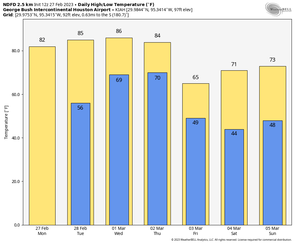
Friday
Expect mostly sunny skies and highs in the mid-60s on Friday. Winds will be breezy from the north, but also lessening the further into the day we get. Lows on Friday night may drop into the mid- to upper-40s in Houston, with cooler conditions inland, and warmer ones near the coast.
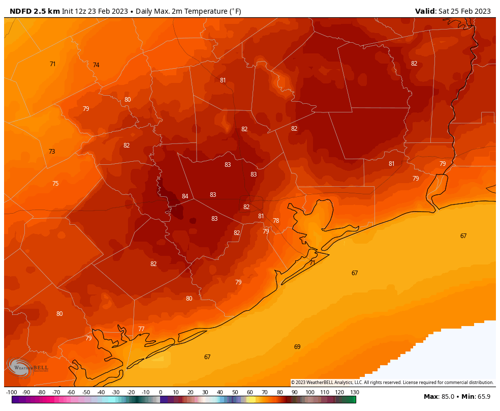
Saturday and Sunday
The forecast for the weekend looks extremely pleasant. We will no doubt have to tweak the details. But for now we’re probably looking at mostly sunny skies and highs in the low 70s. Humidity will be slowly on the rebound, but it should remain mostly at bay through the weekend. This will be one to spend outdoors.