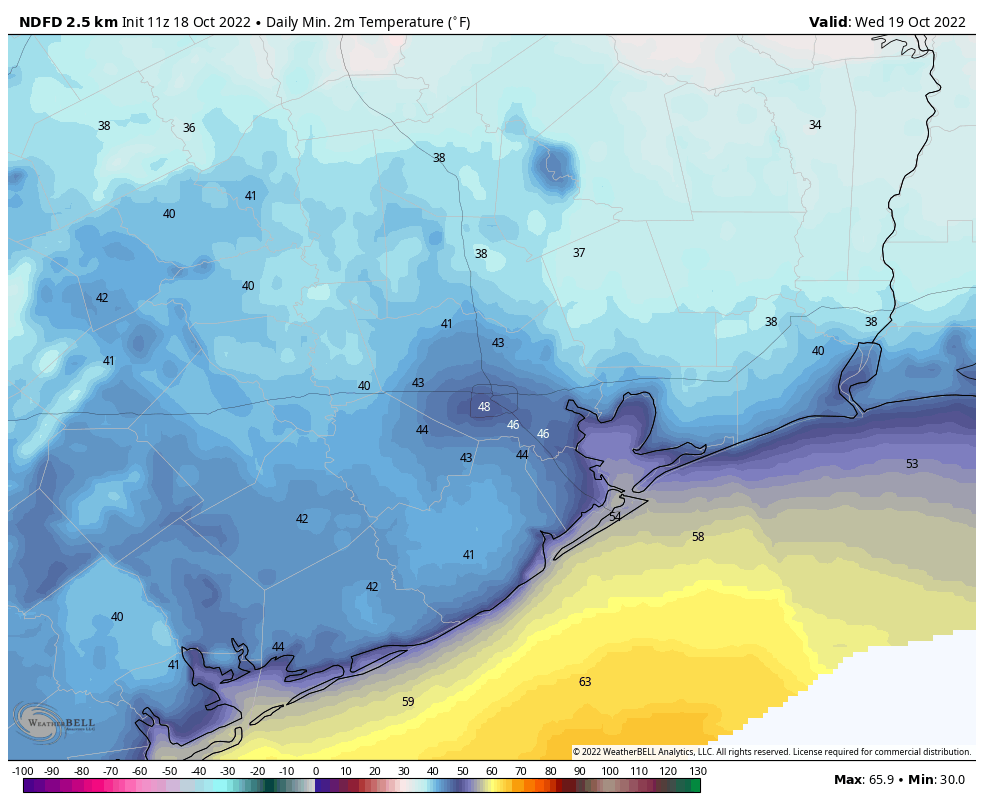
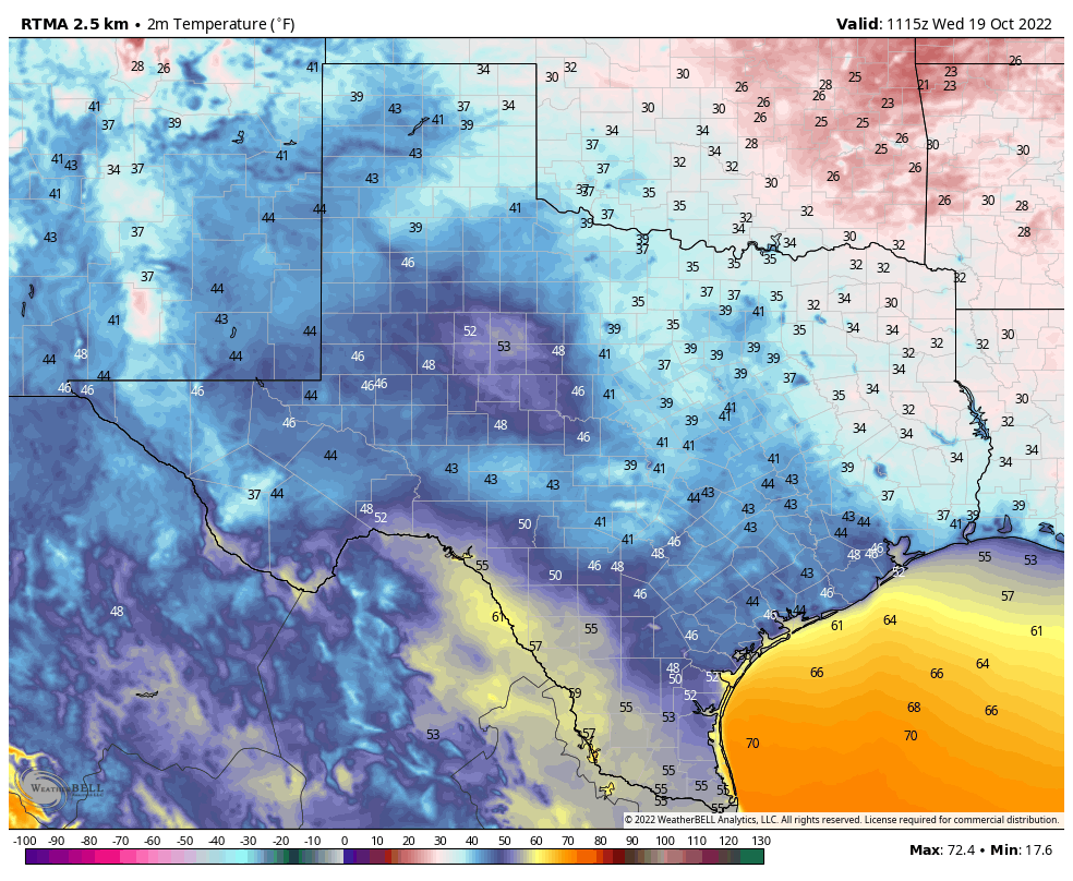
Good morning. Temperatures have generally fallen into the low to mid-40s across much of Houston this morning, with a few colder spots such as the interior of Montgomery County—upper 30s—and a few warmer ones along the coast where lows remain in the low 50s. This will be the coldest morning of the week, but we’ll have one more chilly night before we warm up for the weekend. Next week’s forecast still looks a bit messy, but my expectation is for another front with some rainfall.
Wednesday
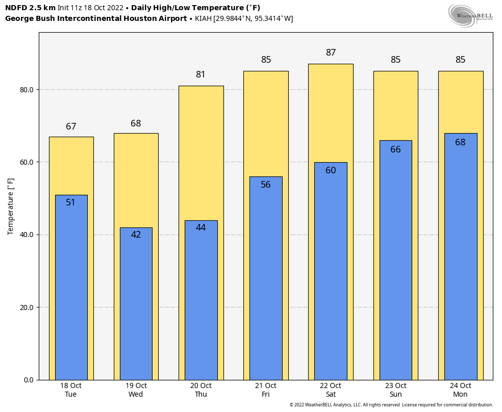
Today will be sunny again, with highs in the upper 60s. Winds will be out of the north at 5 to 10 mph, before turning more southerly later today or tonight. Expect one more chilly night, with lows a couple of degrees warmer than Tuesday night. So again, most of the area should drop into the 40s away from the coast.
Thursday and Friday
As the onshore flow gets going, we’ll start to see a gradual rise in humidity levels, but Thursday should still see pretty dry air. Look for sunny skies and highs in the low 80s, with moderate southerly winds. Lows Thursday night will drop to around 60 degrees. Friday will be warmer, with sunny skies and highs in the mid-80s.
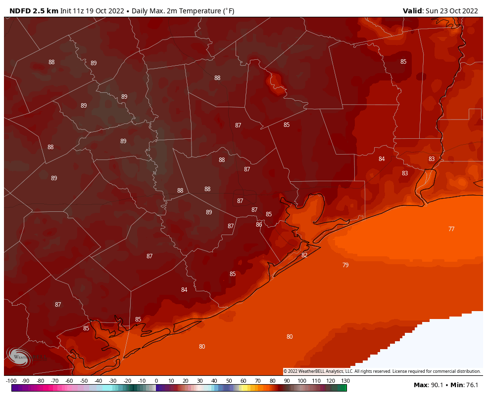
Saturday and Sunday
The weekend looks pretty warm, and it will feel especially so after the cooler weather preceding it. Look for mostly sunny skies and highs in the mid- to upper-80s. Overnight lows will generally drop into the upper 60s. Humidity will be back, it it won’t be full-on summertime humidity. Days will be fairly breezy, with southerly winds likely gusting to 15 to 20 mph.
Next week
We’ll be watching a few things next week including a large trough of low pressure in the atmosphere moving across the plains along with a cold front, and a hurricane in the Pacific Ocean that could transport atmospheric moisture across Mexico and into Texas. While the big picture seems clear the details of the interaction between these weather systems over our area, as of yet, are not.
The bottom line is that I think we can expect to start to see more clouds by Sunday night or Monday, and an increase in rain chances on Monday or Monday night. The front itself will probably arrive on Tuesday or Tuesday night. Alas, how much rain we get, and how much colder and drier air moves in behind the front, remains very much uncertain. My general expectation would be on the order of half an inch of rain and nights in the 50s, but I don’t feel overly confident in that. Sometimes with these kinds of fall-like patterns we see quite a bit of rain, but so far there’s no big signal for that in the models. We shall see.