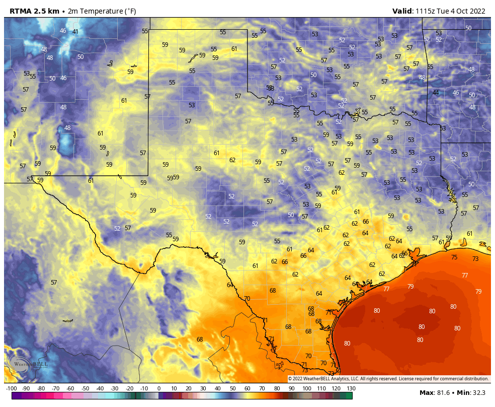
Good morning. Our overall forecast remains more or less on track, with warming conditions ahead of a weak front this weekend, followed by the potential for a stronger front some time later next week. The good news is that while the next seven days or so do look dry, there is a pretty decent chance of some rainfall returning to the forecast by the middle of next week.
Wednesday
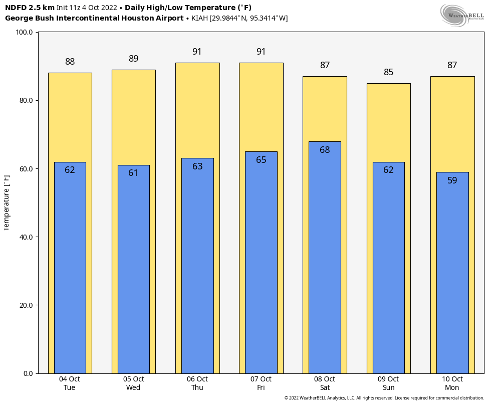
With high pressure more or less in control of our weather, we can expect highs today to reach near 90 degrees, with mostly sunny skies, to go along with light northeasterly winds. Rain chances are virtually zero. Once again, mornings and evenings should be fairly pleasant, with a modicum of drier air still hanging about. Low temperatures tonight will drop into the mid-60s for most of Houston, with slightly cooler conditions inland. If you find yourself sneezing today, it may be due to the ragweed levels, which are very high.
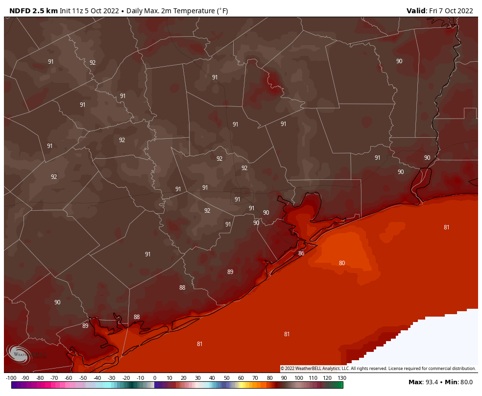
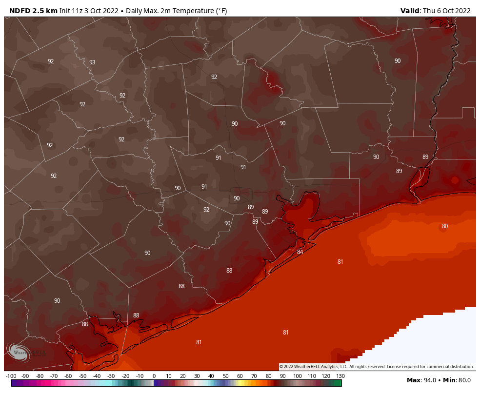
Thursday and Friday
These will be a pair of warm days, with highs reaching about 90 degrees, or a few ticks above, to go along with sunny skies. The air will continue to get a little bit more humid, but nothing like summertime in Houston, so mornings and evenings will still be pretty decent. Lows will drop to around 70 degrees both nights.
Saturday and Sunday
A weak front arrives on Friday night or Saturday morning, but it will be difficult to tell right away. However behind the front more drier air will start to drift in, and this should become noticeable as the humidity drops. Saturday will warm to near 90 degrees, with sunny skies and drier air. Lows will drop into the 60s overnight. Sunday should be sunny and warm, with highs in the mid- to upper-80s. Rain chances, again, are pretty much nil. Plan any and all outdoor activities with confidence, and a measure of sunscreen.
Next week
The dry air is going to hold on through Monday, so expect another pretty nice day, with highs in the 80s and relatively lower humidity. However temperatures and atmospheric moisture levels will then start to rise, such that by Wednesday I bet we’re back to 90 degrees and a fair amount of humidity. What happens after that is still very much up for debate, but the most likely scenario is some combination of healthy rain chances—which my goodness, we certainly need—followed by hopefully a more robust front. That is far from locked into stone, but there’s a decent chance that overnight lows drop into the 50s next weekend.
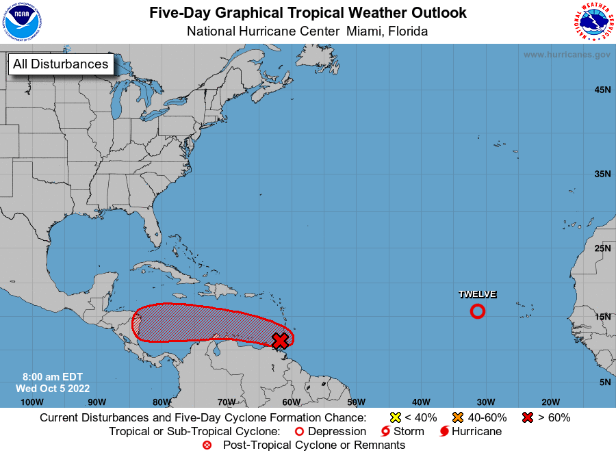
Tropics
Yes, the Texas hurricane season is over. So you can stop reading at this point, if you like. However the overall tropics remain active. In the far Atlantic, Tropical Depression 12 has formed, but it is going to be a weak, short-lived storm everyone can safely ignore. A bit closer to home, another tropical system is likely to become a storm or hurricane as it crosses the southern Caribbean Sea. Eventually it is likely to move into Central America, where it could pose a distinct flooding and wind threat by Sunday or Monday.