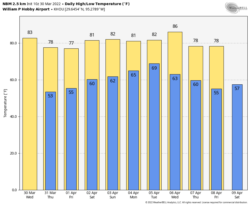
Good morning. Temperatures have dropped into the upper 40s for inland areas, with most of the metro area seeing low 50s this morning. Highs this afternoon will reach the upper 70s, with sunny skies and light winds. For me, this is the kind of very nearly perfect weather we sometimes see during spring and fall in Houston. The only real concern today is tree pollen, but all of the wind and rain on Wednesday should have knocked a lot of that out of the air. In short, if you can spend some time outside today or this evening, you really should do so!
Thursday
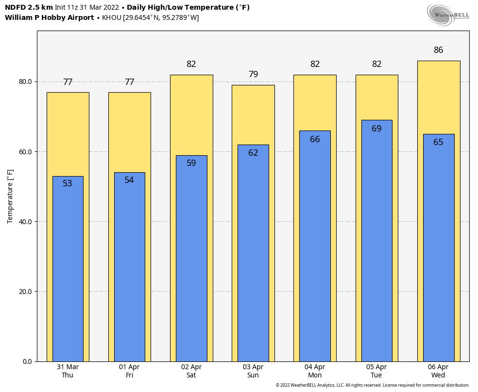
Today started brilliantly. If you were up early this morning, that was Venus shining brightly in the eastern sky, near the horizon before sunrise. With weak high pressure in place, winds today will be light, generally out of the north at 5 mph or so. This will provide a nice contrast from the last several days when we were first buffeted by a strong southerly flow, and then winds quickly shifted to come from the northwest on Wednesday with a cold front. Now things will settle down for awhile. With sunny skies, high temperatures will warm into the upper 70s, and lows tonight should drop to within a degree or two of Wednesday night’s lows. With dewpoints in the low 40s, the air will be pleasantly dry. I mean, come on. On a day like this you could almost forgive Houston’s summer.
Friday
Another day not dissimilar to Thursday, but as light to moderate winds shift to come from the east, we’ll start to see atmospheric moisture levels creep up, and this will generate a few clouds. Highs will again be in the upper 70s, probably, but overnight lows likely won’t drop below 60 degrees in Houston.
Saturday
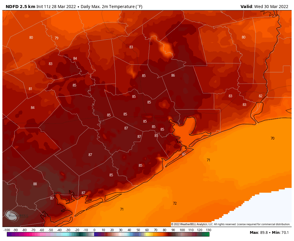
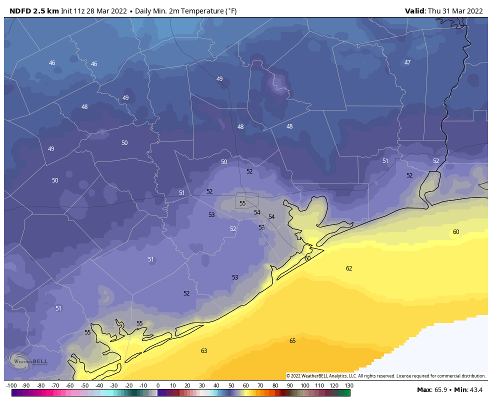
We’ll see a warming trend this weekend as the flow remains southerly, but winds should remain fairly moderate in the 5 to 10 mph range. Highs on Saturday will probably top out between 80 and 85 degrees for most areas, with partly to mostly sunny skies, and slightly sticky dewpoints in the low 60s. Lows on Saturday night should drop to around 60 degrees.
Sunday
Another warmish day, like Saturday, with highs in the 80s, and partly to mostly sunny skies. At some point clouds will start to build in response to increasing atmospheric moisture, but at this point I don’t think that will happen until Sunday afternoon or, more likely Sunday evening. Rain chances this weekend are low, probably 10 percent or less.
Next week
We’ll continue to see warm weather, with temperatures in the mid- to possibly even upper-80s early next week ahead of a cold front arriving later on Tuesday or Wednesday. There are some decent rain chances on Monday night into Tuesday, but right now the forecast models aren’t too enthused about accumulations. We’ll see. At this distant vantage point, the end of next week looks quite nice, with highs in the upper 70s or 80s degrees and drier air. Hopefully the spectacular weather lines up with the weekend!