One more really hot day before a pattern change brings rain chances and cooler weather

Houston now has officially recorded 20 100-degree days this year, which is enough to tie us for fourth all-time for any calendar year. The bad news is that we’re going to see yet another day with widespread triple-digit temperatures across the region today. The good news is that this may be the last one for at least several days with relief on the horizon.

Matt Lanza has been keeping a running tally of 100-degree days on Twitter. (Space City Weather)

Thursday

It will be another scorcher as high pressure drives inland temperatures above 100 degrees, with mostly sunny skies. Winds will be out of the south at about 10 mph, with higher gusts. Like on Wednesday, we’ll see some scattered showers and thunderstorms fire up along the sea breeze, but overall chances are only about 10 or 20 percent. Overnight lows will again struggle to drop below 80 degrees.

Rain chances on Friday for the metro area. (National Weather Service)

Friday

As high pressure retreats, an upper-level low pressure system will help usher in a surge a tropical moisture from the Gulf of Mexico. This will lead to partly to mostly cloudy skies, and bump up rain chances for areas that are either east of Interstate 45, along the coast, or both. We’re talking about a 60 or 70 percent chance of rain for these areas, with lesser chances further inland and westward. Overall accumulations won’t be above a few tenths of an inch for most locations, but some areas should see bullseyes of 1 to 2 inches. Highs will be dependent upon clouds and rain, but should hold in the low-90s for much of the area.

Saturday and Sunday

Both weekend days should see highs in the low- to mid-90s, with mostly sunny skies. Rain chances will remain elevated for coastal areas, especially on Saturday. But we’re not looking at anything approaching a washout as showers will be hit or miss, and should move through quickly.

Next week does not look obscenely hot. (Pivotal Weather)

Next week

This should be, dare I say it, a decent week for August? For the most part we’re going to see high temperatures in the low- to mid-90s, and the most likely outcome is that high pressure does not build back over the region. Rather, we should see enough moisture for at least a 30 percent, if not higher, chance of rain each day. For August, man, I’ll take it.

Two more very hot days before a few cooler and potentially wetter days

High pressure will continue to dominate our weather for a couple of more days before a low-pressure system brings some relief on Friday. Accordingly, instead of highs reaching 100 degrees for much of the region, we should be down in the low- to mid-90s, along with some decent rain chances this weekend.

Wednesday

For today, however, we can expect widespread highs of 100 degrees away from the coast as the Houston region bakes beneath mostly sunny skies. Rain chances are about 20 percent along the coast this afternoon, and perhaps 10 percent for inland areas. Winds will be out of the south at about 10 mph, with higher gusts. The city will struggle to fall below 80 degrees tonight.

High temperatures will generally be 5 to 7 degrees above normal today and Thursday away from the coast. (Weather Bell)

Thursday

More of the same.

Friday

An upper-level low pressure system will move into the area, and this will also bring a surge a tropical moisture. As a result we’re going to see a healthy chance of showers and thunderstorms. I’d put chances for areas east of Interstate 45 as high as 60 or 70 percent, whereas the potential for rain west of the freeway is probably closer to 50 percent. Accumulations will probably average a few tenths of an inch, but there will be pockets of higher totals. As a result of the rain and pattern change, highs on Friday may top out in the low 90s.

Saturday and Sunday

Rain chances of 40 percent, or so, will linger through the weekend but coverage should be less than on Friday. Skies should be partly to mostly sunny, and as a result we can probably expect high temperatures to reach the mid-90s.

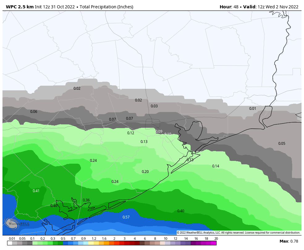
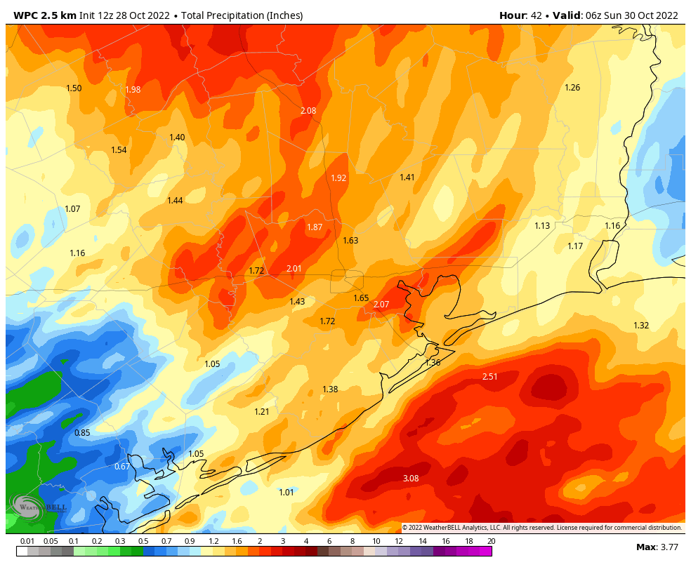
NOAA rain accumulation forecast for now through Sunday. (Weather Bell)

Next week

Most of next week looks to see fairly typical weather for August. Climatologically, early-to-mid August often is the hottest time of year for Houston, so this means highs generally in the mid-90s for Houston, with warmer conditions for inland areas such as College Station. Rain chances won’t be zero, and there’s a chance we could see a mid-week system that will bring us some additional, much-needed rainfall.

Three hot days before some decent rain chances pop up in Houston

Good morning. Houston faces three rather hot days, with high temperatures in the upper 90s to 100 degrees, before a pattern change heading into the weekend. Friday and Saturday should bring fairly healthy rain chances, although showers will likely still be hit or miss for the region. Most of next week should bring typical August-like weather.

Tuesday

High pressure is starting to build back over the region, and will do so for the next three days. If you’ve been paying attention during June and July of this summer, you’ll understand what that means: sunny skies and hot temperatures. Highs today will range from the low 100s for areas well inland, to upper 90s in the city of Houston to the mid 90s right along the coast. Rain chances are probably about 10 to 20 percent, with the slightly better chances near the coast this afternoon. Winds will be slight, out of the south at 5 to 10 mph. Overnight lows will once again only fall to around 80 degrees.

High temperatures on Wednesday will definitely be steamy for the region. (Weather Bell)

Wednesday and Thursday

More of the same. Wednesday will probably be the hottest day of the week, but the difference will be negligible.

Friday and Saturday

The pattern changes toward the end of the week, as high pressure moves off, and the region opens up to an influx of tropical moisture. It looks like the bulk of this moisture will remain east of Houston, over the Beaumont and Port Arthur areas, but I still think we’ll see scattered, if not widespread showers. With partly sunny skies, look for highs to generally only reach the low 90s for much of the region.

Sunday

There probably will be a little more sunshine, and fewer rain showers, by Sunday. Look for highs in the mid-90s.

Next week probably will be a bit warm for August, but not excessively so. (Pivotal Weather)

Next week

As of now, next week appears likely to bring classic August-like weather to Houston, which is to say sunny skies, highs in the mid-90s, and a smattering of rain chances driven primarily by the afternoon sea breeze.

August may be the only “normal” month this summer

Welcome to August, everyone. With an average temperature of 88.1 degrees, this month beat out 1980 (87.5 degrees) as the warmest July in Houston’s recorded history, dating back to the year 1889. Of course, Houston also experienced the warmest June in history this year. So does that mean August will be torrid as well? This is far less certain, and the first week or ten days of the month should feel mostly like a typical August. We’ll even start the month with a nice chance of rain showers today. All of this may provide little comfort, of course, as August is typically the hottest and most unpleasant of the year for Houston, weather-wise.

Also, as of today, we’re one-third of the way through the Atlantic hurricane season. It has been a relatively quiet start in terms of overall activity—while there have been three named storms, they have all been weak, short-lived systems. Happily, the next week or so looks pretty quiet as well. Unfortunately, most of a season’s activity comes later in August, and September, so we cannot draw any conclusions yet about what lies ahead for the Atlantic Ocean, Gulf of Mexico, and Caribbean Sea. Matt will have more tomorrow in his tropics update.

The blue dots on the map above represent where three, brief-lived, tropical systems formed this year so far. (Wikipedia)

Monday

Today should bring scattered showers later this morning, and into the afternoon hours, as low pressure and a reasonably moist atmosphere support rainfall. Chances will probably be in the 30- to 50-percent range for locations south of Interstate 10, with slightly reduced chances further inland. Skies will be partly cloudy, with high temperatures likely topping out in the mid-90s. Winds should generally be light, out of the southeast, at 5 to 10 mph. Lows tonight may briefly drop below 80 degrees.

Tuesday, Wednesday, and Thursday

High pressure builds back into the region during the middle of the work week, and this should bring mostly sunny skies overhead. This will push high temperatures into the upper 90s, to possibly 100 degrees for inland areas. Rain chances will fall back to around 20 percent each day, with isolated to scattered showers developing along the sea breeze.

Wednesday probably will be the hottest day of this week. (Weather Bell)

Friday, Saturday, and Sunday

As high pressure backs off, our atmospheric conditions will become more favorable for rainfall heading into the weekend. Right now I’d peg rain chances at 50 percent for both Friday and Saturday, with perhaps lesser chances on Sunday. It’s still too early for a precise forecast, but certainly we could see a fair amount of showers and thunderstorms. Regardless, partly cloudy skies should help to limit high temperatures in the low- to mid-90s.

Highs should remain in the mid-90s to start next week.