Good morning my friends. After a chilly start to today, much warmer weather lies ahead for Houston, with sunshine and 80-degree days through the weekend. In fact, it should remain abnormally warm through the end of 2021. But what about the New Year? You may be starting to see rumors on social media about a snowstorm in Houston about two weeks from now. We’re, uhh, not sold.
Wednesday
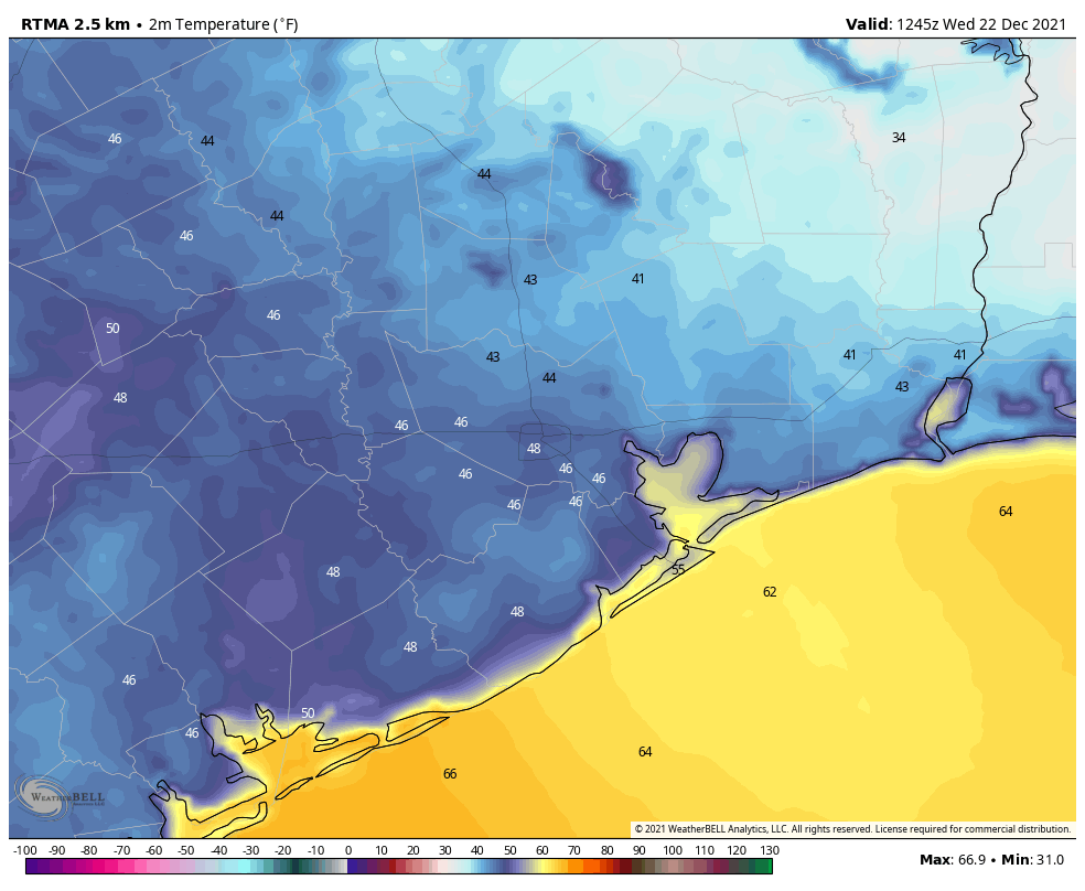
Today will be simply lovely. With mostly sunny skies, high temperatures will rise to about 70 degrees this afternoon. With modest dewpoints, the air will feel exceptionally pleasant. Winds will be light, out of the southeast at 5 to 10 mph. Really, today will just be super nice for anything you care to do outside. Please enjoy if you can. Temperatures tonight will be 5 to 10 degrees warmer than Tuesday night as the southerly flow continues to modify our air mass.
Thursday
This will be the last day with moderately drier air for awhile. Highs likely will get into the mid- to upper-70s, but dewpoints should hang around 60 degrees which should be nice enough. Skies will remain mostly sunny, and winds will continue from the south. Lows on Thursday night won’t drop out of the 60s for most of the region.
Friday
Christmas Eve will be warm and mostly sunny, with highs near 80 degrees. Winds out of the south may become a bit more blowy, perhaps gusting up to 20 mph. As dewpoints rise, so too will humidity levels. Overnight temperatures will be in the upper 60s for most of the area.
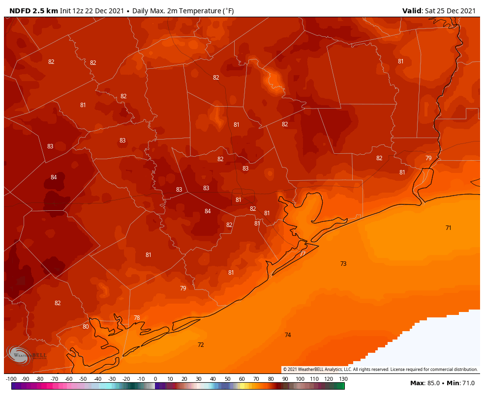
Christmas Day
Christmas will see unseasonably warm weather, with highs likely in the low 80s for most of Houston. At least it will be sunny, with a zero percent chance of rain. If you went all Clark Griswold and bought the family a swimming pool this year, feel free to take a dip. Expect another warm night.
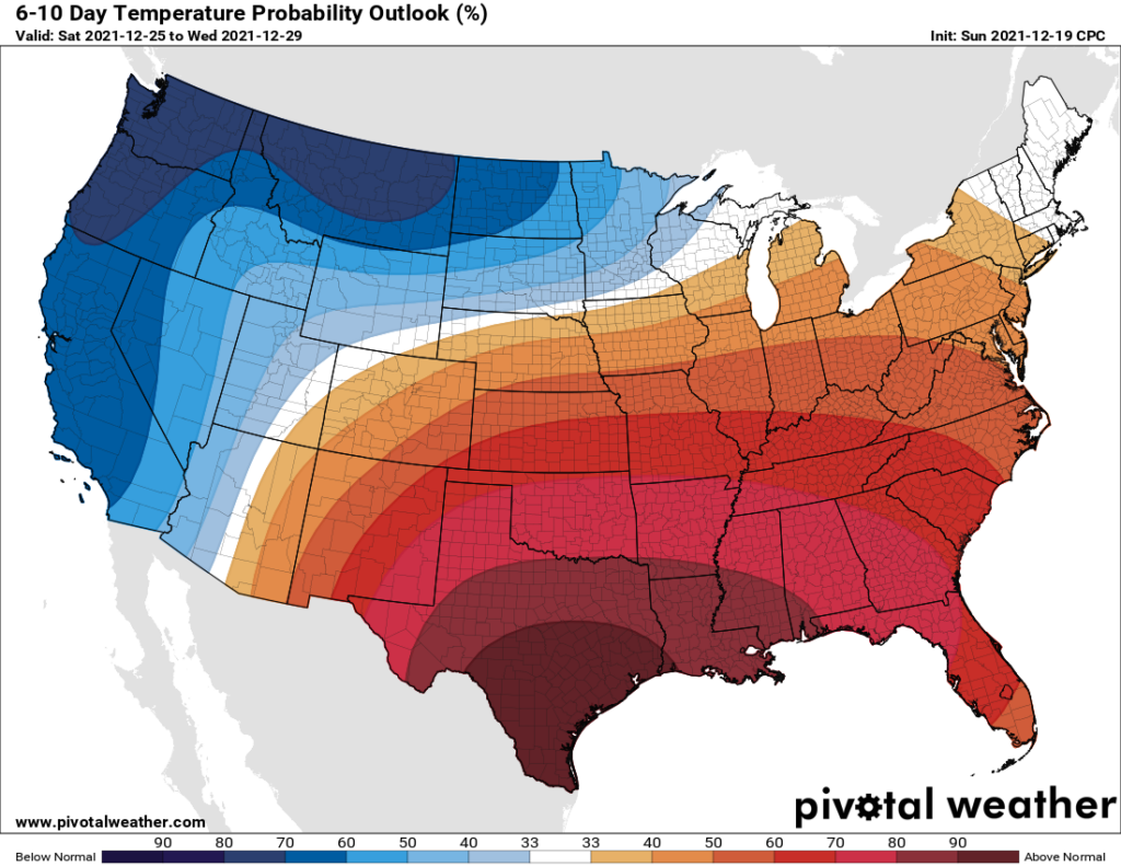
Next week
It now appears as though the possible front for early next week won’t make it, so we’re staring at a warm final week of 2021. Expect highs around 80 degrees and nights likely in the 60s. There probably will be a few more clouds, but rain chances remain low to very low. The most likely window for the arrival of our next real cold front is New Year’s Eve or New Year’s Day. This should, at least, drive lows into the 40s or 50s.
Snowstorm?
We’ve started to see some chatter on social media about a “snowstorm” coming to Texas in the January 4 to 6 timeframe. First of all, if you’ve read Space City Weather for any period of time, you’ll know to have a sufficiently high sense of skepticism about model forecasts 10 days out, let alone 14 to 16 days.
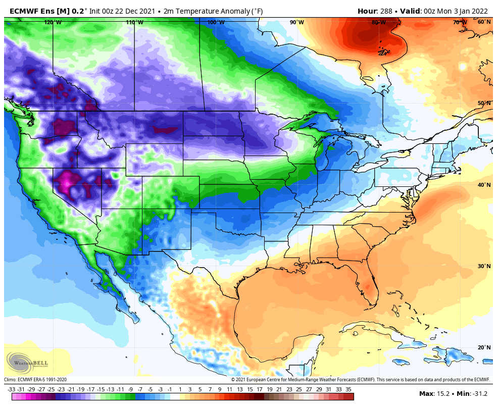
With that said, a substantially colder air mass is likely to move into Canada and the northern tier of the United States during the first few days of the new year—we’re talking temperatures 10 or 20 degrees below zero in places like Minnesota. But we’re not sold on a significant chunk of that really cold air working its way across the United States and into Texas, let alone to find the right conditions for snowfall. So while a snowstorm in Houston is certainly possible in early January, it’s probably a 1-in-20 shot at this point. I’d not buy sleds for the kids’ Christmas just yet.