Good morning, Houston. Our region will continue to see healthy rain chances this week through around Wednesday, after which high pressure should bring them back into the 20 to 30 percent range. Highs will be generally in the low- to mid-90s. It now appears likely that our region will not be affected by Tropical Depression Grace.
Monday
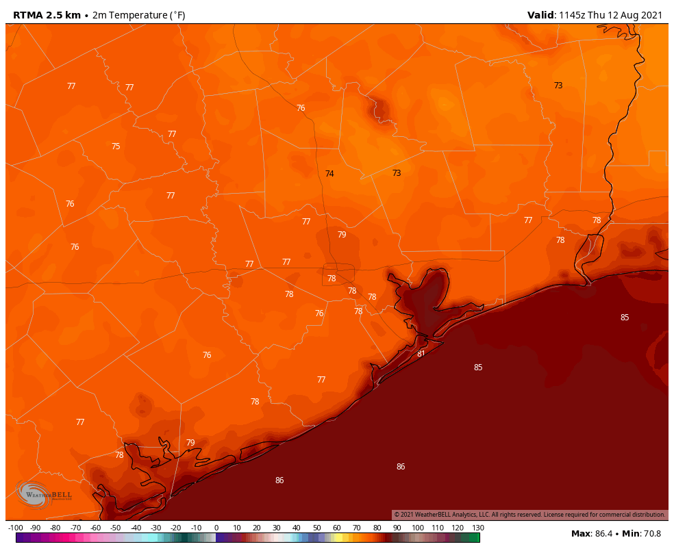
Very light winds overnight, essentially 0 mph for some locations, have been problematic due to a chemical release in the La Porte area at the Lubrizol Plant on Sunday evening. Unfortunately there is very little reliable information online about this incident, but in areas from La Porte to Seabrook to Friendswood and beyond there has been a distinct “oily” odor in the air that has made people feel unwell. I wish I had more information about the chemical in question, but I don’t. I do know that the lack response by local and officials so far has been unacceptable. Winds will remain light this morning, but should be 5 to 10 mph this afternoon.
Chemical odor aside, today should be similar to Sunday, with highs in the mid-90s and healthy rain chances. For some that will mean a quick 1 to 2 inches of rainfall under a strong thunderstorm, and for others that will mean hearing the rumble of nearby thunder, with little or no rainfall. Rain chances will peak this afternoon and then wane this evening. Skies should be mostly cloudy.
Tuesday and Wednesday
This unstable pattern continues through Tuesday and Wednesday, with partly to mostly cloudy skies, highs in the low to mid-90s, and healthy rain chances peaking alongside daytime heating.
Thursday and Friday
A building ridge of high pressure should return Houston to more summertime weather toward the end of this week, and by that I mean afternoon showers should become more isolated to scattered, with skies becoming at least partly sunny. Highs will be in the mid-90s.
Saturday and Sunday
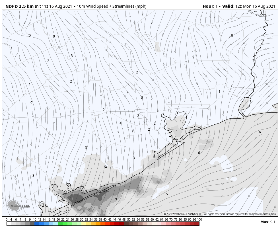
Assuming the tropics forecast holds—more on that below—this weekend should be most sunny, with a continued chance of scattered afternoon showers to go along with mostly sunny skies. In short, it should be a fairly typical August weekend for the region.
Tropics
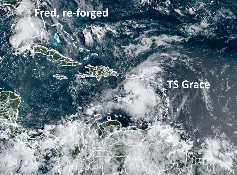
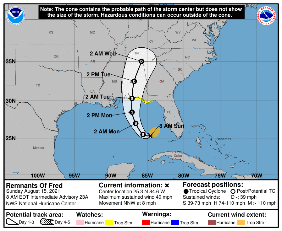
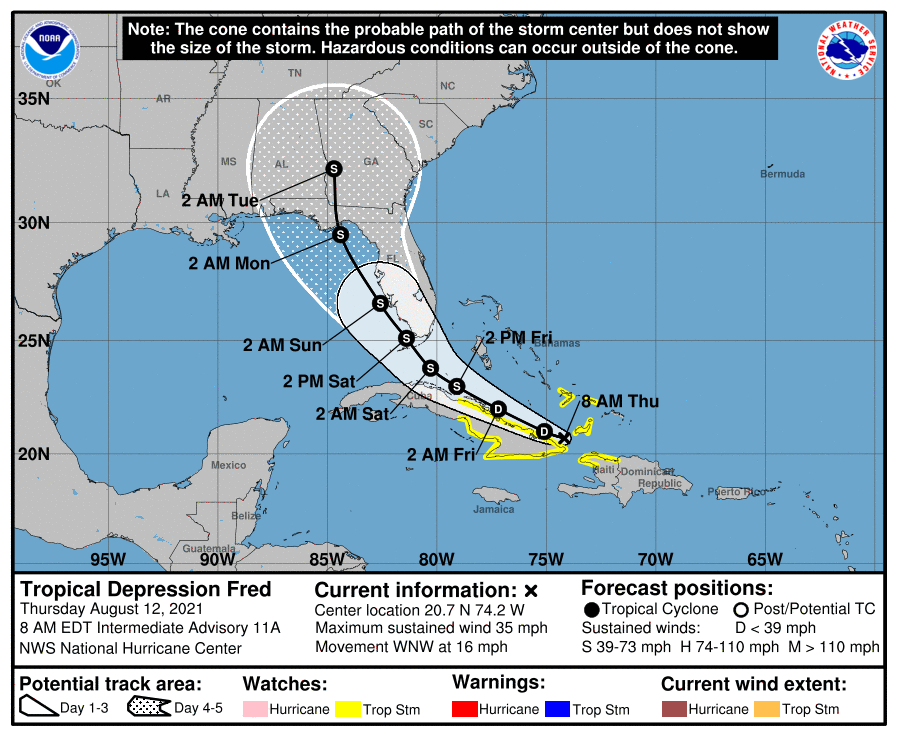
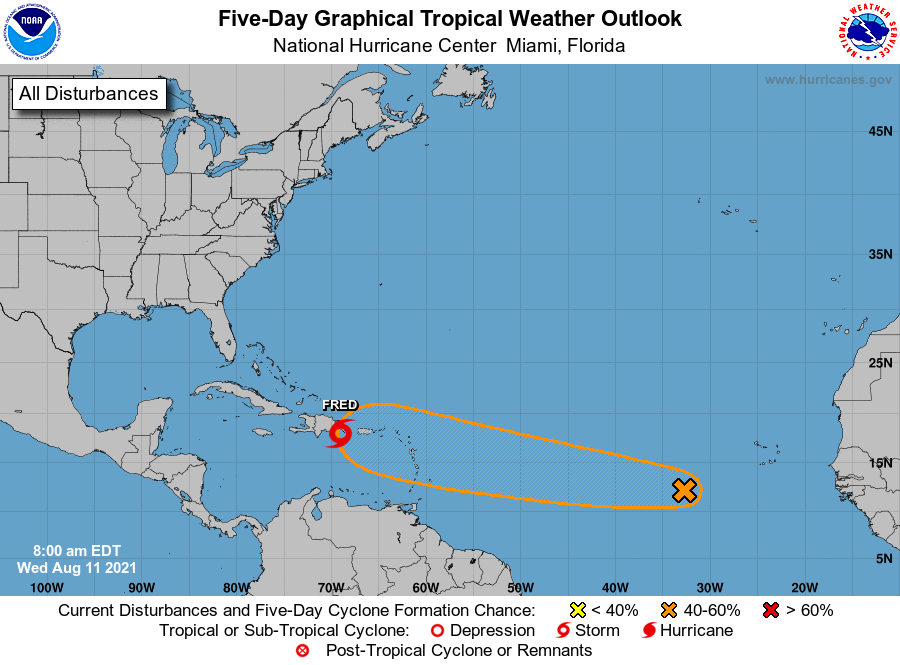
As one would expect during August, the tropics are active. Tropical Storm Fred should reach the Florida Panhandle this evening as a strong tropical storm, bringing rains and stronger winds to places such as Destin and Panama City. Fortunately the storm is moving at a good clip to the north. And near Bermuda, Tropical Depression Eight has formed. But aside from affecting Bermuda, this system should remain offshore the mainland United States.
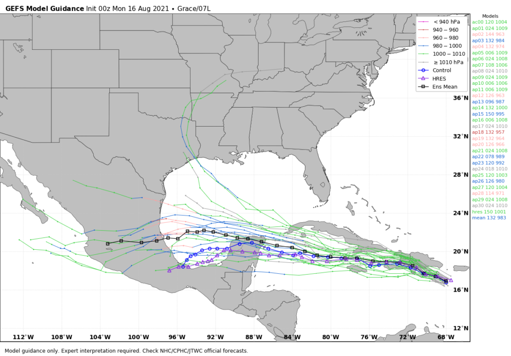
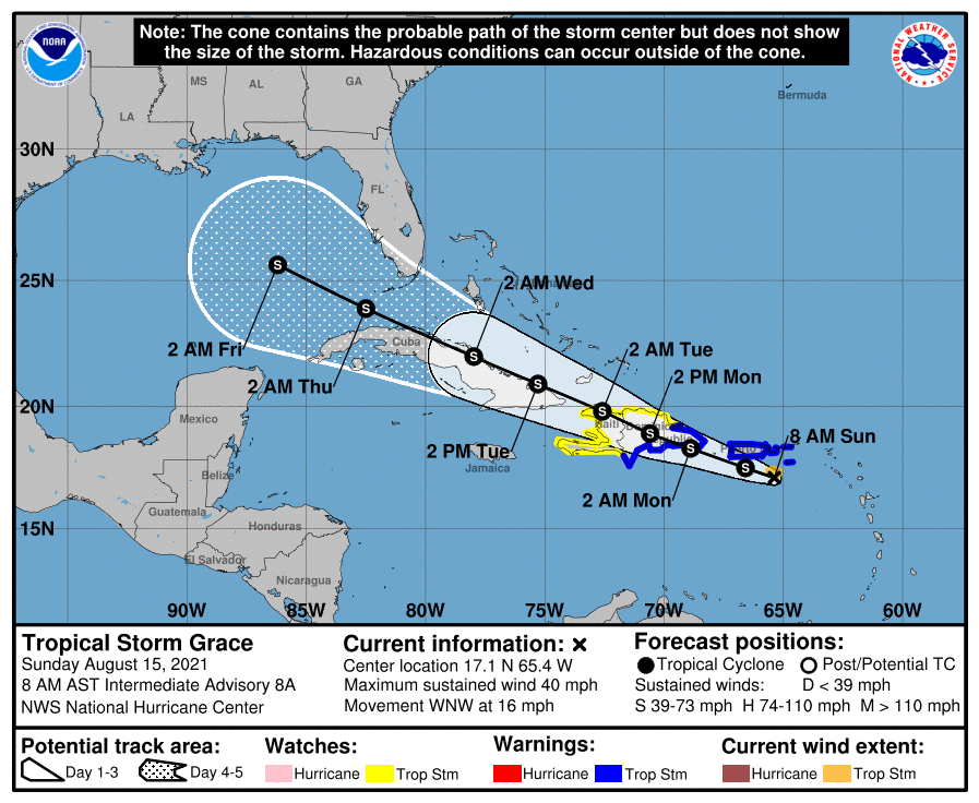
This leaves us with Tropical Depression Grace, which continues to move more due west than anticipated. Along this track its center will pass south of Hispaniola and Cuba (flash flooding remains a distinct possibility for these islands, unfortunately). This track means there is less of a chance that the storm will be shredded by the higher elevated terrain of these islands.
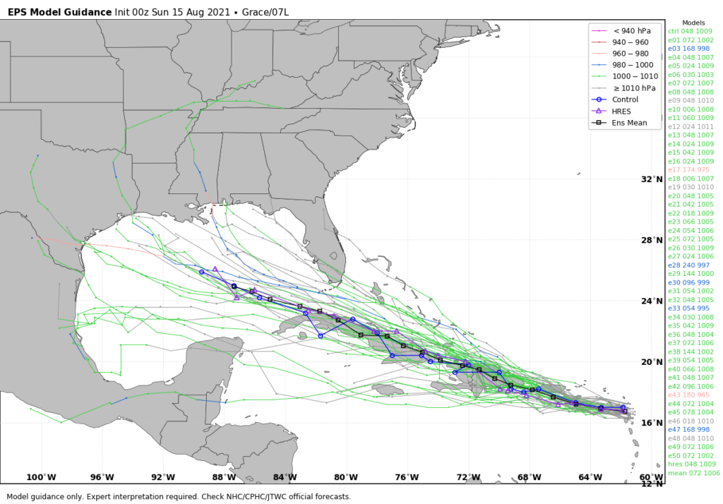
Models have also come into better agreement about Grace’s track. Given the high pressure building over the northern Gulf of Mexico, the storm is now expected to move more or less to the west, across the Yucatan Peninsula, the Bay of Campeche, and into Mexico. While we certainly cannot rule out direct impacts to Texas, their likelihood seems fairly low at this time. Grace probably will remain a tropical storm, but intensification into a hurricane cannot be ruled out this week.