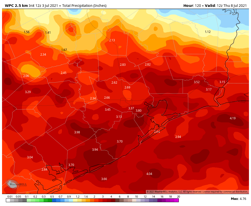
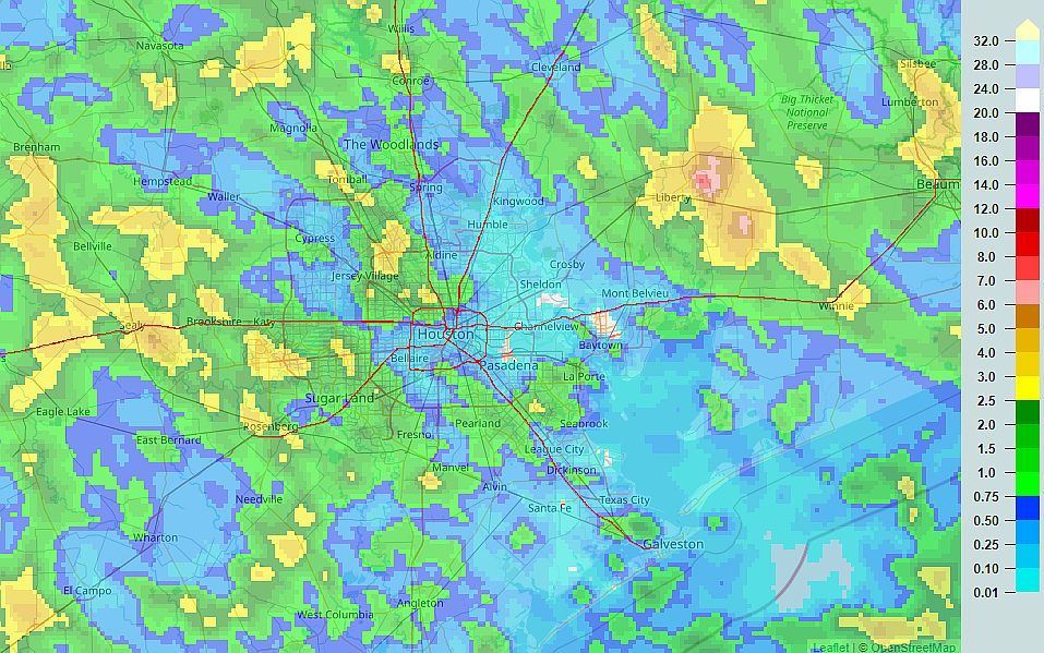
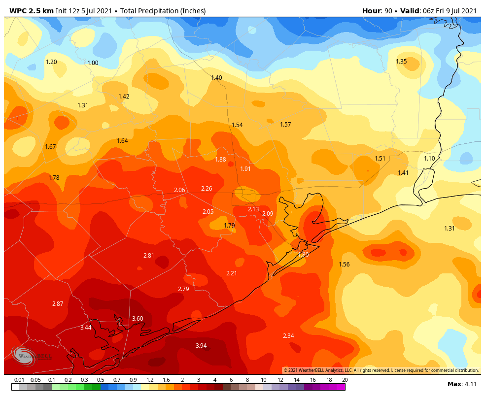
Good morning. After a wet weekend for some—a really wet weekend for the Liberty area, with more than 8 inches of rain—the greater Houston region will see an ongoing wet pattern for much of this week. However, these rains should be manageable for the most part, so we don’t anticipate significant flooding issues.
Monday
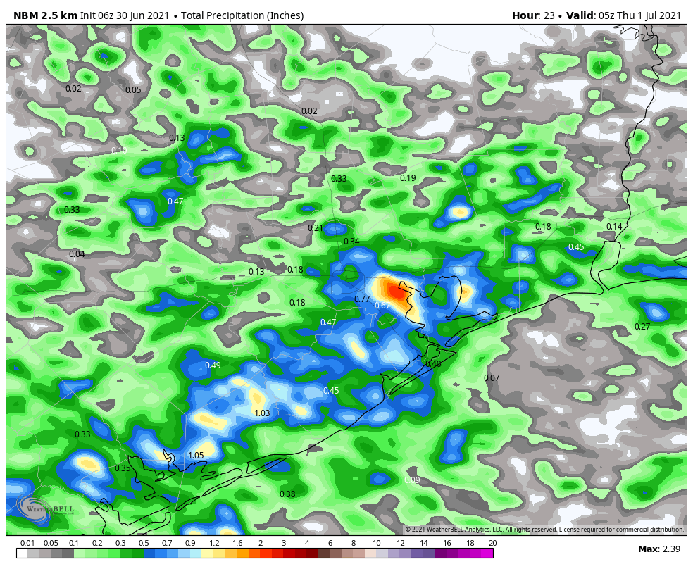
Today should be similar to the July Fourth holiday, with showers developing this morning and spreading inland. Accumulations will vary widely, with some areas seeing little rain, and others picking up a couple of inches. Areas most likely to see heavy rains are to the southwest of Houston, particularly the Matagorda Bay region. Skies should otherwise be partly sunny, with highs near 90 degrees, and light southeast winds. Rain chances will slacken overnight, but not go away entirely.
Tuesday and Wednesday
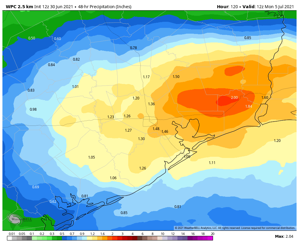
With high moisture levels in place, and an absence of high pressure, this fairly wet pattern should continue with additional chances of showers, thunderstorms, and briefly heavy rain. All of this will combine to limit high temperatures to the upper 80s to 90 degrees. In terms of accumulations, most of Houston should see 1 to 3 inches of rain through the middle of the week, with higher totals possible closer to the coast.
Thursday and Friday
Rain chances will begin to decrease on Thursday, and will probably drop back to about 20 or 30 percent by Friday. This should allow for a little more sunshine, and if sunny skies align with afternoon hours, some areas may see highs in the low 90s. Otherwise, much of the area may remain capped at about 90 degrees.
Saturday and Sunday
So is another soggy weekend in store? Although the forecast is not yet locked in, I don’t think we’re going to see full on rainfall this weekend, but each afternoon should see a decent chance of showers with at least partly cloudy skies. Highs will be around 90 degrees, with super high humidity.
Tropics
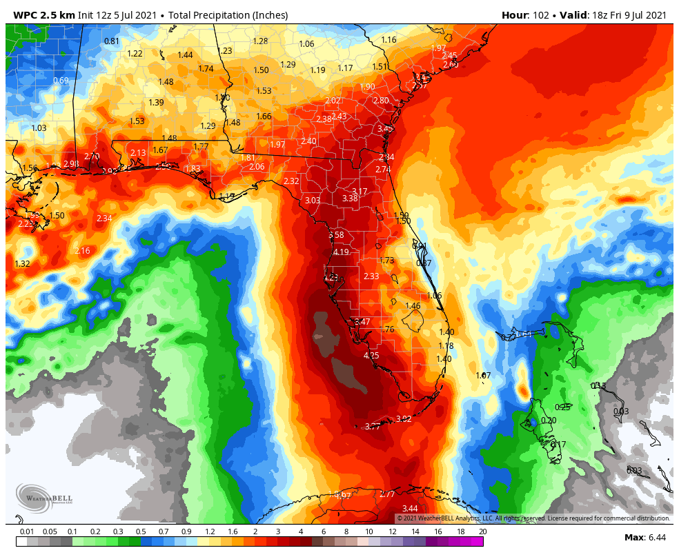
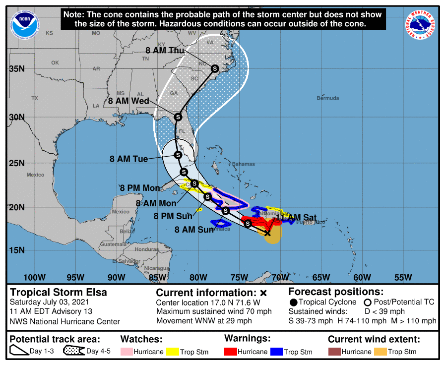
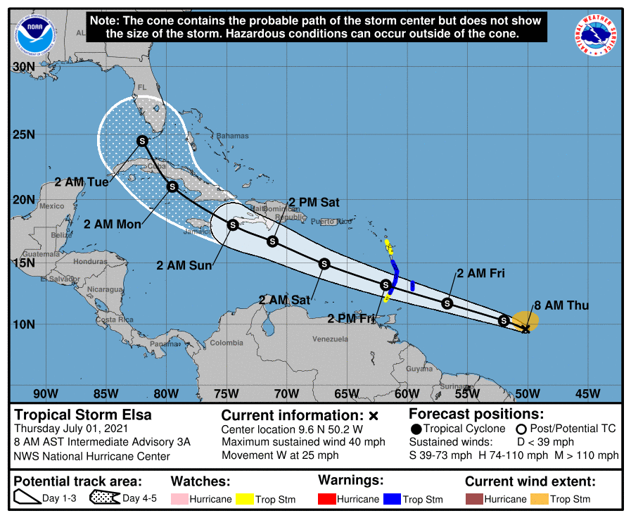
Tropical Storm Elsa will move across Cuba today, and then track up the western coast of Florida before making landfall, likely some time on Wednesday. It is not expected to do so as a hurricane, due to wind shear and its interaction with Cuba. The main threat, as usual from tropical storms, is rainfall. But so far the forecast does not look too extreme as these things go.