In brief: In today’s post we discuss a very strong ridge of high pressure that is establishing itself across the Western United States, and what that means for Houston’s weather across the next 10 days.
Rocky Mountain High
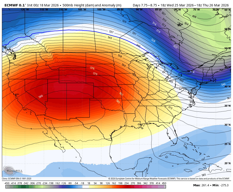
Houston’s weather, and that for much of the Western United States, will be dominated by a large and persistent pattern of high pressure for the next week or 10 days. Although it is still early spring by the calendar, this high pressure system will be more characteristic of summertime, bringing intense heat across California and the Desert Southwest, with some locations there certain to break records for earliest 100-degree heat.
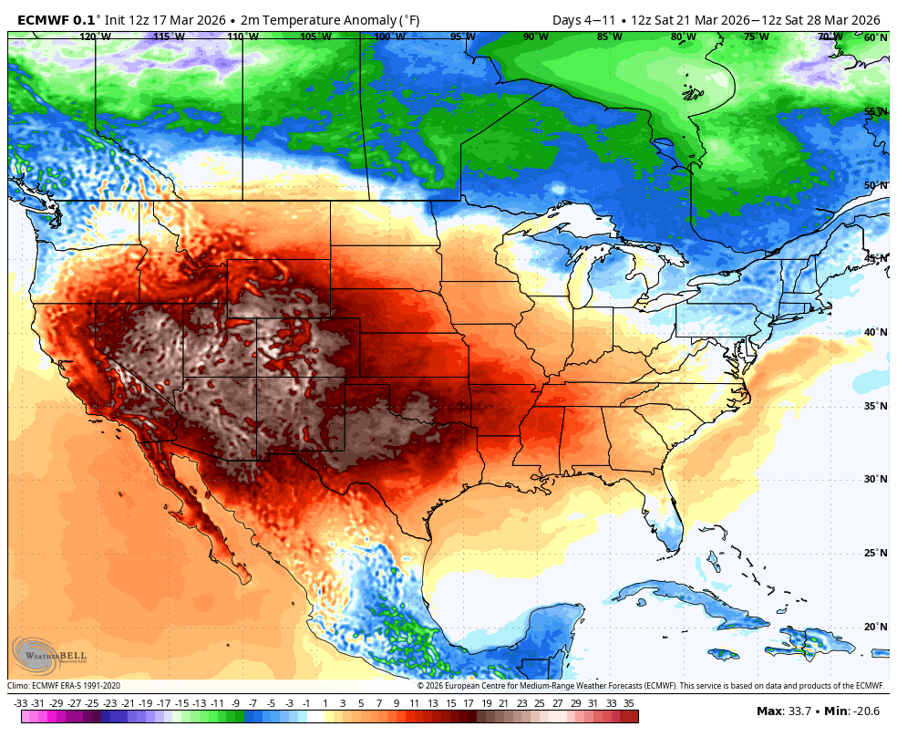
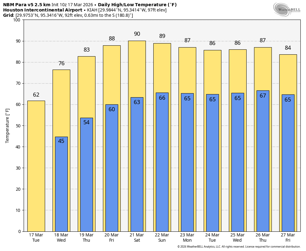
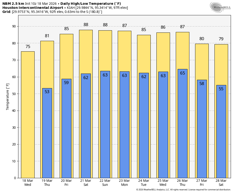
Here in Houston we will be on the periphery of this high pressure system, but still feel its effects. Beginning Friday, and lasting at least a week, we are likely to see mostly sunny skies and warm days with high temperatures in the mid- to upper-80s. Along with this, rain chances will be near zero throughout the forecast period. The bottom line is that, beginning Friday, every day will be very much like the next.
Wednesday
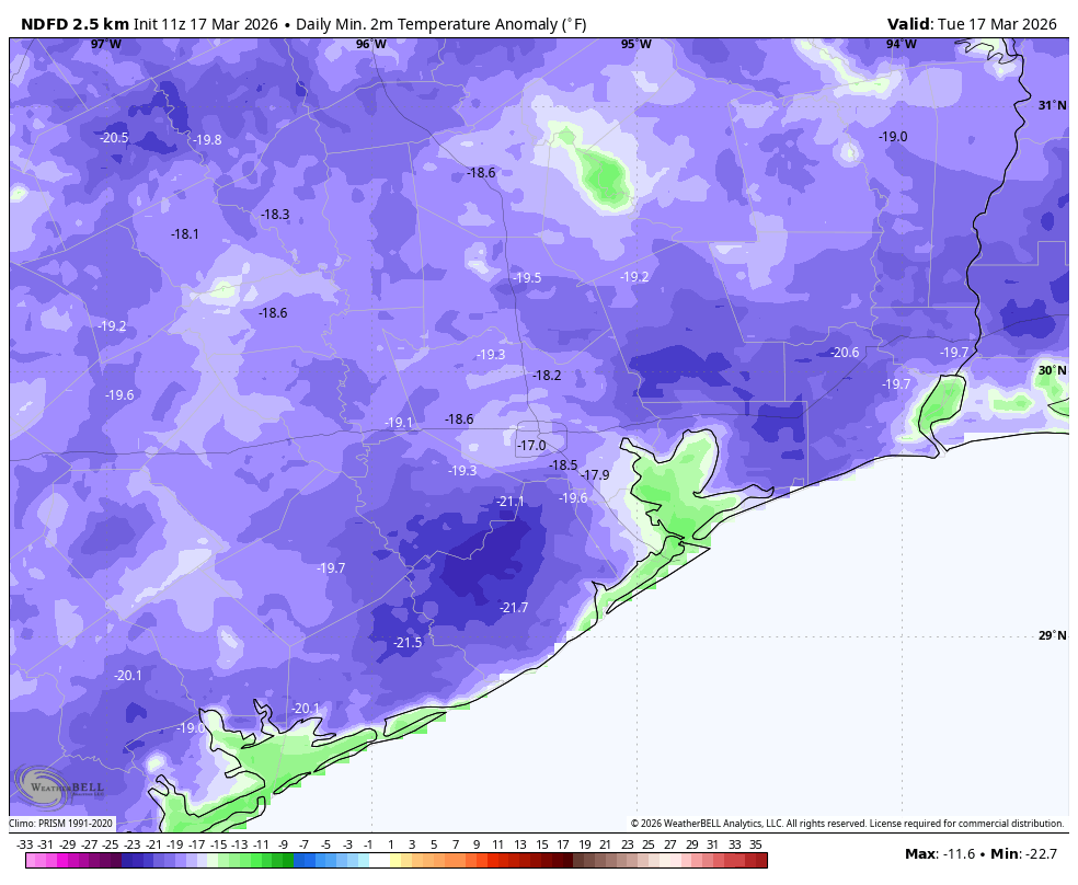
It has not warmed up yet, however. Low temperatures this morning, away from the coast, are generally in the 40s. However, with mild southerly winds we are going to warm up nicely today, into the mid-70s. Skies will be sunny with relatively low humidity levels. Honestly, it should be a gorgeous day.

Houston rodeo weather
It’s Family Wednesday at the rodeo, and conditions look excellent. Temperatures late this afternoon will be in the lower 70s, falling to the lower 60s after the show. Winds may be a bit gusty early this this evening (perhaps up to 15 to 20 mph) so it may be a bit chilly in the shade. Low temperatures will fall into the mid-50s tonight, which is warmer than we’ve been, but cooler than we’ll be for awhile.
Thursday
This will be a sunny day with highs in the vicinity of 80 degrees. Lows on Thursday night have a chance to drop into the upper 50s.
Friday, Saturday, and Sunday
Expect sunny and warm weather with highs in the mid- to upper-80s. Sunday looks like the warmest day of the forecast period, with highs possibly reaching 90 degrees for some far inland areas. Nighttime temperatures will generally be in the 60s. Humidity levels will be rising, but not oppressive like they can be during the summer.
Next week
Sunny and warm conditions will persist for much of next week, with highs generally in the mid- to upper-80s. Some sort of front may arrive by next weekend, and hopefully may bring us some rain showers. But no promises on that score, I’m afraid.