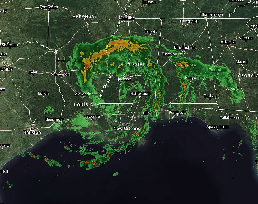
Tropical Storm Cristobal made landfall on Sunday evening in southeastern Louisiana, bringing winds, waves, and heavy rainfall to the northern Gulf of Mexico coast. This seems as good of a time as any to take stock of a frenetic start to the 2020 Atlantic hurricane season, and assess what it means for the rest of the year.
Busy start
Cristobal formed on June 2 in the Southern Gulf of Mexico, and this was the earliest ever point in the Atlantic season that the third named storm has formed in a given year. (However imperfect, the Atlantic basin has records dating back to 1851). The previous earliest “C” storm was Colin, on June 5, 2016. Arthur and Bertha, which were both relatively weak and short lived storms, formed this year even before the season officially began on June 1.
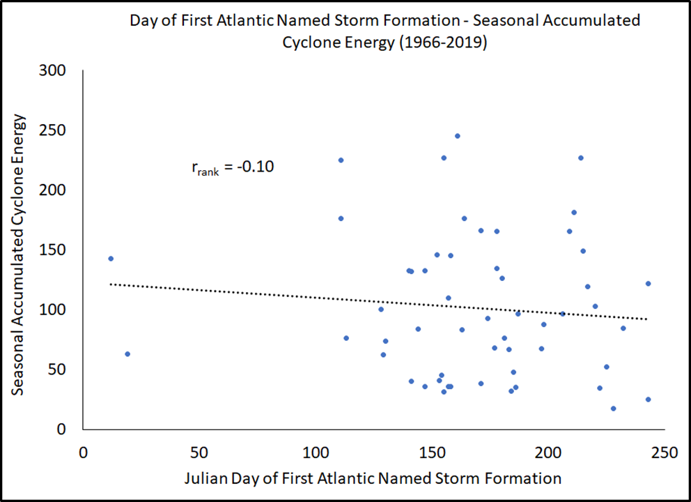
This may seem like an ominous beginning to what seasonal forecasters have predicted to be a busy season. But according to hurricane scientist Phil Klotzbach, there is little correlation between early season storms and the total activity (in terms of number of storms and their overall intensity) for the remainder of the year. In fact, the correlation is slightly negative.
What this means is that we’re not really going to know the full tale of the 2020 season until about August, when activity in the tropical Atlantic Ocean—known as the Main Development Region—gets fired up. This is the period of summer when we start to watch tropical waves spin off the western coast of Africa, and develop into tropical systems as they migrate westward across the Atlantic Ocean toward the Caribbean Sea. We’re still about six to eight weeks from the opening of this period.