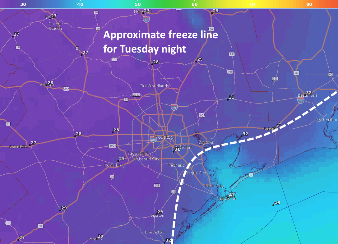
Houston’s temperature dropped below 40 degrees on Tuesday morning for the first time since February 12, and our lows this morning will be quite a bit warmer than the next two mornings. The region’s first freeze since January is on tap for tonight for most of Houston except the coastal areas.
Tuesday
Today will be a cold one, without a doubt. Skies should remain mostly cloudy, and this will likely limit high temperatures in the mid-40s. Brisk, northerly winds at around 15 mph will push wind chill temperatures into the 30s—so you’ll definitely want a jacket at the very least. The radar is showing some very spotty snow flurries and sleet to the west of the region this morning, and this area of moister air aloft will move over the Houston region between about 8am and noon. However, the air nearer the surface of our region is very dry, so while we can’t entirely rule out a few sleet pellets or snow flurries this morning, they’re unlikely.
Tuesday night temperatures will be very cold. (National Weather Service/Space City Weather)
Tonight will be the region’s coldest since mid-January, with most of the area seeing a light-to-moderate freeze .The usual precautions for pets and plants apply, although it probably won’t be cold enough to threaten pipes. The record low for Nov. 14 in Houston is 28 degrees, and I suspect the city’s official station at Bush Intercontinental Airport will come close to that.
Showers associated with a low-pressure system have generally moved east of our region, and now we await the arrival of a strong cold front later this afternoon that will be blustery. This will bring a freeze to parts of Houston, perhaps even most of the city, by Tuesday night. I’ll say it—Winter isComing.
Monday
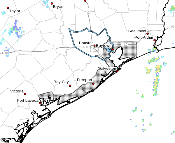
Temperatures will climb into the upper 50s today before the arrival of a front this afternoon; probably around 1 or 2 pm for central parts of the city and a little later along the coast. For the most part this should be a dry front, with only scattered rain showers, and these will end regardless later this afternoon. From that point temperatures should begin to fall as winds gust above 25mph in the city, and perhaps above 35mph along the coast bringing in chill northerly air. There is a wind advisory in effect from 2 pm Monday through 6 am Tuesday for the coast. It will be blowing out tonight.
Extent of wind advisory for Monday evening and Tuesday morning. (National Weather Service)
Overnight low temperatures should generally remain in the mid- to upper-30s for the Houston area on Monday night, but with the winds it will feel quite cold outside. Wind chill temperatures for Tuesday morning will feel like the 20s for much of the region.
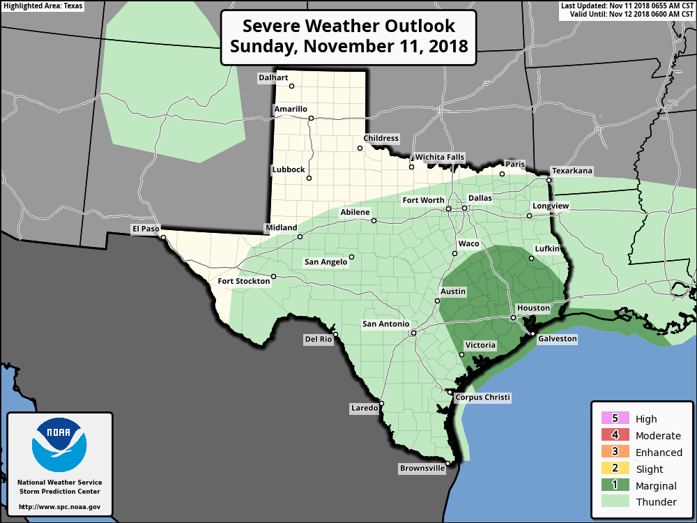
Just jumping in with a quick update on Sunday to call attention to some potentially severe weather later today. The overall pattern is one in which low pressure over the southern Gulf of Mexico near Brownsville will move up the coast today, and into the Galveston region tonight. This low will combine with Gulf moisture, and upper-level energy, to produce a healthy chance of showers and thunderstorms later today and tonight. NOAA has placed the region under a “marginal” threat of severe weather.
Severe weather outlook for Sunday and Sunday night. (NOAA)
Effectively, this means we’ll see high temperatures in the upper 50s today, with an elevated chance of thunderstorms around sunset and overnight. The precise location of the storms will depend upon how far the low, and associated “warm front” move inland, but the biggest threat is probably damaging winds and an isolated tornado. We don’t anticipate rain accumulations above 0.5 inch or so for most people.
A strong cold front arrives in the area on Monday morning, and these gusty winds will bring drier conditions. Rain chances should diminish during the day, and skies should begin to clear by the afternoon hours or so. It will be a cold day in the 50s with the winds providing a chill, so bundle up accordingly.
We’re still looking at a cold week, with Tuesday night and Wednesday morning the coldest of the bunch. Chances of a freeze for inland area look decent, and we’ll have an estimated freeze line map for you tomorrow.
Note: This is a sponsored post in which I review a security system installed by Reliant.
Here’s a little secret: I have never been a big believer in home security systems. However, this has been a non-negotiable point with my wife, who turns out is a believer in home security systems. We had one installed in our first home, more than 15 years ago. It was a fairly basic system, and it seemed to make my wife happy. I paid the monthly bill and then forgot about it. Fortunately, we never needed the system to work during an emergency. Over time, I forgot the access code. My assessment of security systems never changed.
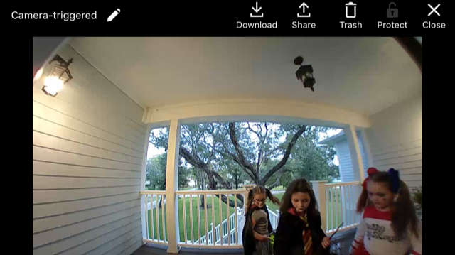
Uh-oh, it looks like we’re being invaded by Harry Potter characters.
Nearly a year ago, we moved into a new home, and because of Space City Weather’s relationship with Reliant, they invited me to test out their security system. (I paid for the installation, and received a discount for services because I am an electricity customer). As part of our Security by Reliant package, we had sensors installed on six doors, an interior camera, a doorbell camera, a motion detector, and sensors on the garage doors that allow them to be opened remotely. This was a nice package but far from “the works” I could have had installed. All of these features were non-intrusive in the sense that they blend into the house.
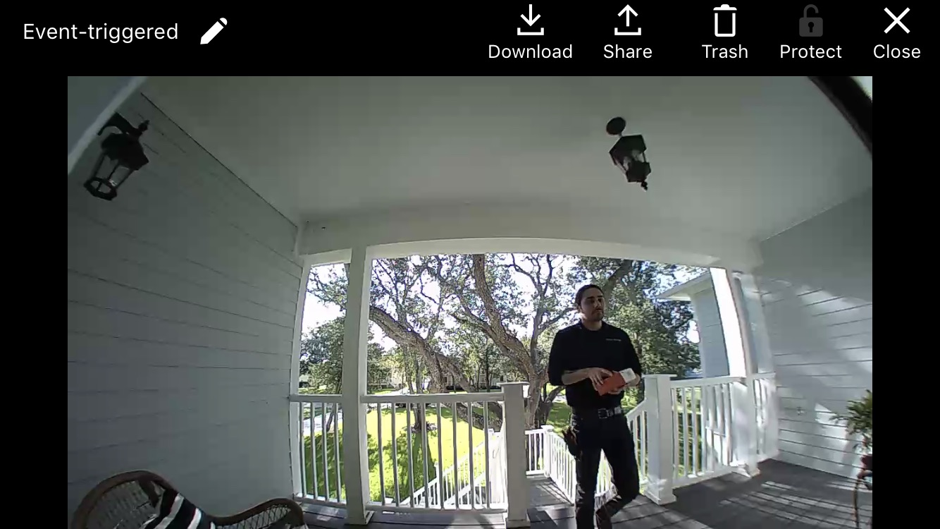
Reliant’s installer was friendly and helpful. Here we’re testing out the doorbell camera.
Now, I am sure that alarm systems have come a long way in the 15 years since I had one installed by another company. Nonetheless, I have been pleasantly surprised by the performance of the Security by Reliant system, and more importantly its ease of use. It is all pretty intuitive, and allowed me to turn my home into a sort-of “smart home” without investing thousands of dollars. I can do all of the important things through a single app, such as:
See who is at the front door
Let someone in the garage while I am away
Check out what’s going on inside my living room
Turn the alarm on or off
Adjust the thermostat
The Wi-Fi doorbell is especially nice, because it is easy to see who is there (whether we are home, or not) and to talk with him or her through the system.
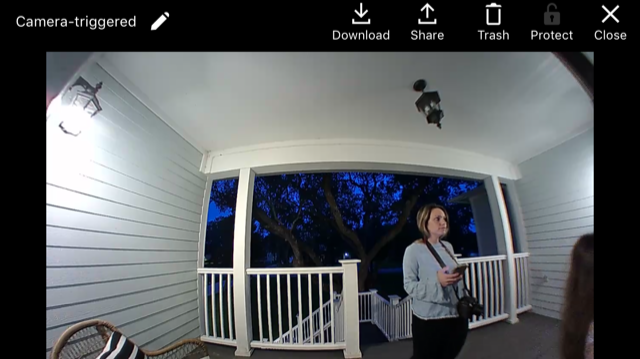
My sister-in-law! Better pretend we’re not home 😉
I really just want three things from a security system: that it is reliable, that it provides a sense of security, and my wife is happy. (Ok, being honest, the last thing matters most). And the reality is that, at least after year one, Security by Reliant hits all three for me.
Reliant and I are teaming up to offer Space City Weather readers a special offer – if you sign up for Security by Reliant by clicking this link, or calling 1-844-443-0180 and mentioning promo code “SCW”, you’ll receive your first 2 months FREE!