Just jumping in with a quick update on Sunday to call attention to some potentially severe weather later today. The overall pattern is one in which low pressure over the southern Gulf of Mexico near Brownsville will move up the coast today, and into the Galveston region tonight. This low will combine with Gulf moisture, and upper-level energy, to produce a healthy chance of showers and thunderstorms later today and tonight. NOAA has placed the region under a “marginal” threat of severe weather.
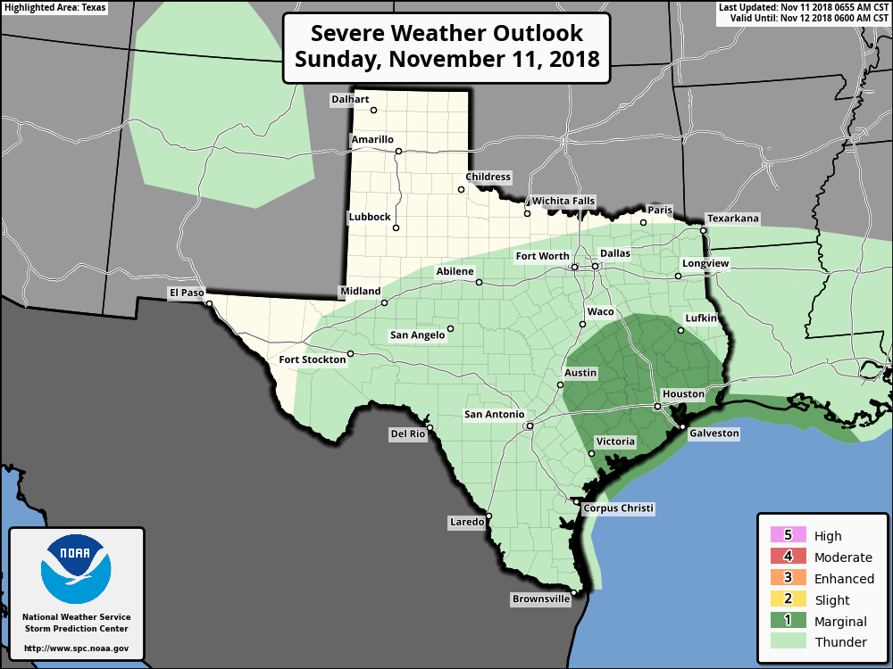
Effectively, this means we’ll see high temperatures in the upper 50s today, with an elevated chance of thunderstorms around sunset and overnight. The precise location of the storms will depend upon how far the low, and associated “warm front” move inland, but the biggest threat is probably damaging winds and an isolated tornado. We don’t anticipate rain accumulations above 0.5 inch or so for most people.
A strong cold front arrives in the area on Monday morning, and these gusty winds will bring drier conditions. Rain chances should diminish during the day, and skies should begin to clear by the afternoon hours or so. It will be a cold day in the 50s with the winds providing a chill, so bundle up accordingly.
We’re still looking at a cold week, with Tuesday night and Wednesday morning the coldest of the bunch. Chances of a freeze for inland area look decent, and we’ll have an estimated freeze line map for you tomorrow.

Thanks for the update! It’s appreciated!
Thanks Eric!
Thanks guys. Picking up a horse in Conroe today. Just bumped up the departure time to beat most of this.
If only these sort of report details were 9 months out of the year!