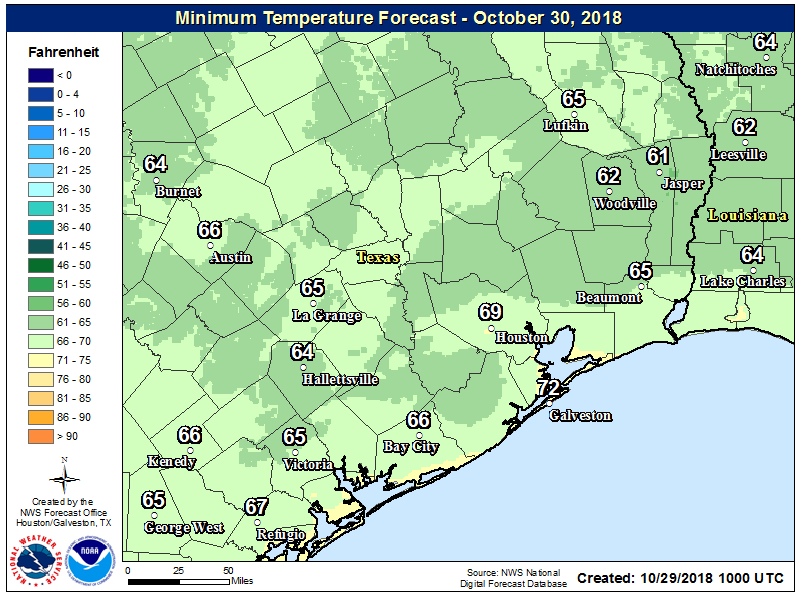
Overnight lows have nudged back up this morning, ranging from the upper 50s in Conroe, to the upper 60s in central Houston, and lower 70s just along the coast. Our weather will remain warm-ish through Wednesday, after which point a cold front will make for gorgeous fall weather for the Thursday through Saturday period. Speaking of that cold front, it will spark a round of potentially strong storms later on Wednesday, and this will certainly affect some trick-or-treaters. Much more on that in the post below.
Tuesday
Humidity levels are back to near 100 percent this morning for most of Houston, as our old friend the onshore flow really kicks in. As a result, we’ll see an at-times breezy day, with some gusts possible above 20mph as southerly winds get flowing.
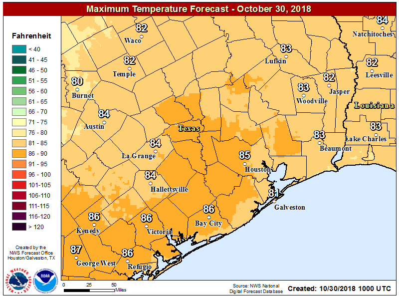
The increased moisture will manifest in some clouds, but today should still be a partly sunny affair, and rain chances remain near zero (can’t rule out a very few isolated showers). Expect highs in the mid-80s today, and a night in which lows don’t fall much (if any) below 70 for most of the area.