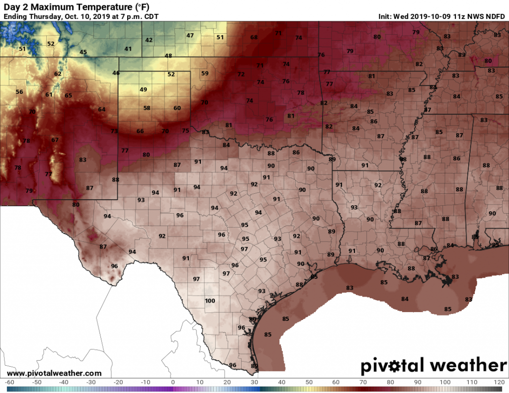
If you’ve been missing summer, you’re in luck. It returns for a one-day engagement Thursday with highs of around 90 degrees. My guess is that we’ve only got two or three days with 90-degree temperatures left in 2019, so if you really like the heat please get outside and enjoy it today. Cooler weather arrives Friday.
Thursday
Today will be quite warm, with highs of 90 degrees in the city of Houston, and possibly mid-90s just to the west, in places like Katy. Mostly sunny skies will amplify the heat, and we’ll get no respite from the humidity as the sun goes down tonight. (Just as the Tampa Bay Rays will not get any respite from the Astros’ bats tonight).
Friday
But that all changes on Friday. A potent fall cold front has been sweeping down the central United States, and it will reach the Houston area on Friday morning. Areas such as College Station will likely see the frontal passage before sunrise, and it should move into central Houston by around 10am, and push off the coast around Noon. A broken line of light-to-moderate showers should accompany the frontal passage, but any storms should be short-lived.
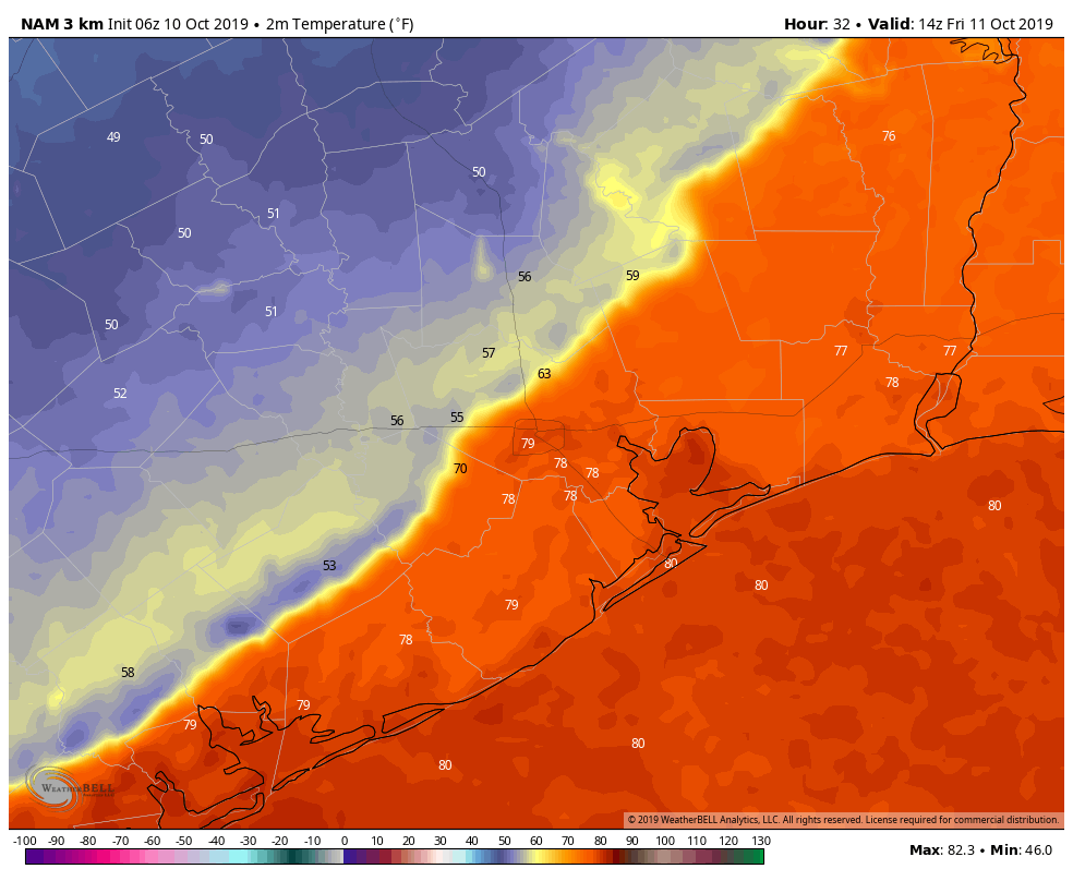
Conditions after the front will be significantly drier, cooler, and gustier. We can’t entirely rule out some light rain after the front’s passage, but for the most part it will be just cloudy. With the lack of sunshine, and winds gusting to 25 mph (or higher, along the coast), you may well want a longer-sleeved shirt or light jacket on Friday afternoon and evening.