There are several ways to define the beginning of winter—the onset of cold weather, Dec. 1, or the winter solstice. The latter is today, and because we’re only now publishing our winter forecast for Texas, for the purposes of this post we choose to define winter this year as the period from Dec. 21 through March 20, the spring equinox. Anyway, we’re expecting slightly cooler, and wetter conditions.
Temperatures
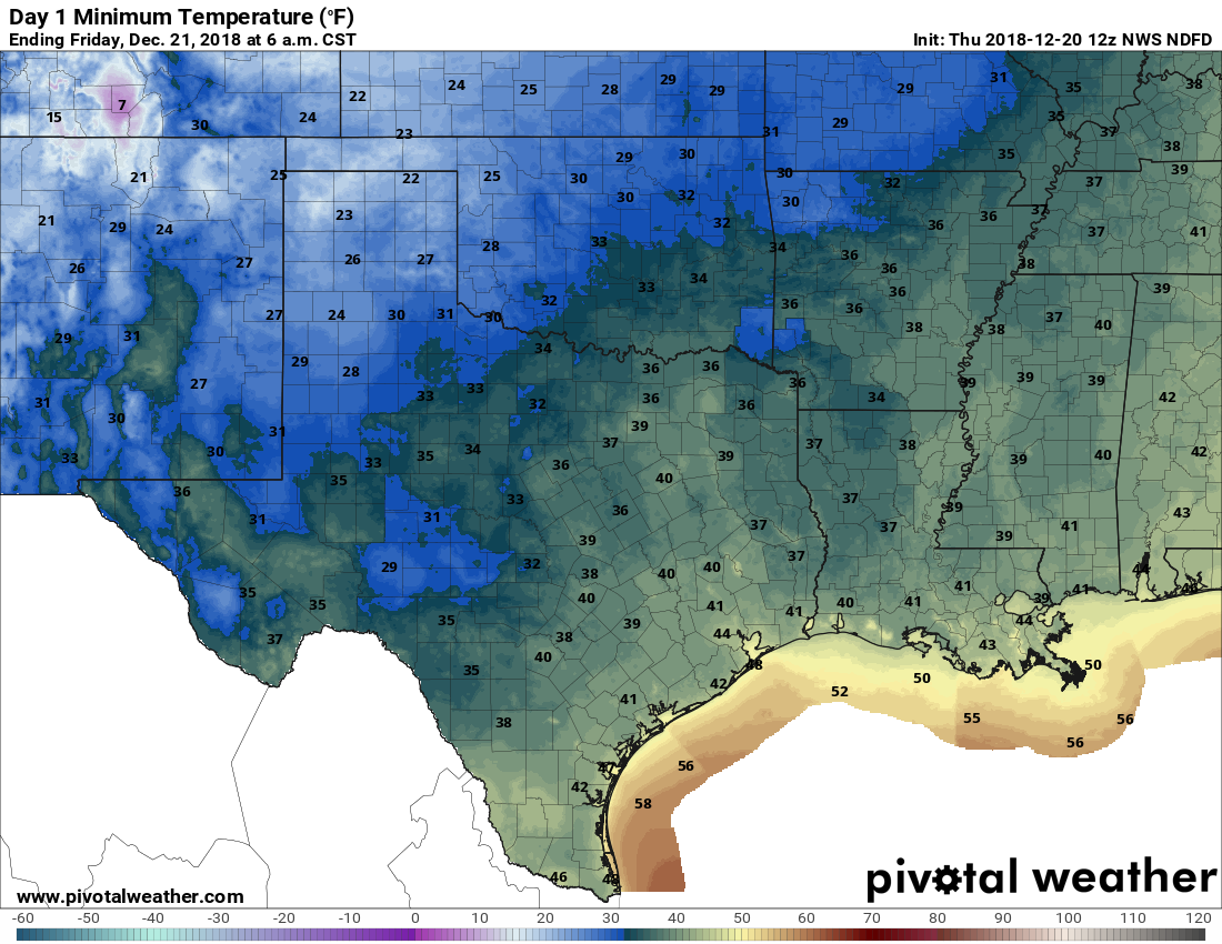
After a cold November—remember the early freeze and trace of snow?—conditions so far this December have been fairly standard for Houston. Temperatures have been near normal, and there’s yet to be a freeze. The next week or so should be fairly warm for this time of year, with highs generally in the low 70s, before a cooldown to end the year.
The dominant factor for our weather in January, February, and early March should be the arrival of El Niño, warmer sea surface temperatures in the tropical Pacific Ocean that have effects downstream. Generally, this tends to make temperatures a bit cooler in Texas, and wetter, with a more active storm pattern over the southern United States. The official NOAA forecast, just released Thursday, shows near-normal temperatures for Texas for the January through March period.
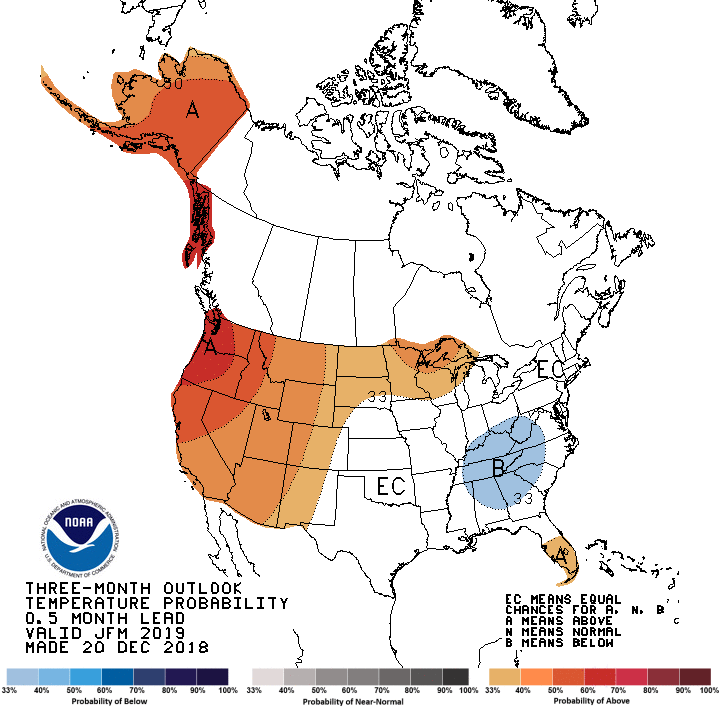
This is probably accurate, although we expect to see a couple of rather strong fronts during the coming months, with the coldest period most likely coming during the first half of February. The bottom line is that although the last 10 days of December may be fairly warm, we do not expect this trend to continue through the winter.