With highs generally in the mid-90s, and lows in the upper-70s, temperatures so far this month are running about 5 degrees above normal for early June. We’re probably going to remain in this warmer-than-normal pattern for about another week before we see the potential for temperatures to back off some next week, and rain chances to increase.
Tuesday
Some storms will be possible today, but like on Monday pretty much all of the action should be north-northeast of the region because that’s where the atmospheric disturbances will be most pronounced. The following forecast from the HRRR model is representative of this kind of thinking, showing the potential for isolated, but very gusty storms.
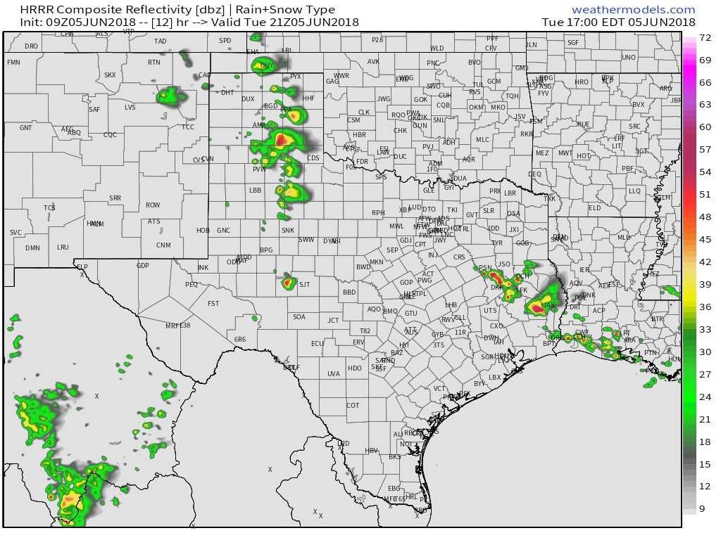
I think, for the most part, we can simply expect another mostly sunny and hot day in Houston, with high temperatures around 95 for most of the area and a few degrees cooler right along the coast.