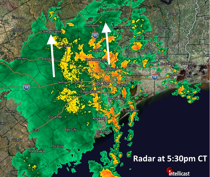
After very wet commute home on Wednesday evening, Houston had a chance to dry out during the overnight hours. However, we have to get through one more day of storms—probably not as widespread as Wednesday—before drier air helps bring down moisture levels and puts us into a more typical summertime pattern. And make no mistake, these 80-degree days will be long gone.
Thursday
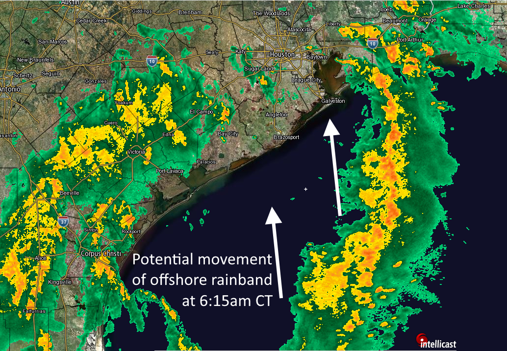
Broken bands of precipitation persist along the Texas coast this morning, and these should remain on and off during the daytime hours although likely with less organization than we’ve seen. The system will shear out, and heavier precipitation will eventually move south into Mexico, and northeast into the central United States.
For the greater Houston region, this probably means another day of scattered to widespread showers, with accumulations of 0.5 to 1 inch of rain (likely greater closer to the coast), and a slight potential of some street flooding. Showers will be most likely this afternoon, and high temperatures should reach near 90 degrees.