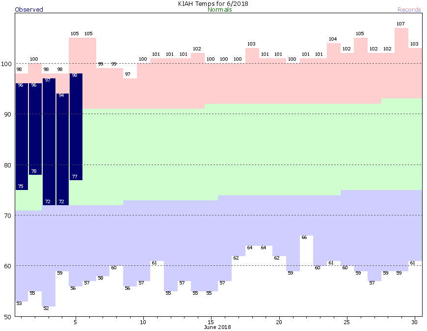
As summer continues in Houston, so do the warmer temperatures. According to the National Weather Service, through the first five days of this month, Houston has had its second warmest start to a June on record, and Galveston its third warmest. I wish I could tell you that we’re going to see significant relief from the heat in the days ahead, but this is a reality-based website. So, nah. At best we’ll probably fall back a couple of degrees closer to normal temperatures.
Wednesday
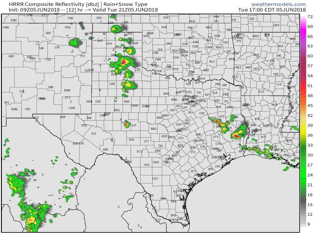
We have an interesting weather pattern across the region today that may just allow some areas to see some needed rain showers. Unsettled weather off to our southeast, and northeast, may slide back toward the region later this morning. As the region heats up today I think we’re going to see some scattered showers in the vicinity of Houston, which should be a bit more likely to the east of Interstate 45. Rain chances are probably only in the 20 to 30 percent range, but that is certainly better than the next two days. Highs should remain in the mid-90s. Any showers should end this evening, with the loss of daytime heating.