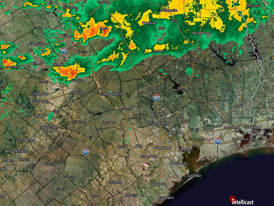
As expected a line of showers and thunderstorms is moving down through Texas this morning, and it should reach Houston by the mid- to late-morning hours.
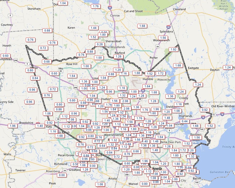
This line is generally producing about 0.5 to 1.5 inches of rain as it moves toward the coast, and the good news (if there is any) is that the system has generally moved at a pretty good clip. This means the threat of slow-moving storms is lower. Although we can’t rule out some isolated areas of 3 inches or more, I think for the most part people will see about 1 inch of rain. After the system moves through, later today and tonight, we should see some scattered, but potentially intense, thunderstorms pop up as we saw on Tuesday afternoon and evening.
Scattered thunderstorms—some of them pretty intense—have begun dying out this evening with the loss of daytime heating. After what I expect to be a fairly quiet night tonight, what comes on Wednesday?
Probably some more rain. We’ll see a spike in atmospheric moisture levels on Wednesday, and several forecast models show a fairly healthy line of showers moving down through Texas, likely reaching the College Station area an hour or two after sunrise, and perhaps moving into the Houston area by around noon. Note: these times are estimates, and the timing may vary. But I think it’s reasonable to expect the possibility of some heavy rain in Houston between the late morning hours on Wednesday until around 5 p.m.
As expected with warmer daytime temperatures some isolated, but fairly strong thunderstorms have popped up over the Houston area. The National Weather Service has issued a street flooding advisory for one area just to the southeast of downtown Houston. Fortunately, so far these storms have not moved over areas hard particularly hit by rains Sunday night and Monday morning.
Good morning. A day after historic flooding in Houston the radar is quiet. We also got good news last night when showers over central Texas broke mostly apart before reaching the Houston region. As we clean up today, will Mother Nature continue to cooperate?
TODAY
A flash flood watch remains in effect through Wednesday morning for the entire Houston metro area.
I think things will remain quiet this morning, but we’re still seeing moisture flow in from the Gulf of Mexico, and mechanisms remain to lift that moist air. My guess is that we’ll see development of spotty showers later this morning or early afternoon along the coast, and possibly more organized activity to the east of Houston, which is good because these areas were hit least hard on Sunday night and Monday. Some scattered showers could move inland into central and western Houston later this afternoon.
The big concern will be storms that produce rainfall rates of 1 to 2 inches per hour, that would fill bayous back up quickly. However at this time I don’t think we’ll see those kinds of rains today over the western part of Harris County, Montgomery County, Waller County and other areas that were hammered. If that changes I will let you know.
WEDNESDAY
Some forecast models show a more organized system of showers and thunderstorms moving into Houston late Tuesday and on Wednesday morning. (Others do not). What concerns me about the potential for this system is that it could have fairly high precipitable water levels to work with.