Spring has come to Houston, and that means a steady diet of 80-degree temperatures for at least the next week or so. A risk of storms remains on Friday.
Today and Thursday
We’ll see continued warm weather—for this time of year—as high pressure sort of sways across Texas during the next couple of days. Expect partly to mostly cloudy skies and highs in the low- to mid-80s. These are near-record high temperatures for this time of year. Lows will moderate into the low- to mid-60s. The primary concern will be the possibility of some scattered, dense fog.
Friday
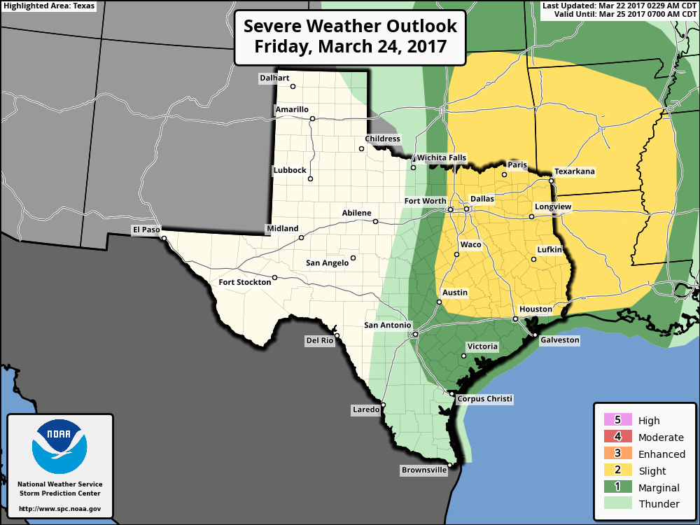
As we’ve been discussing, an upper-level low pressure system, and an associated cold front, will move off the Rocky Mountains later this week and drag what will probably be a significant line of storms across parts of the central and southern United States. Most of the action should be north of the Houston metro area, but we’ll need to be wary of the possibility of a few severe thunderstorms north of interstate 10.
(Space City Weather is sponsored by an anonymous donor this month)