Winter arrives, will stay for awhile

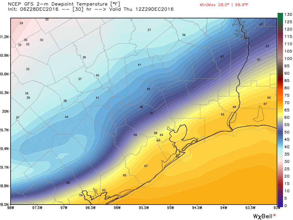
Wind chill temperatures this morning are in the 30s across the Houston area, and for the first time in more than a week it really feels like winter outside. And it’s going to remain that way.

Winter has come to Texas this morning. (Weather Bell)


TEMPERATURES

Winds will finally die down today, but temperatures are only likely to rise to about 50 degrees. Lows will fall into the 30s, but won’t reach freezing levels in the metro area. Welcome to the new normal for this week and weekend.

Wednesday looks to be the warmest day, with high temperatures of around 60 degrees.

Temperatures on New Years Eve — heading toward midnight — will generally be in the upper 40s, with partly cloudy skies. So bundle up!

RAIN

Houston may see a slight chance of rain on Tuesday night, but for the most part this week we will be dry.

The forecast models are split as to whether we’ll see some rain this weekend. If we do it most likely will be in the form of light rain. I wouldn’t have any confidence in a weekend forecast yet, beyond the fact that it’s going to be cold.

WARM UP?

This colder pattern will stick around for the next eight or nine days before we finally begin to see high temperatures climb back up into the upper 60s.

Severe storms possible Sunday ahead of an Arctic front

Hey all. Here’s a quick holiday weekend update on the possibility of severe weather Sunday in advance of a cold front.

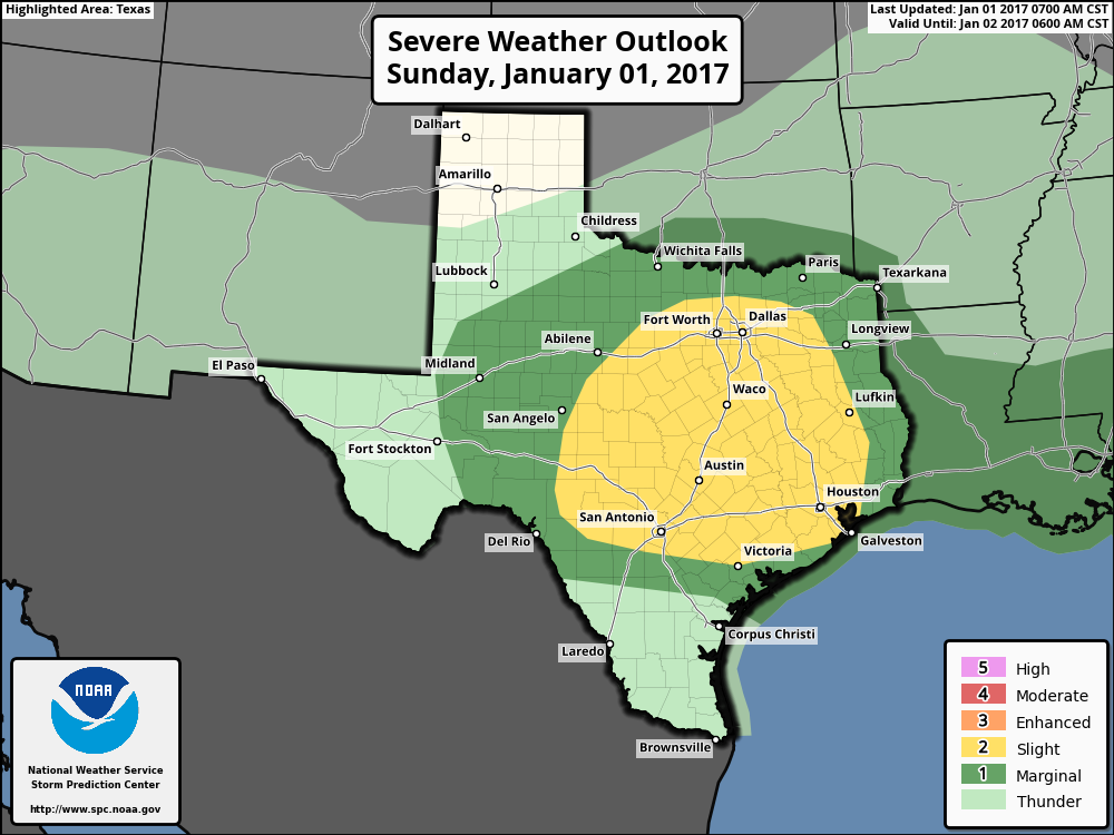
NOAA’s Storm Prediction Center has upgraded the outlook for severe weather on Sunday for parts of the Houston area to “enhanced,” which means there is a greater likelihood of organized thunderstorm activity, some potentially intense. For areas marked in orange below there is a 30 percent chance of severe thunderstorms occurring within 25 miles of a given location.

Severe weather outlook for Sunday. (NOAA Storm Prediction Center)

See full post

A Merry Mosquito Christmas, but storms, then winter are coming

Merry Christmas, everyone! It sure doesn’t feel like a holiday out there, between the humidity and quarter-sized mosquitoes. And it’s going to get worse before it gets better. But it will get better.

TODAY

Although it’s moist at the surface, the mid- and upper-levels of the atmosphere are pretty dry. As a result we’re not going to see too much rain, if any today. The Sun might even peek out from time to time, but that’s just going to make things warmer. Today’s record high is 82 degrees, and we’re likely going to come close to that today.

SATURDAY

I expect Saturday to be a lot like today, albeit with stronger southerly winds during the late morning and afternoon hours. Skies will again be mostly cloudy, with slightly better rain chances. But I’d expect any rain to be very light.

See full post

A forecast only the Grinch could love: Slight chance of storms on Christmas morning, and warm

We’ve got a few more warm — and potentially stormy — days before winter arrives in Houston.

TODAY

Overnight temperatures bottomed out this morning in the upper 50s across parts of Houston, but already a warm front has moved back in off the coast so it’s not chilly out. At all. Houston set a record high on Wednesday (81 degrees) and we’ll come close to, but probably not match today’s record of 82 degrees (set in 1955). Clouds and scattered rain chances should hold back temperatures just a bit.

CHRISTMAS

The forecast for Christmas comes straight from the Grinch.

Storm outlook for Christmas Day morning. (National Weather Service)

See full post