After a nearly perfect week of weather, we’re now at the point where Houston is going to transition into summer. For most of this week we’ll see lows fall only into the low 70s, and fairly strong southeasterly winds. Hello, humidity.
TODAY
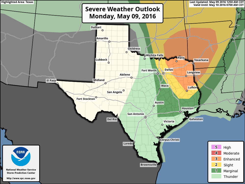
An area of mostly light rain is moving through Houston this morning and the other noticeable thing is that overnight lows have gotten quite muggy, falling only into the low 70s. The light rain should end during the next couple of hours. Later today an upper-level system will move across northern and east Texas. By this afternoon and evening this could bring some showers and thunderstorms into Houston, especially to the north of the city. Severe weather chances will be greatest in the Texarkana area.
Because the storm system will moves well to the north of the area, rain chances for most of Houston this afternoon are likely less than 50 percent. Areas such as Montgomery County and points north might see slightly higher rain chances, but we’re still not looking at any kind of flooding rains, I think, in the metro area.
TUESDAY
In the wake of the storm system we should see partly to mostly sunny skies, and highs in the upper 80s. Houston might just record its first 90-degree day of the year. Didn’t I tell you summer was coming?
WEDNESDAY
Some slight rain chances, but with a fairly strong capping inversion I’d not expect too much activity. Highs will depend upon cloud cover, but probably will climb again into the upper-80s. If, for example, you’re planning a pool party for the kindergarten class your daughter attends on Wednesday morning, the weather should cooperate.
THURSDAY
A weak cool front will move through Texas, and along with it some instability. This could allow for the development of thunderstorms, but right now it does not appear as though we’re looking at any kind of heavy, sustained rain. Still, we’ll have the watch for the possibility of a line of severe weather moving into Houston. Temperatures won’t cool down much in the wake of the front, perhaps into the mid-80s. Lows will remain around 70 degrees for Houston.
FRIDAY
We’ll continue to see slight rain chances in the wake of the front, with highs again climbing into the mid-80s.
SATURDAY and SUNDAY
The weekend doesn’t look bad at this point, with highs in the mid-80s or so, and partly to mostly sunny skies. Can’t rule out a few showers, but right now they seem unlikely.
How long will these high winds last today?
Through early this afternoon, but we will see higher than normal winds through the middle of the week.
Why?
Eric, you said:
“A weak cool front will move through Texas, and along with it some instability. This could allow for the development of thunderstorms, but right now it does not appear as though we’re looking at any kind of heavy, sustained rain. Still, we’ll have the watch for the possibility of a line of severe weather moving into Houston.”
Well, the soundings do show the potential for 2500+ cape and LI-6 to -10, but I personally believe that the amount of moisture will be insufficient for any damaging thunderstorms.
Do you agree with me?
At this point I sure do.
I’m not a weatherman, but I think what Sky Guy’s telling you is that severe weather moving through Houston, though possible, is unlikely. Is there anything to what he says?
Alternate title: Spring was on a Tuesday this year.
Lol. To be fair we have had a lot of really nice weekends during this late winter and spring season.