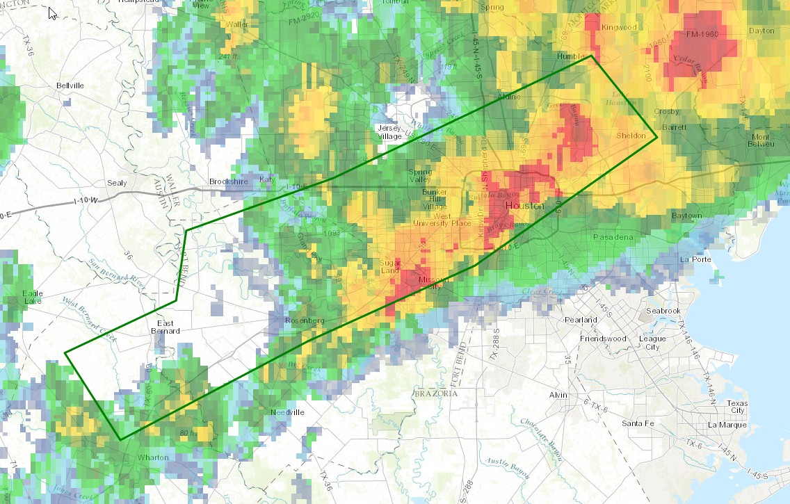
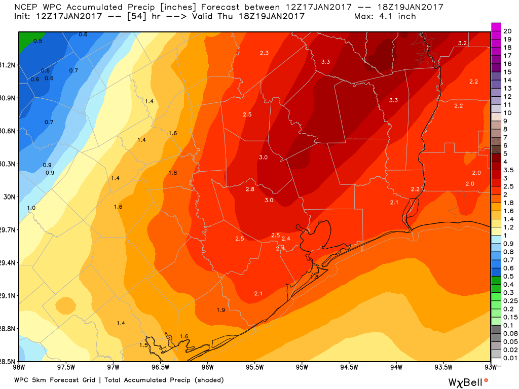
A second round of rain showers is en route to Houston as another upper-level disturbance is approaching the Houston region from the west. They should affect the region from about 11:30 am to 3 pm CT). With some clearing skies now (11 am) across Houston this is allowing daytime temperatures to climb into the upper 70s, and combined with this heating and high moisture levels would could see an additional 1 to 3 inches of rain with these storms.
It is not clear where the heaviest rains will fall, but areas of most concern include southwest and northwest Houston. The 12-hour rainfall rain totals are impressive, including the following high-water marks in Harris County:
- 2 NE West University Place 6.50 in
- White Oak Bay Heights Blvd 6.44 in
- 1 NE Houston 6.38 in
- Buffalo Bayou @ Milam 6.19 in
- Little White Oak Bayou @ Tri 6.12 in
- Brays Bayou Gessner Dr 6.08 in
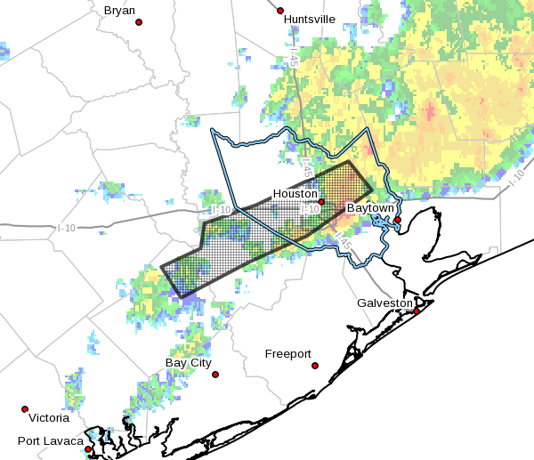
The National Weather Service has issued a flood warning for a large chunk of Fort Bend and Harris County through 4:15 pm today. The good news is such that the storms moving in later this morning and afternoon are flying along at a pretty good clip to the east, about 30 mph, so I’m less concerned about their flooding potential than those that accompanied the overnight rains. However, for areas hit hard early this morning, it won’t take too much precipitation to push swollen bayous back to near the tops of their banks.
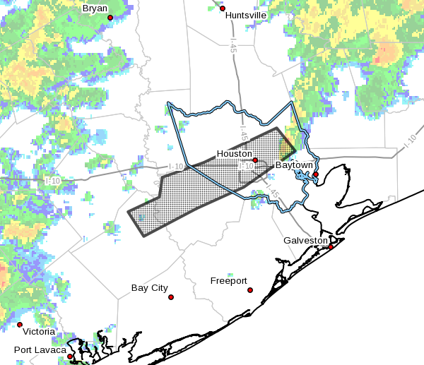
After this afternoon’s storms I think we’ll see some clearing for the late afternoon and evening hours, but we could be looking at another round of storms by Thursday morning. We’ll update you on that later today.
Posted at 11:10am CT on Wednesday by Eric
(Space City Weather is sponsored by Westbury Christian School for this month)