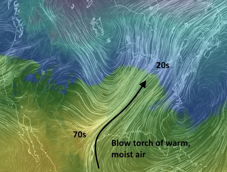
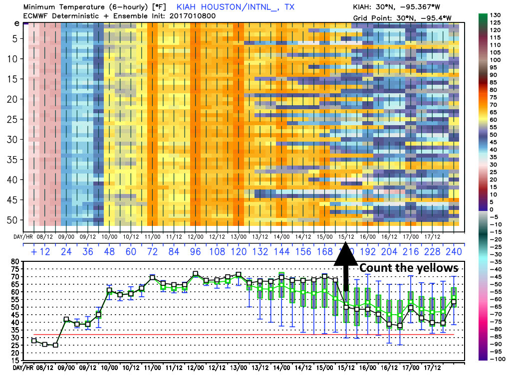
As the sea breeze and a weak front collide over Houston we’re starting to see widespread development of showers and thunderstorms over the metro area. It appears that storms between 2:30 and 4:30pm CT will probably be heaviest for the central and northern parts of Harris County.
A flood advisory has been issued for the following areas until 4:30pm CT:
Area of flood advisory in effect until 4:30pm CT. (National Weather Service)
These storms will be capable of producing moderate to heavy rainfall with the potential to flood some low-lying streets. However we do not expect these storms to produce widespread flooding. Strong wind gusts and lightning are also a threat. These storms will probably die out for good by, or shortly before sunset.
Good morning. The second half of June has been pretty dry for Houston, so all things considered the region could use some rain as we head into the warmest 10 weeks of summer. Fortunately much of the region should see just that today.
Tuesday
A weak front will sag into Houston today, meeting up with air moistened by the Gulf of Mexico. This should lead to some fairly widespread showers and thunderstorms developing before or by around noon, and sliding southward toward the coast. The most likely time for rain is between noon and sunset. I’m not expecting anything too extreme in terms of rainfall totals, and am hopeful half or more of Houston will pick up 0.25 to 1.0 inch of rainfall. Highs should climb into the low 90s.
HRRR model forecast for radar conditions at 3pm CT on Tuesday. (Weather Bell)
After a mostly hot and dry weekend (some areas, particularly west of Houston weren’t entirely dry, of course) we’re going to see a pattern change this week, with some better rain chances returning. And don’t begrudge the rain—we’ll need it for what’s ahead.
TODAY
As high pressure to the northeast of Houston continues to move off we should see some slightly better rain chances today, especially when temperatures near their peak levels in the low 90s this afternoon. Some of these showers could be locally heavy, although probably brief. For parts of Houston that don’t see rain (likely a majority of the city) conditions will be pretty hot, with the heat index rising into the low 100s.
TUESDAY
On Tuesday most of the forecast models show a frontal boundary pushing into the Houston region. Now this isn’t going to bring significantly cooler air, but it will bring some instability that should lead to fairly widespread showers, and the potential for some locally heavy rain that might briefly flood some streets. But I’m not anticipating any widespread flooding problems because these storms should develop and then weaken pretty quickly. Highs will depend upon the amount of rain coverage. For most areas accumulations should be well under 1.0 inch.
NOAA rain accumulation forecast for now through Thursday. (Weather Bell)
Good morning. It’s Thursday. So we’re edging closer to the weekend, Houston!
TODAY
Houston’s not directly under a ridge of high pressure today, but we’re close enough that any rain showers that do develop should be fairly isolated. For the most part we’re going to be hot, humid and sunny with highs in the low- to mid-90s. Heat index values may climb into the low 100s.
Texas is seeing typical summertime lows for late June this morning. (Weather Bell)