In brief: Today’s post goes into just how hot this week is going to get in Houston, and when we might expect a smidgen of relief. We also discuss the disastrous rains from Debby over the southeastern United States, and another tropical wave in the Caribbean Sea. Finally, if you’ve been noticing data issues on our app, we have an explanation.
A quick note on our app
If you opened our iOS or Android apps in the past couple of days, you may have noticed that weather data was missing. Issues with AccuWeather resulting in data ceasing to flow. We’re still working through the problem, but in the meantime, we’ve released a version of the app that reverts to using National Weather Service data. Make sure the devices where you’ve installed the app are set to auto-update and you should be good. Or, go to the respective app stores and manually download the latest version, which should appear today or tomorrow.
And it’s not just a bug fix: We’ve now made it easy to submit a bug report to us, which auto-populates with the technical details we need to chase down the issue. Tap/click the Settings gear icon in the drawer that shows all the cities and look for “Send Feedback.” Choose your email software at the screen that appears and an email with much of the needed info filled will be generated. Add as much detail about what you’re seeing and send it.
Thanks for your patience, and thanks for using the SCW app!
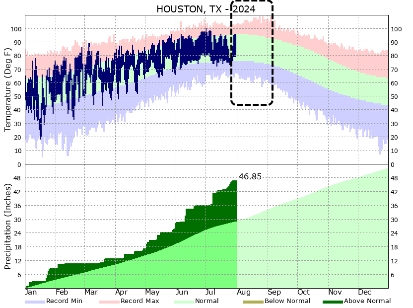
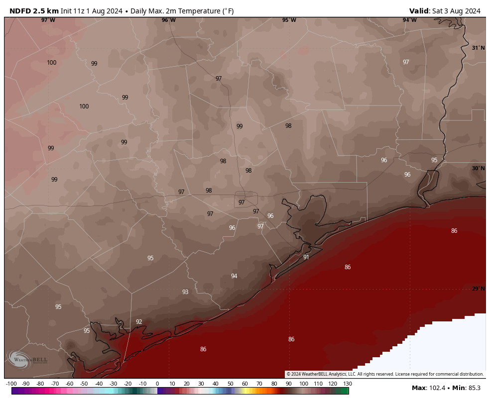
Tuesday
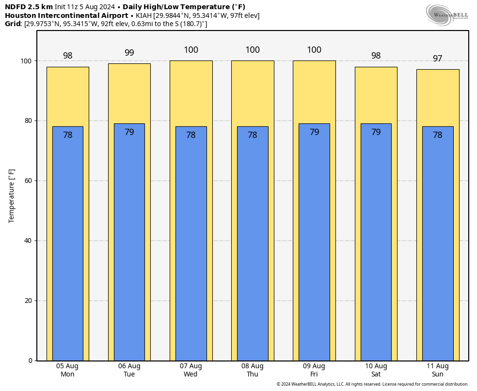
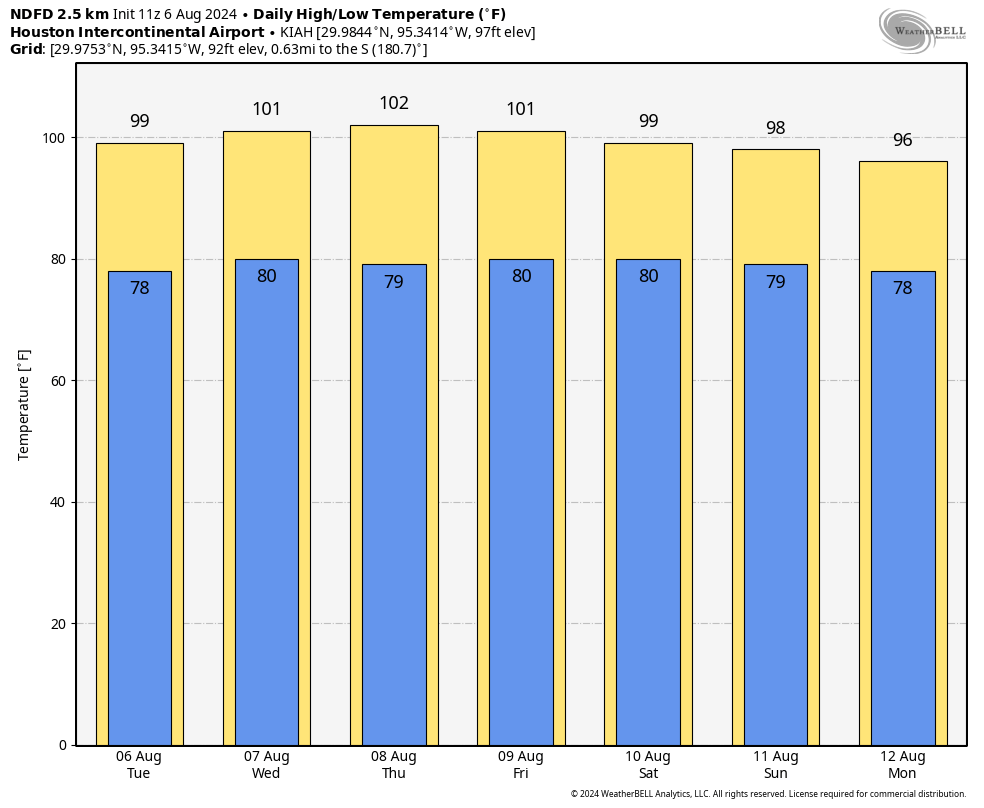
With high pressure firmly in control of our weather, today will be sunny and hot. High temperatures will push into the upper 90s for the majority of the Houston metro area, with a few inland locations possibly hitting 100 degrees. Do not expect much relief from a breeze, as winds will max out at about 5 mph. We may see a few clouds mix in this afternoon, but the chance of a shower is, at best, 10 percent. Low temperatures will fall only to about 80 degrees overnight.
Wednesday through Saturday
The heat will peak during this period, with high temperatures reaching around 100 degrees most days. Skies will be mostly sunny to completely sunny during this period, with clear, warm nights. Winds will remain low throughout the period. Rain chances are effectively zero. Houston in August, you’ve got to love it, right? Just kidding. I’m counting down the days until September (we have 26 left, by the way).
Sunday and next week
As high pressure backs off, we should see temperatures start to back off slightly on Sunday, perhaps into the mid- to upper-90s for most locations. It’s not much, but it’s something. We may also start to see some slightly better rain chances with some sea breeze showers starting Sunday or Monday. But we’re still looking at predominantly sunny skies, and any rain chances are likely on the order of 20 percent daily.
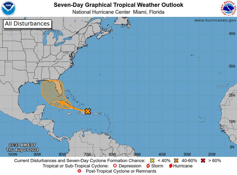
Tropics
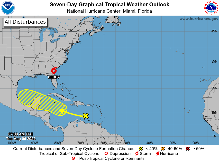
Tropical Storm Debby is continuing to pound the coastal regions of Georgia and the Carolinas with heavy rainfall, and it’s likely to continue to do so for a couple more days as the storm essentially stalls offshore. This is already producing devastating flooding in locations such as Savannah and Georgia. We have more details about all of this on The Eyewall.
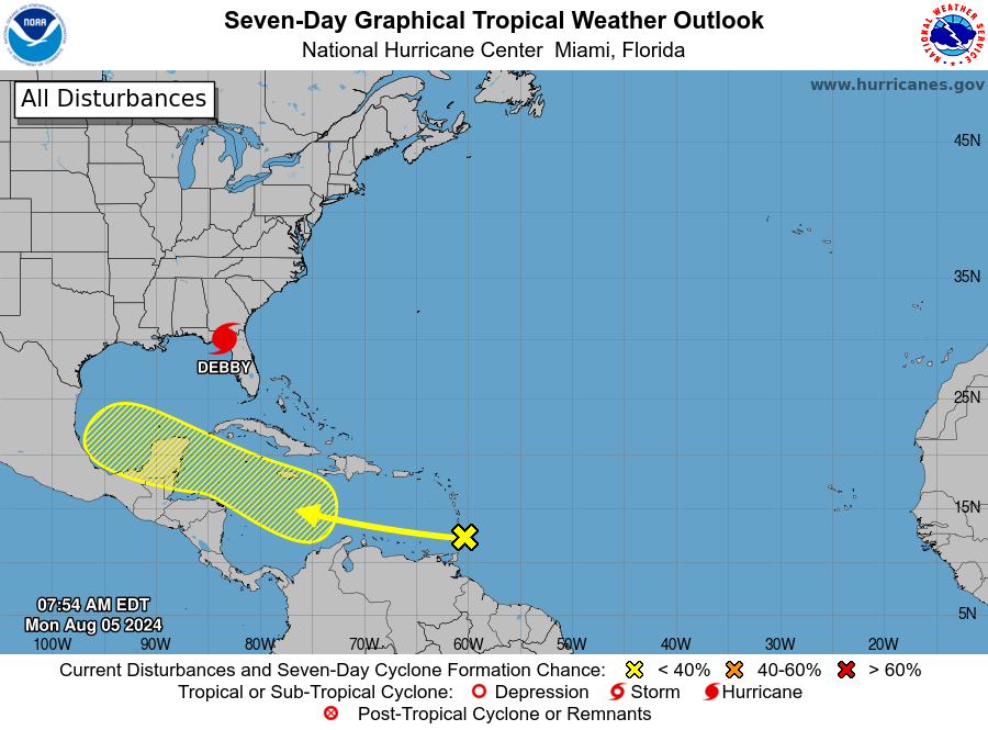
The National Hurricane Center also continues to track a tropical wave in the Caribbean Sea that is moving a little north of due west. There has been a hue and cry about this system on social media, as a handful of operational runs of the GFS model have brought a tropical system to Texas. While we cannot rule that out, there remains little support for such a scenario in the ensembles. The most likely outcome is a weak disturbance that continues to plow westward, remaining south of Texas. Regardless, we’ll keep an eye on things.