Saharan dust just began to infiltrate the Houston area yesterday, and it was not yet thick enough to obscure the sunset, which proved to be a real treat in spots.
The sky is putting on quite a show in Aggieland this evening. @KBTXShel @BillyForney3 @NWSHouston pic.twitter.com/ce45ifzNGM
— Danny McConnell (@dannytamucc) June 26, 2020
Compare that to yesterday’s sunrise off the coast of Louisiana where dust was thicker.
Scene from the Mummy? Saharan Dust sunrise near the Mouth of the Mississippi. 📸Christopher Green @HankAllenWX @BrookeLaizer_Wx @NWSNewOrleans pic.twitter.com/5eH6ArvxRE
— Scot Pilié (@ScotPilie_Wx) June 25, 2020
Your sunrise and sunset mileage during dust events will certainly vary. Should the clouds clear, we expect thick dust today, but it may begin to disperse somewhat toward sunset, so there’s a chance we end up doing well. I think sunrise on Saturday may be fairly nice as well.
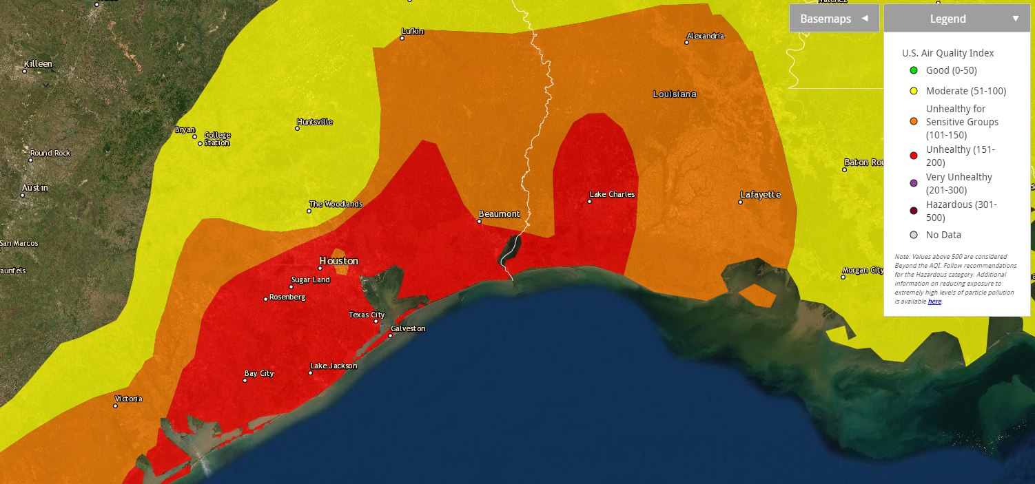
Aside from optical treats, there are practical issues with Saharan dust. The Texas Commission on Environmental Quality is forecasting today to be “unhealthy for sensitive groups” in the Houston area. Per the EPA air quality maps, we’re already one notch above that and “unhealthy” in much of the southeast half of the region.
If you have allergies, asthma, or other respiratory ailments, you will probably prefer to spend the better part of today indoors. Air quality should be improved a little bit tomorrow, though still probably considered poor. Sunday will be a little better than that.
As far as the rest of the weather goes….
Today
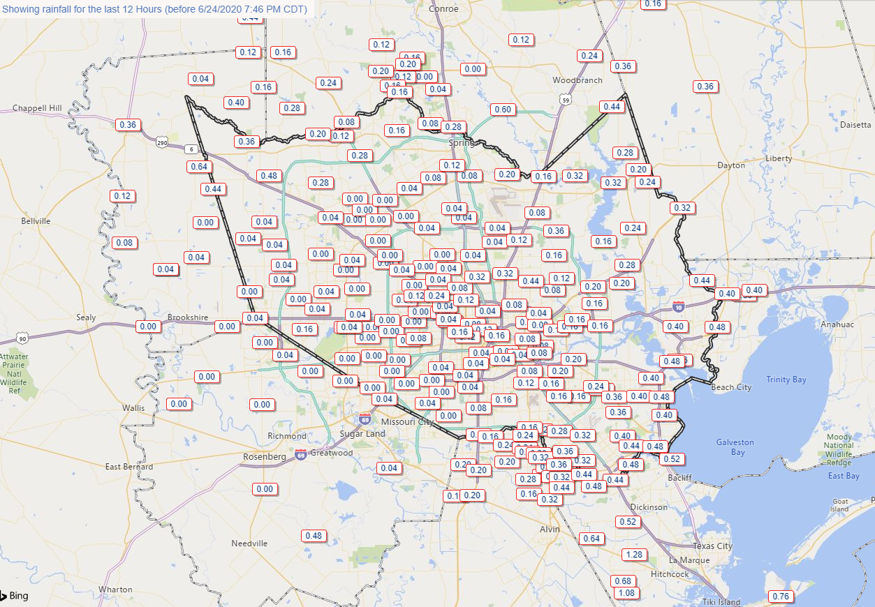
Radar is quiet for a change in the Houston area this morning, aside from a few light showers here and there. There are some storms north of Beaumont and some locally heavy rains in the Victoria area, with just nuisance showers in between.
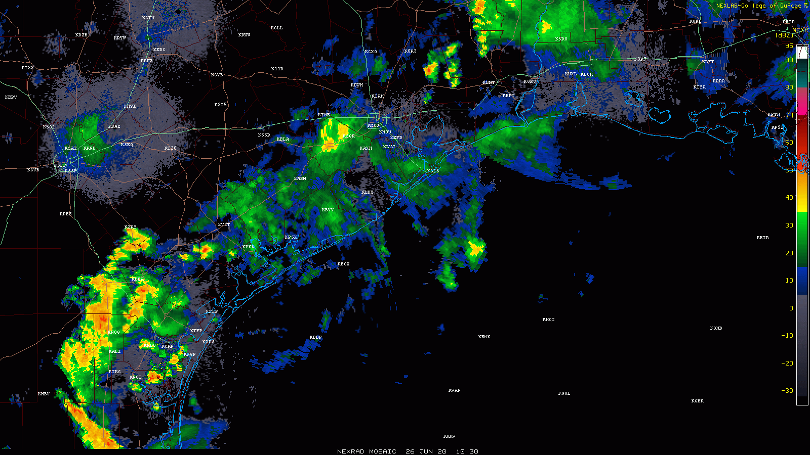
Expect the heavier rains to our south and west to continue down there and lift northward today. This should keep those west of the Houston area and west of the hardest hit areas yesterday morning. While we could still see a few downpours or thunderstorms today, the focus will likely be between San Antonio and Columbus. If that should change, we’ll let you know. Yes, you might see some dust or “mud” residue on outside surfaces if it rains. Maybe. Rain would also help improve air quality.
With clouds, haze, or dust, don’t expect much in the way of true sunshine today. Highs will be in the 80s.
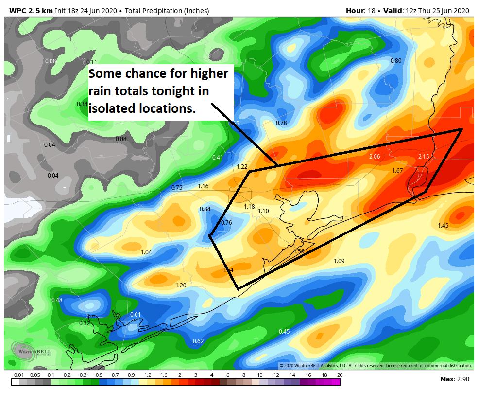
Weekend
Both Saturday and Sunday will feature a chance at a shower or thunderstorm. There may be a few small pockets where rain moves slowly and falls heavily for a time. So while many of us may not see much of anything this weekend, it’s not out of the question that a few neighborhoods end up with a couple inches of rain in a short time. I might give an edge to Sunday for having a higher rain chance, but both days will be setup for a few storms. Outside of that, expect a mix of clouds and sun with highs around 90, give or take a couple degrees and lows in the upper 70s.