Worst of Houston’s rain over

Just a brief update for you for the late afternoon and evening.

We have good news: The heaviest rain this afternoon organized a bit too late to hit the areas hardest hit this morning. Instead, heavy rain is now sliding off to the east of Houston.

Narrow band of heavy rain has moved east of Baytown and extends south to about League City as of 3:30 PM. (College of DuPage)


Most rain will exit east of the city for the evening commute. You will want to continue to watch for areas of high water around the area. The Flood Warning remains in effect for the western Harris, northern Fort Bend, and northeast Wharton Counties until 4:15 PM. Additional minor flooding is possible along Little Cypress Creek, but serious flooding in northern Harris County is not expected.

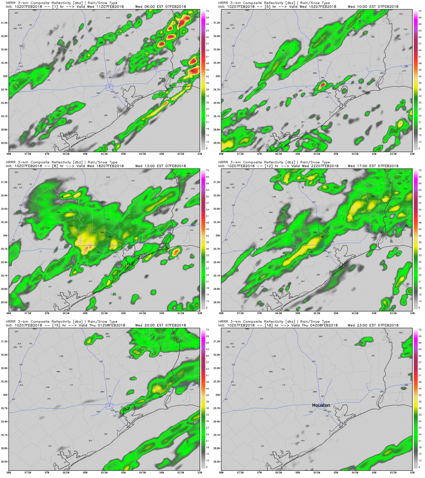
For tonight and tomorrow morning, I do expect showers to re-organize, but with the front now off to the east of most of Houston, the heavy rainfall threat will shift toward Beaumont or (more likely) Lake Charles. In Houston, just expect some showers, maybe a rumble of thunder, but no severe weather and likely no serious flooding issues.

HRRR model forecast shows the idea of rain redeveloping tonight, with the heaviest off to the east of Houston. (Weather Bell)


By tomorrow, this will all be history. We should see gradual clearing and a nice break from rain.

Posted at 3:35 PM by Matt

(Space City Weather is sponsored by Westbury Christian School for this month)

Houston’s wobbly warm winter continues

This winter has been one warm but wobbly roller coaster ride. We’ve had both the coldest weather in a few years and the most persistent warm weather in a number of years. In fact, Wednesday and Thursday represent the first time since 2002 and only the 16th time on record that Houston has officially recorded two consecutive days of 80° or warmer in January. We’ve hit 80° a lot of times in January, but usually not for more than a day. After last weekend’s cold and now with this warm weather, some are probably wondering if winter is over. Doubtful. Read on.

Today and Saturday

We have a few showers around this morning, especially north of Houston.

Radar as of 6:30 AM shows scattered showers lifting north of Houston. (GRLevel3)


As the day goes on, don’t be shocked if you see a shower or sprinkle or two around in your travels.

We will continue with a very warm pattern the next few days. Though it probably won’t hit 80 again today and tomorrow, it will come close. We’ll see mid to upper 70s today and mid 70s tomorrow. Both days will feature partly to mostly cloudy skies. The slight chance of a stray shower or some sprinkles continues Saturday also. I do expect ongoing fog near the coast to be pretty persistent through the period.

For the Texans up in Foxborough on Saturday evening, weather shouldn’t be a huge factor, though it will be quite cold. Kickoff temps will be in the mid 20s, falling into the low 20s. Winds should thankfully be light.

(Space City Weather is sponsored by Westbury Christian School for this month)

See full post

A widespread freeze this weekend and conversational sleet today?

This roller coaster of a winter shows no signs of letting up as we head through the opening days of 2017. We have sleet, wind chills in the teens, a widespread freeze…and 80° weather to discuss. Here’s how it will unfold.

Friday & Weekend

Cold weather has now settled into the region.

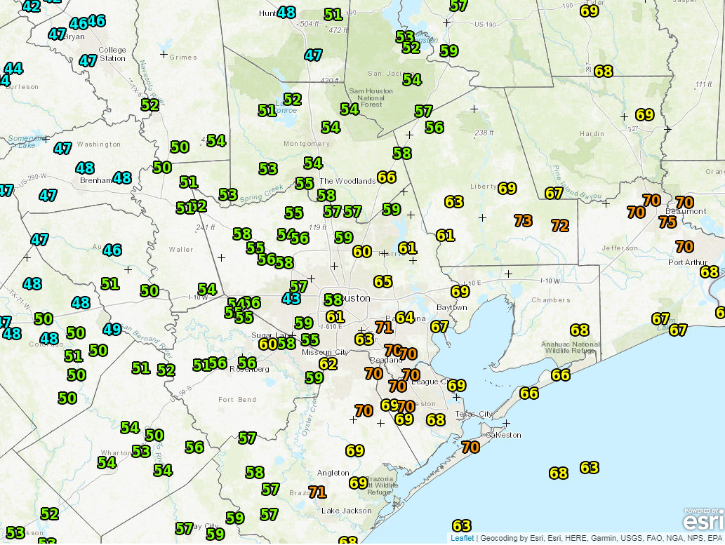
6 AM temperatures are cold enough for perhaps some sleet or ice pellets to mix in, mainly north of Houston. (NOAA)

Expect a chilly, raw day today. We’ll have a stiff north wind, coupled with temperatures not getting much warmer than they are on the map above. In addition, we’ll have clouds and occasional light rain and drizzle throughout the day. Temperatures will be cold enough for perhaps some sleet or ice pellets to mix in over the area. Fortunately, the precipitation looks light enough and temperatures just warm enough that this shouldn’t be anything more than “conversational” wintry precipitation.

HRRR model forecast radar for today shows potential for some sleet to mix in at times, but probably no travel problems or ice accumulation. (Weather Bell)

But don’t be shocked to see or hear some ice pellet pings today.We’ll clear skies out, and actually, the weekend is going to be an absolutely beautiful winter one for Southeast Texas.


(Space City Weather is sponsored by Westbury Christian School for this month)

See full post

Unsettled weekend, but real winter lurking

Unsettled weather is going to be the story of the next several days. We have a lot to discuss, so let’s break it down.

Today & Weekend

No big issues for Friday, as we’ll see clouds thicken and seasonably cool temperatures. There could be a sprinkle later today, but steadier light rain won’t begin to break out until probably after Midnight. Rain may become steady to heavy at times on Saturday morning. Here’s the good news though: Rain will likely end early to mid afternoon Saturday, and the bulk of New Year’s Eve night will be dry. If you have outdoor plans, don’t cancel them, but I encourage you to follow the forecast just to be safe.

We’ll ring in 2017 the same way we spent much of 2016: Milder than usual and a bit damp.

While there will continue to be a slight chance of showers Sunday, I think the majority of the day will be dry. It will continue to be mild, with temps in the 70s.

For Monday, the weather gets a little more interesting. A vigorous upper level disturbance will arrive, bringing renewed showers and thunderstorms. There are a lot of details that are TBD with this one, but it could potentially produce some strong to severe thunderstorms, especially north of I-10. We’ll keep you posted if this becomes more than just a “potential.”

See full post