Just a quick late afternoon update for everyone. The National Weather Service has issued a Severe Thunderstorm Watch until 11 PM for basically everyone north and west of the center of Houston.
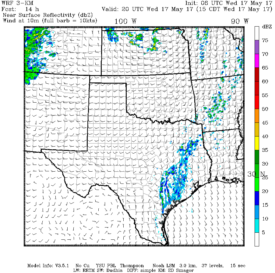
A few showers and storms are developing north and west of College Station, mainly in the I-35 corridor this afternoon as a cold front slides this way.
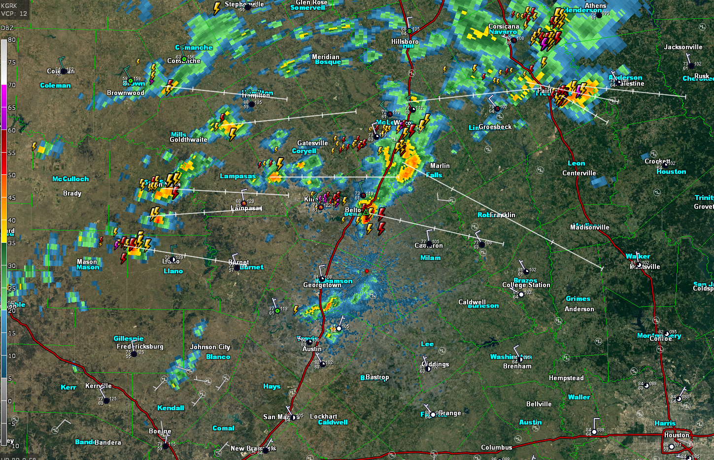
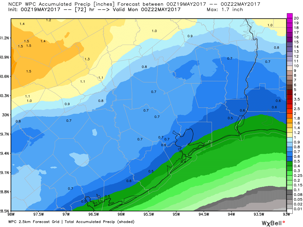
As we go into this evening, we expect these storms to hold together and strengthen a bit further. As a result, scattered showers and strong to severe thunderstorms will approach the Houston metro area after about 6-7 PM. They should clear the coast by about 11 PM or so. Storms will probably peak in intensity northwest of Houston, but some of the stronger ones could hold together to the coast as the front moves through the Houston metro this evening. The NWS may expand the watch a little later if necessary. Any thunderstorms could have strong winds (50-70 mph or so), large hail, and heavy rain. Tornadoes are always a possibility with severe weather, but in this case, the risk of that looks very low and is not a significant concern.
As is often the case in these scenarios, not everyone will see thunderstorms or severe weather; that will be isolated to scattered. But some of you could see some strong to severe storms this evening. Have a way to receive weather warnings, particularly if you’ll be outside enjoying the nice weather we’re having today. Don’t worry: Equally nice or nicer weather is on tap tomorrow.
(Space City Weather is sponsored this month by Jetco Delivery)
Posted at 3:50 PM by Matt