We’ve been talking since last week about how the end of this week and/or the weekend look like hot days in Houston, giving us our first shot at 90° in 2017. However, after looking at weather data today, I think there’s a legitimate chance Houston could officially touch 90° for the first time tomorrow. Not a guarantee by any means, but there’s a chance. And the meteorology around it is sort of interesting, so let’s lay it out for you.
Step 1: Have a warm air mass in place
The recipe for Houston to hit 90° in late April involves a few factors. And this may seem like a “duh” statement, but it’s important to touch on. You need to have a warm enough air mass overhead.
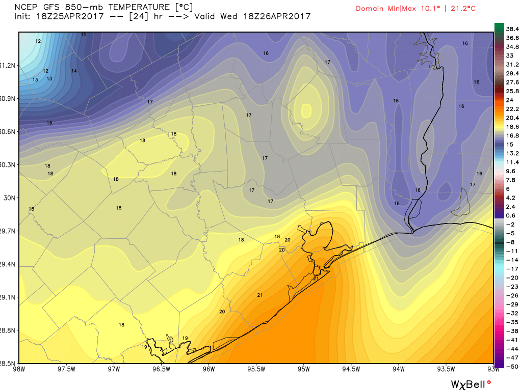
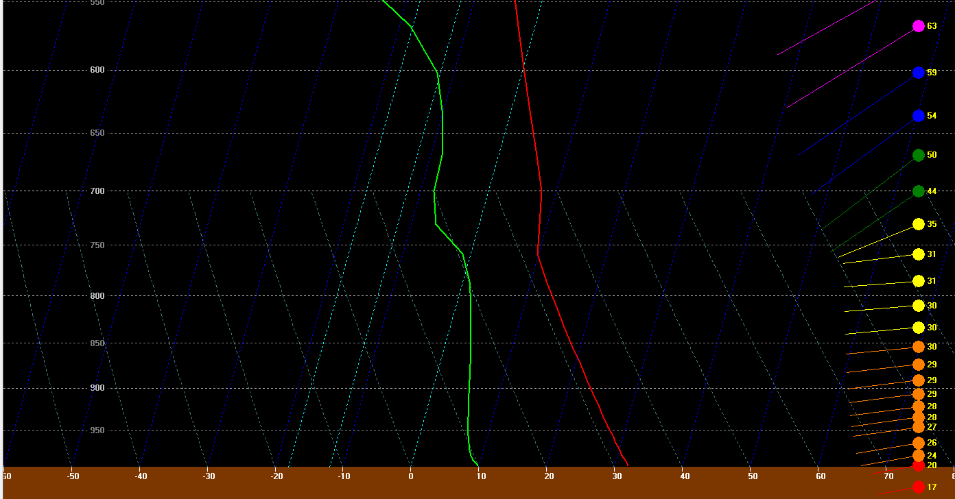
The GFS forecast for tomorrow afternoon has temperatures borderline, but close enough to historically be capable of producing a 90 degree day in Houston. The map of 850mb temperatures above shows how warm it is about 5,000 feet up in the atmosphere. There’s an old school meteorology trick you can use to forecast high temperatures using the 850 mb temperature in the morning. It involves using a sounding (as explained here) and taking the 850 mb temperature down what we call the dry adiabat to the surface. One of the problems tomorrow is that with a front coming through, it creates volatility, which makes using that method difficult. But if you look at forecast soundings for 4 PM tomorrow afternoon, they look healthy for at least an 87-89° sort of day.
So on Wednesday, we have just a barely warm enough atmosphere to work with.
(Space City Weather is sponsored this month by The Mole, a Jonathon Price novel.)