Good morning, and happy Go Texan Day, y’all! Today looks great, but this weekend should get mixed reviews, as we’ll be dealing with some rain chances dampening things a bit. On to the details.
Today & Saturday morning
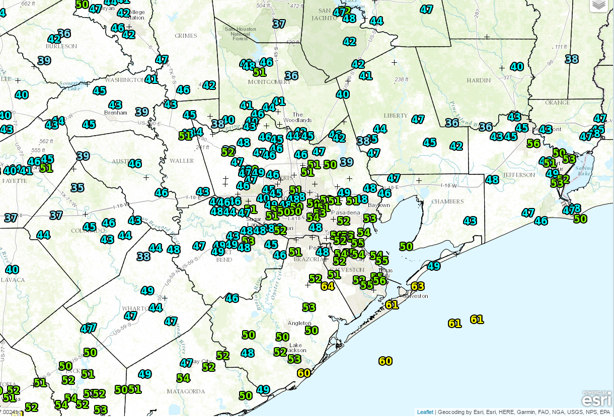
Today will be a fine day. We are starting off a bit chilly this morning, with a lot of 40s on the board north and west of Houston.
It looks mostly sunny and dry this morning and afternoon. We’ll have some high clouds skirting through from time to time, but overall it looks to be a nice day. Temperatures should get up to near 70 degrees with a modest breeze.
It should be a quiet evening, though it won’t be quite as cool as this morning or Thursday morning. Temperatures should start Saturday about five to ten degrees warmer than those days. Clouds will begin to increase tonight as well, leading to a mostly cloudy, but likely quiet Saturday morning. It *should* be good weather for the Downtown Rodeo Parade or the Rodeo Run. We can’t entirely rule out a sprinkle or some light rain, but steadier rain should hold off until after Noon.
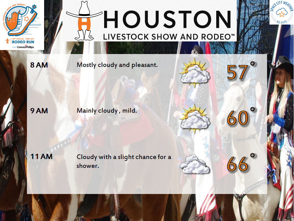
You’ll still want to keep tabs on the forecast before you head out in the morning, just to be safe.