After a mostly quiet weekend around Houston, we had some excitement Sunday. In the morning, we had a waterspout in Galveston that prompted a Tornado Warning. Then, we saw numerous showers and storms around the area in the afternoon.
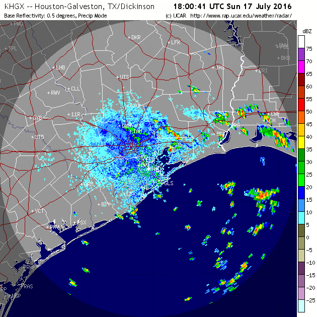
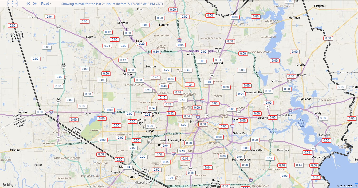
Rain totals weren’t terribly impressive, but a couple spots saw up around an inch of rain.
Anyway, as we go into this week, we’ll start with rain chances similar to what we saw yesterday.
MONDAY & TUESDAY
With a good onshore flow and a surge of good moisture, it will be wise to keep rain chances in the forecast for Monday. Like yesterday, this won’t end up being a widespread soaker, but some of us will see some beneficial showers, downpours, and possibly thunderstorms both this morning and this afternoon. Outside of that, continued sticky and hot, with highs in the low to mid 90s.
I think tomorrow will be a similar story, except we begin to see high pressure flex from the north. That means the best rain chances will be south of I-10. But again, a modest amount of shower/storm coverage should be expected. Again, highs should be in the low to mid 90s, with mid to upper 90s north of the Houston metro area.
WEDNESDAY-WEEKEND
The much ballyhooed heat dome of high pressure over the Central US should really begin to flex its muscles by Wednesday and continue to do so into the weekend. At this point, expect few to no rain chances, except south of US-59 (and even those look slim) through the weekend. High temperatures will likely average 97-99° in Houston, a little hotter north, and a little “cooler” south. Morning lows, which have been tolerable the last several days, will stay generally in the upper 70s or low 80s.
Bottom line: Let’s hope for rain today or tomorrow because it’s going to be a pretty unpleasant, hot stretch into the weekend.
I’ll be filling in for Eric this week to give him a little bit of a breather. Tomorrow, we’ll touch on the tropics, and Wednesday we’ll talk a bit about chances for a pattern change here, so stay tuned!
Posted at 6:05 AM by Matt
Thanks for the informative posts! Looking forward to an analysis (and forecast?) of the tropics.
I’m not looking forward to anything about the tropics. FSU says there’s a 95% chance of some kind of tropical cyclone impacting the TX coast this season. Did you see the same thing, Eric?
And, Eric, when we finally do get the surface low pressure, rising air, low wind shear, plentiful low to mid-level moisture and an African tropical wave needed to spawn an Atlantic hurricane, WATCH OUT! Record to near-record levels of heat energy are in the Atlantic in the Caribbean, Gulf of Mexico and waters surrounding the Bahamas, EXCEEDING EVEN THE HEAT ENERGY THAT WAS AVAILABLE DURING THE NOTORIOUS HURRICANE SEASON OF 2005! This year’s high levels of ocean heat content in the Atlantic increases the odds of dangerous rapidly-intensifying major hurricanes if the other conditions needed for intensification are present.
In other words, Eric, if an organized storm gets to our region before the season’s over, RUN FOR YOUR LIFE! It could/will become a monster beyond any Gulf storm we’ve seen since the heydays!
It’s difficult to place odds on exactly where a tropical system might impact before it forms. We’re a lot better at predicting quantity of storms at a seasonal timescale than we are at predicting where they might go. I’d say the odds are good that at some point we are going to be tracking something this summer/fall. Whether that impacts Texas (and remember, Texas is big) versus Louisiana or Mexico…I don’t feel strongly one way or another to be honest.
I wish we could’ve taken April-May’s washout and spread it evenly throughout the year.
A small number of people, including me, have partially lost power in the Heights area after that storm rolled through.
It’s interesting, it seems that we’re getting a low voltage as I can turn on incandescent lights but not LED or fluorescent lights. This is a new one on me… Usually, the power is either on or off….
Yeah. Centerpoint Energy —-Always There. NOT!!!!!!
Once again today it seems that the storms that have tracked from Louisiana to Texas along the coast have split as they have approached the entrance to Galveston Bay. This is a phenomena that seems to happen with storms that move close to the the coastline from either direction (well except for Ike..lol). Is there something about the land temperature change near the mouth of the bay or something else that causes this or am I just imagining it living on Tiki.
Thanks for all the great info on this site and in previous years guys!
I think it’s more coincidence than anything. It may have something to do with the fact that in the morning, those storms tend to weaken as they approach land, whereas during the afternoon, they use the heating of the land to strengthen. So it may have something to do with orientation and that more than anything. But I don’t doubt it’s something you’re actually witnessing! I’ve seen it in spots too.
The houston weather these days has definitely been odd. The winter is 70degrees and very spotty cold breezes.
Houston weather is always crazy. I love it when it gets cold though. I’m also partial to rain. You gotta keep a coat, a tank-top, shorts, and pants round these parts.
Houston still has the craziest weather. It’s been beautiful lately though!