In brief: Houston will see gorgeous weather today and increasing clouds Saturday. Scattered showers are likely Sunday before the first of two fronts Monday. Winds will be gusty Sunday into Monday. It’s a second front Tuesday night that gives us the real cool stuff to close out next week.
Before we begin today, two quick housekeeping items. First, Galaxy Lights, presented by Reliant kicks off tonight! It finally feels a little more fall-like, so if you want to get yourself in a more festive mood, go check it out. And thanks to Reliant’s sponsorship of Space City Weather, you can get $5 off your tickets if you use code: GLSCW24!
Secondly, a reminder that our annual fundraiser continues. Y’all love the umbrellas and astronaut t’shirts. Thank you again for your support of the site!
Today and Saturday
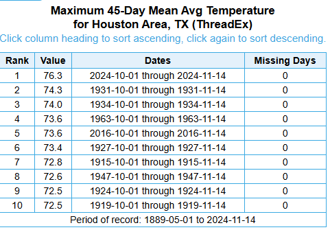
The period between October 1st and yesterday has been the warmest on record in Houston for that range by a full 2 degrees, which over 45 days is pretty remarkable. We’re in the upper-40s officially this morning for the first time in about a month. This autumn has been anything but typical.
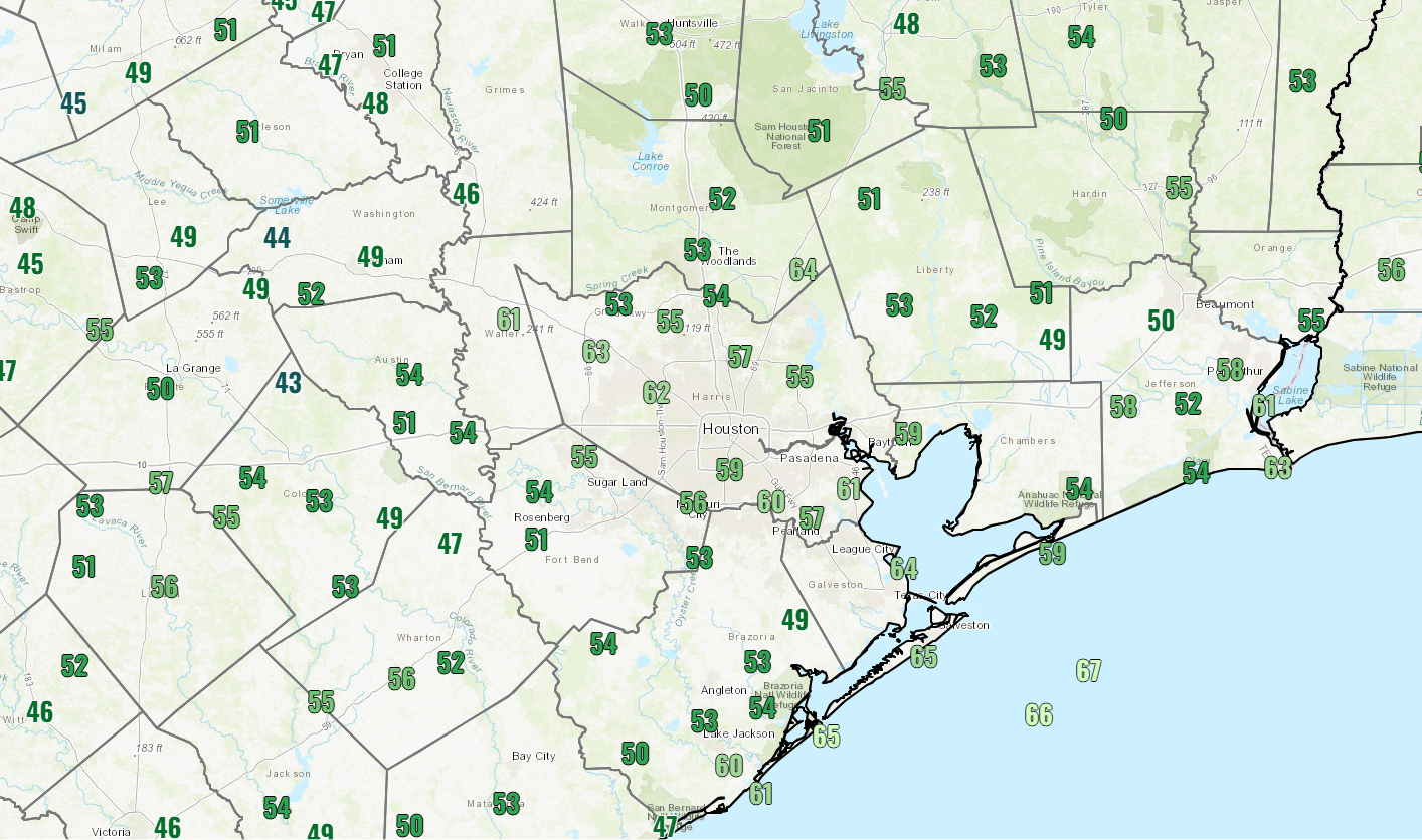
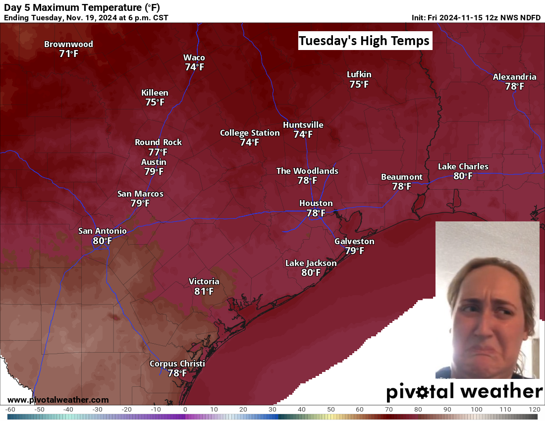
There will be lots of sunshine today with continued pleasant weather. Highs will top off in the mid-70s. Clouds will begin pushing in tonight and tomorrow, so look for less sun. Morning lows tomorrow should be in the 50s to perhaps near 60 degrees, while daytime highs will be near 80 degrees as long as we get a little sunshine.
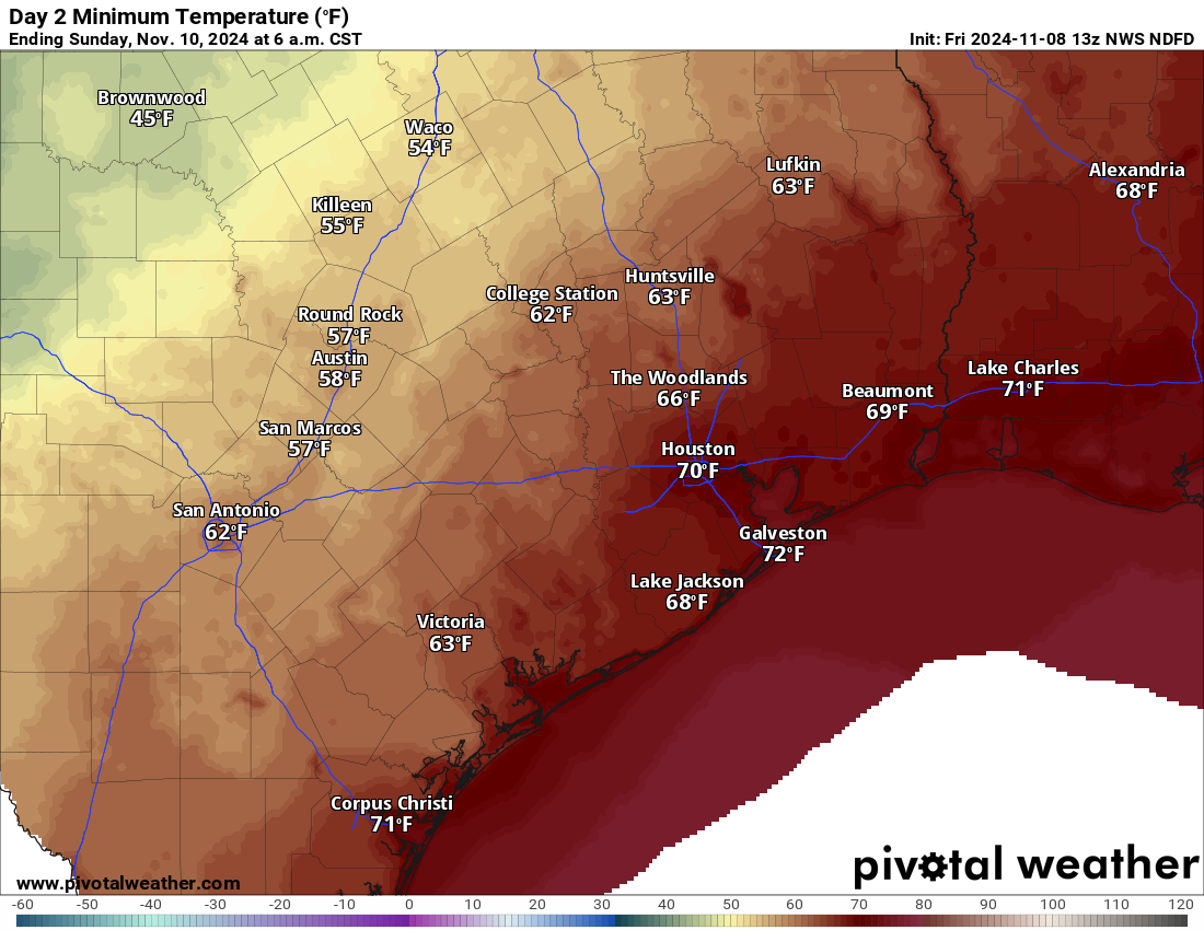
Sunday
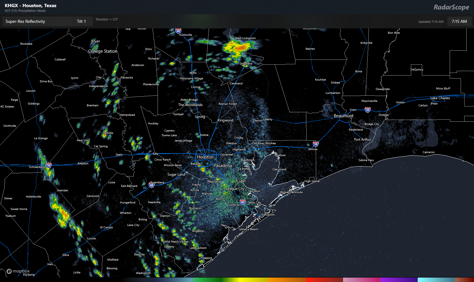
Isolated to scattered showers will begin to pop up late Saturday night and continue into Sunday. I don’t expect Sunday to be a washout right now, but there will be rain showers to dodge throughout the area and the day. Highs on Sunday should be in the low-80s after a very mild morning in the 60s or low-70s with increasing humidity. It will also be quite breezy on Sunday, with winds gusting to 25 mph or so, perhaps a bit stronger over the bays and at the coast.
Monday
The first volley in the transition to late autumn comes Monday with our scheduled cold front. There should be a line of thunderstorms that accompanies the front around midday on Monday. Some could have very gusty winds. Once those push east of the area, we’ll see a slow drop in humidity and slightly cooler weather. Ahead of the front, the morning will be breezy, but the wind will die off behind the front in the afternoon.
Rest of next week
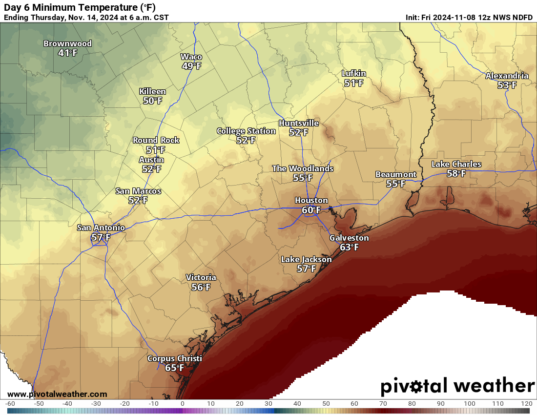
Don’t be tricked by Monday’s front! Some folks will be quick to call “bust” with this, as Tuesday morning will only be in the 50s and Tuesday itself quite warm in the upper 70s.
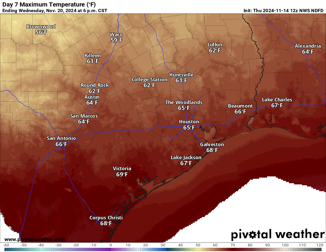
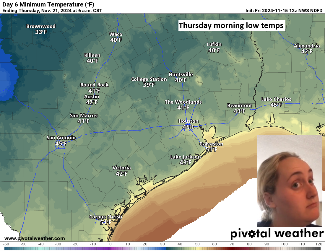
It’s a second front early Wednesday morning that ushers in the real cool stuff. Wednesday will probably struggle to get to the mid-60s for highs, with lows in the 40s and some pockets of 30s Wednesday night and Thursday morning.
Nice weather should continue into next weekend.
Tropics
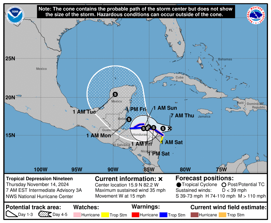
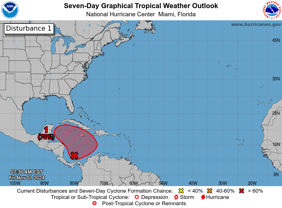
Tropical Storm Sara made landfall in Honduras this morning. Rain totals in excess of 20 to 25 inches are possible in the northwest mountains there. Substantial rain is now likely in Belize over the next couple days as well.
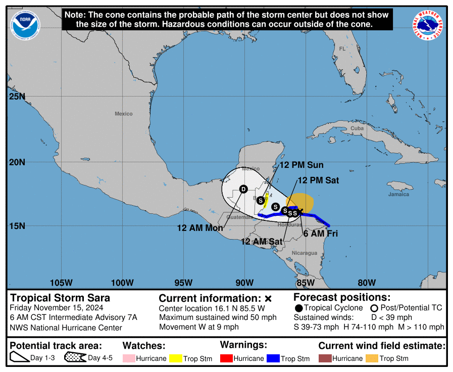
The good news is that Sara should degenerate into a remnant low next week and get swiped east ahead of the cold fronts that push into the Gulf. Never say never, but that should close the books on the 2024 Atlantic hurricane season.