In brief: We’ll have one more pretty quiet day before rain chances begin to increase. This will lead to cooler weather and healthy, daily chances of rain beginning this weekend and continuing into much of next week. It won’t feel terrible for midsummer.
We managed 94 degrees at Bush yesterday and 93 at Hobby as fairly typical mid-summer weather continues. We’ve got one more day of it, and then the rumblings of change begin.
Today
Copy and paste yesterday’s weather for the most part.
Wednesday
Look for the day to start as a repeat of Monday and Tuesday, but by afternoon, shower chances will begin to increase. Scattered showers and storms are likely. Call it about a 30 to 40 percent chance or so. I might say that the highest chances will be south and east of Houston tomorrow. We’ll check in on this obviously tomorrow morning. Highs should peak in the low to mid 90s with lows in the 70s.
Thursday
We will have an additional 40 to 50 percent chance of afternoon thunderstorms. Prior to that, expect a mix of sun and clouds with highs in the low-90s. Lows will be in the mid-70s.
Friday
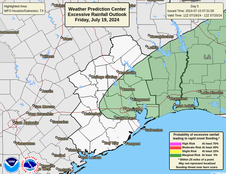
Here’s where I’d begin to expect scattered to more numerous showers and thunderstorms and some locally heavy rain. Temperatures may struggle to get to 90 on Friday, depending on the exact coverage and timing of storms.
Weekend
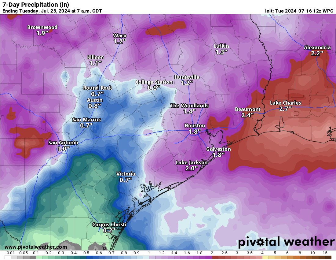
Both Saturday and Sunday should see scattered showers and thunderstorms each afternoon. All of this will be caused by a cool front that should stall out, or really kind of wash out in our area. The location of the stall will help determine the exact focal point of storminess into the weekend, but most areas should see at least some rain between Thursday and Sunday and some areas will see several rounds of it as well.
Next week
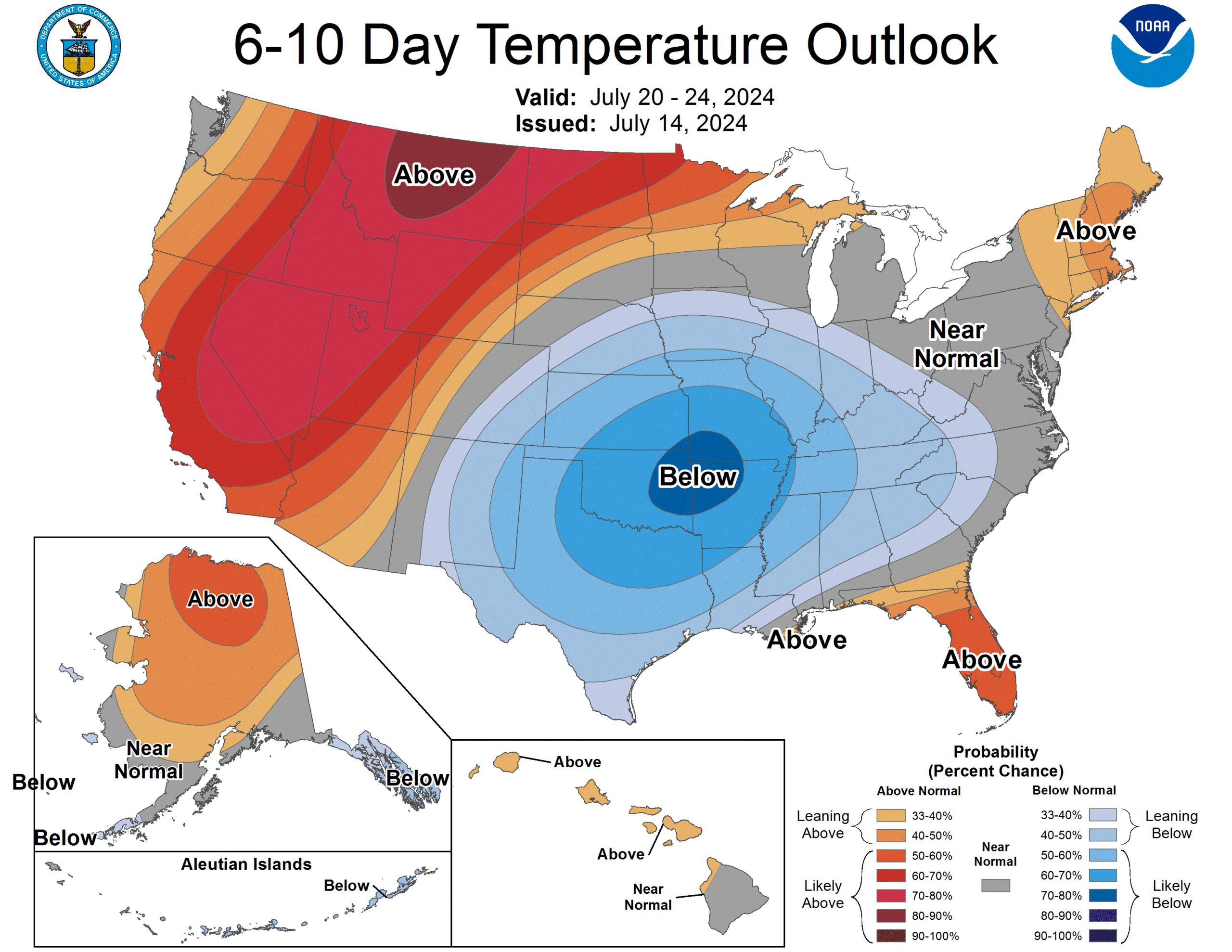
It’s too soon to get super specific, but we will be seeing numerous shower and storm chances next week, at least through midweek before perhaps easing up some toward next weekend. We will probably have multiple days with highs failing to reach 90 degrees due to cloud cover and rain. Despite this, there will be little relief from the humidity which should remain high. So nighttime lows will continue to remain in the 70s. But the periodic rain and storms and the overall cooler air mass should help lead daytimes to feel not terrible for late July.
We may also get a round or two of Saharan dust next week, and any rain can aid in minimizing those air quality impacts a bit too.