In brief: After enduring one of the longest, strongest late season heat waves on record in Houston, we will begin to slowly reduce heat after today and tomorrow. Look for slightly “less hot” weather next week and an opportunity at a weak cool front. We’re also watching the tropics but are not currently too worried about what develops near the Yucatan as it pertains to Houston.
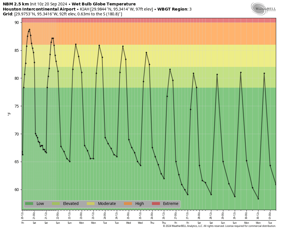
We hit 98 degrees yesterday officially in Houston, our seventh straight day above 95 degrees that began on September 13th. In the history of Houston’s weather records back to the 1880s, a one week stretch above 95 degrees has not ever occurred after September 13th. We had a couple five day stretches back in 2011 and late last September but never a week. If you’re like me and hate September because it only teases and never delivers autumn in any lengthy fashion, then this stretch of weather inspires much loathing. It’s just that it hasn’t been this hot for this long this late in the season before in Houston. We may make a run at an eighth straight day of this today, but the good news is that change is on the horizon.
Today through Sunday
Today and tomorrow should be similar in nature, with highs generally in the mid-90s, give or take, with limited rain chances. We will probably get the same out of Sunday, though it may be a degree or two cooler. It should still be above 90 though. Morning lows should be stable, generally in the mid-70s. If you’re out for a morning walk, it’ll really depend on exactly when you step outside. Either way, it will be quite humid.
Next week
I get the sense that next week is the week we really start to transition to autumn. It won’t be cool and refreshing by any means, but we will see high temperatures shave off a degree or two each day. We’ll start the week on Monday likely in the low-90s and finish the week in the upper-80s. Morning lows will go from the mid-70s Monday to the low-70s by Friday.
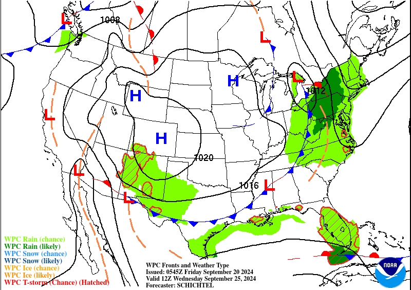
The Weather Prediction Center’s forecast map for next Wednesday does show a cold front pushing into our area. This won’t be a sudden ultra-refreshing change, but I think this will reinforce this idea of a slow drift back toward “less hot” weather next week. With high humidity early in the week and an approaching front there will be a slight chance of showers each day, especially south and east of Houston. But meaningful rain seems unlikely next week.
Tropics
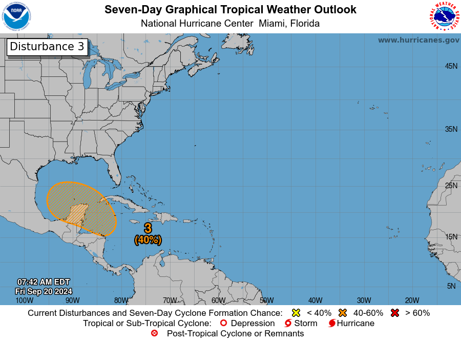
Yesterday evening I pushed a post out at our companion site, The Eyewall to discuss the latest on the Caribbean disturbance we expect to try to develop next week. In the post, I included a section about Texas and why I don’t believe this one is our storm. Meteorologically, the setup is such that whatever it becomes should move very slowly in the southern Gulf or near the Yucatan for several days before eventually getting scooped up by a trough in the Eastern U.S. and whisked off to the northeast. Overnight modeling did nothing to dispel that thinking on my end, so I’ll refer you to the post yesterday to get a better understanding of why we’re not currently too worried. That said, we’ll keep monitoring things this weekend and have the latest for you on Monday, assuming this remains likely to stay away. We will also update The Eyewall this weekend with more. For those of you with travel plans next weekend in that region, you’ll want to keep tuned in.