Well, I sure hope you were able to get outside this weekend. For some people it was perfect weather, while others may have found it a little cool. Whatever the case, it was nice to step outside and not feel like my face was about to melt off. Surely, the next question some people have is whether or not this was just “faux fall,” and we see a return to a lengthy stretch of warm and humid weather again. The answer is not quite! More autumnal weather is on the way, and for some folks, more rain is on the way too.
Today
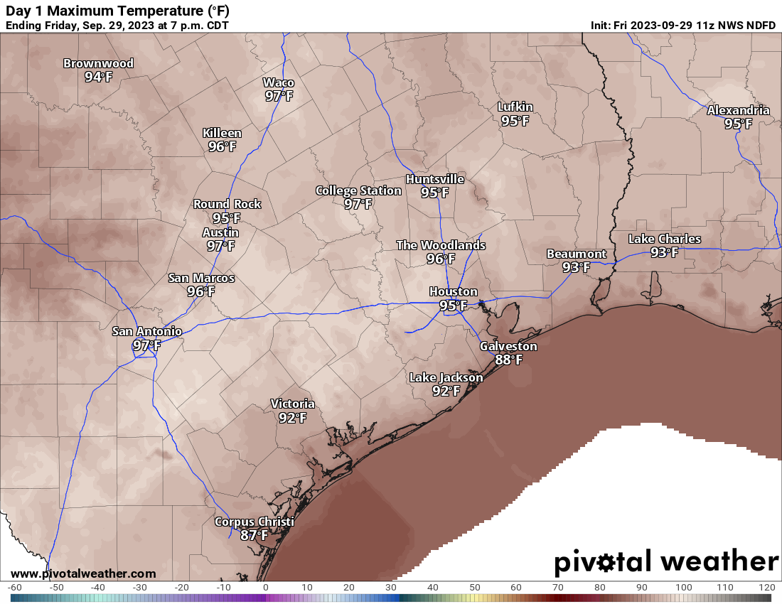
One thing that did surprise me a little this weekend was the resiliency of the high cirrus cloud deck. It certainly made for some nice skies, but it also diminished the sun a bit. We’ll likely see more of that today, especially south of I-10. North of I-10 should be basically fully sunny. It should be at least a little warmer overall, with highs in the low to mid-80s.
Tuesday
We’ll see a notable uptick in humidity here as onshore winds kick in, bringing in a relatively moist air mass. In addition, clouds will likely increase, and there should be at least some chance for a few mostly light showers, especially near the coast. Morning lows will generally be in the 60s, with highs in the low-80s.
Wednesday into Thursday
The forecast gets interesting here. Pacific-driven moisture courtesy of Tropical Storm Lidia and Tropical Storm Max will surge across Mexico and toward South Texas on Wednesday. This will all combine with a developing area of low pressure in the Bay of Campeche that will lift north and then quickly east across the Gulf. This should mean periods of rain or showers and a chance of thunderstorms. However, whether that’s in the Houston area or along the coast and offshore is still a bit fluid. North of I-10 should expect minimal rainfall. South of I-10 will see upward of a quarter-inch to perhaps as much as an inch near the coast. The heaviest rainfall is likely to occur from Matagorda Bay south to Corpus Christi and the Valley.
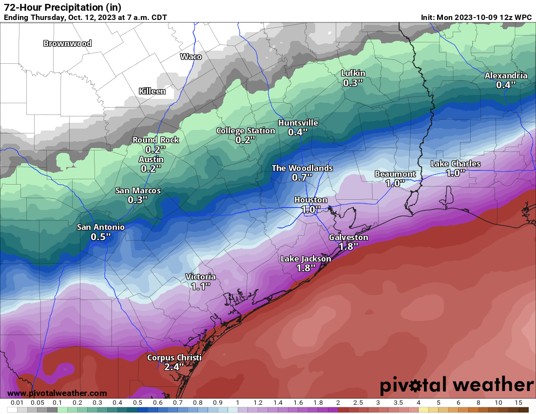
Personally, I think the rainfall forecast above is a bit generous. I might shift the gradient 25 to 50 miles south based on the overnight model data. We’ll fine tune this tomorrow when we get a better idea of exactly how far north rain should get. Look for variable highs on Wednesday, with perhaps 80 or so north and 70s south depending on how much rain occurs. Wednesday may also have a bit of a breeze as well out of the east-southeast.
We’ll see gradual clearing Thursday, though there may be another chance of showers late in the day. High temps should be back in the mid-80s most places.
Friday
We’ll peak temperatures on Friday with a bit of drier air. It will be start very warm and humid with mid to morning lows in the 70s. The humidity may drop some during the day with offshore winds, but that will allow temperatures to warm well into the 80s.
Cooler air arrives Friday night into Saturday, ushering in another delightful fall air mass for the weekend. This front won’t have much moisture with it, so while a shower or two will be possible, most places will likely remain dry.
Weekend & annular solar eclipse
This weekend looks like a repeat with highs in the 70s, lows in the 50s, and low humidity. Just super nice autumn weather. For now, the cloud cover situation for Saturday’s annular solar eclipse looks great with most of Texas in the clear (the exception may be the Rio Grande Valley and Panhandle).
I will say that I want to be a little cautious after this weekend’s more abundant high clouds, but at this point things look great. Fingers crossed. We’ll watch this closely through the week.