In brief: Houston’s best chance at rain remains Saturday, where some parts of the area could see a stronger thunderstorm. Still, it will be a bit of an uneven distribution of rainfall, with some areas likely seeing little rain when all is said and done. Easter looks cool and dreary but overall, not very disruptive.
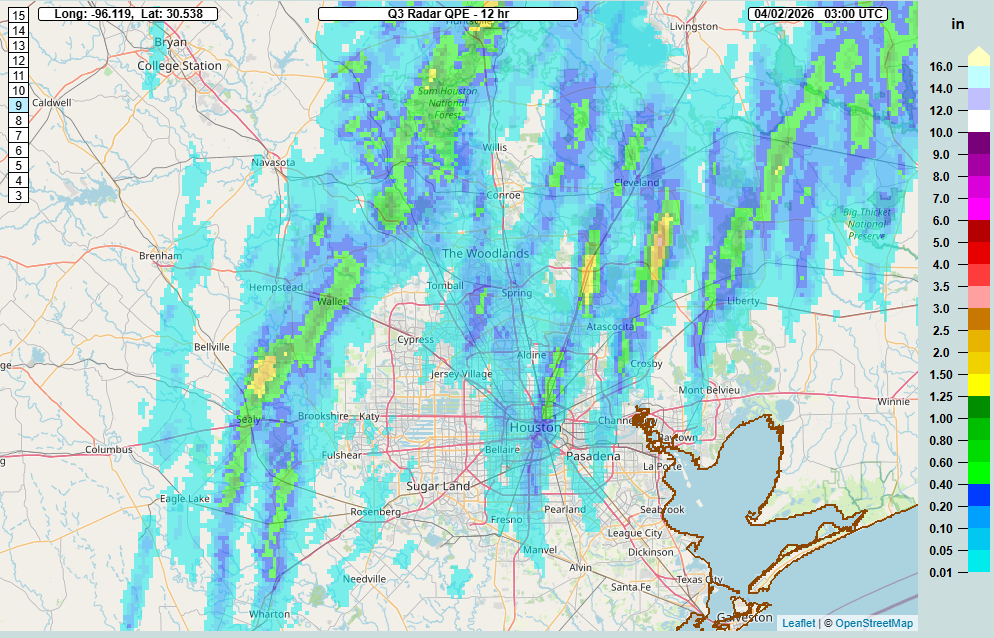
Pretty much as expected on Wednesday morning, most of the area was void of meaningful rainfall yesterday. So where did it rain? Go north.
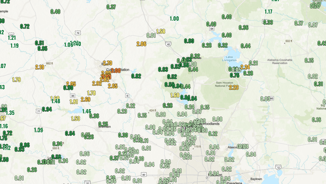
From the Brazos Valley to just near Lake Conroe saw anywhere from 1 to 3 inches of rain, as did a small bullseye south of Lake Livingston and in Sam Houston National Forest. The 2.81″ of rain in College Station was a record for April 2nd and the wettest day of 2026 with the most rain measured there since October 25th of last year. Good news for that area. For us? Frustrating, but that’s how it goes. Are the odds better tomorrow? Let’s discuss.
Today
Today should see clouds, some sun, and a few mostly inconsequential showers around the region. A few places may see up to a half-inch in a steadier downpour but most of us will see minimal rainfall or nothing at all. Highs will be in the mid-80s.
Saturday
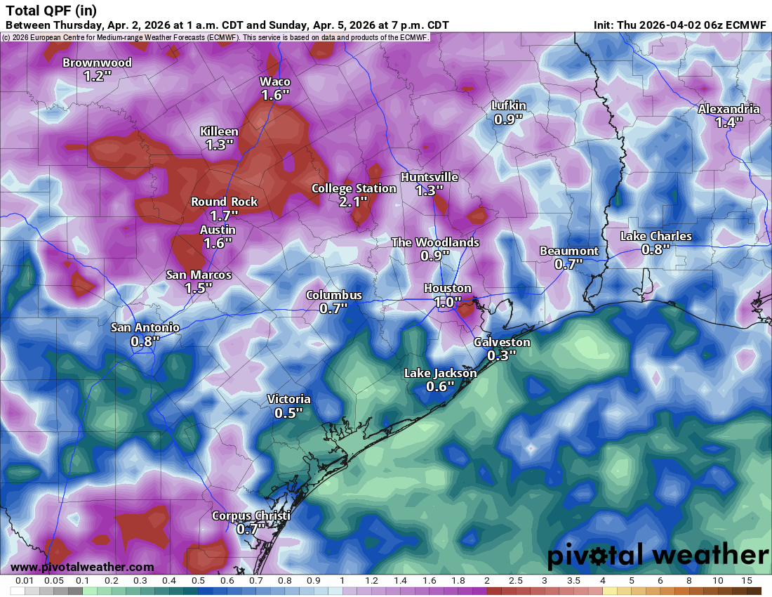
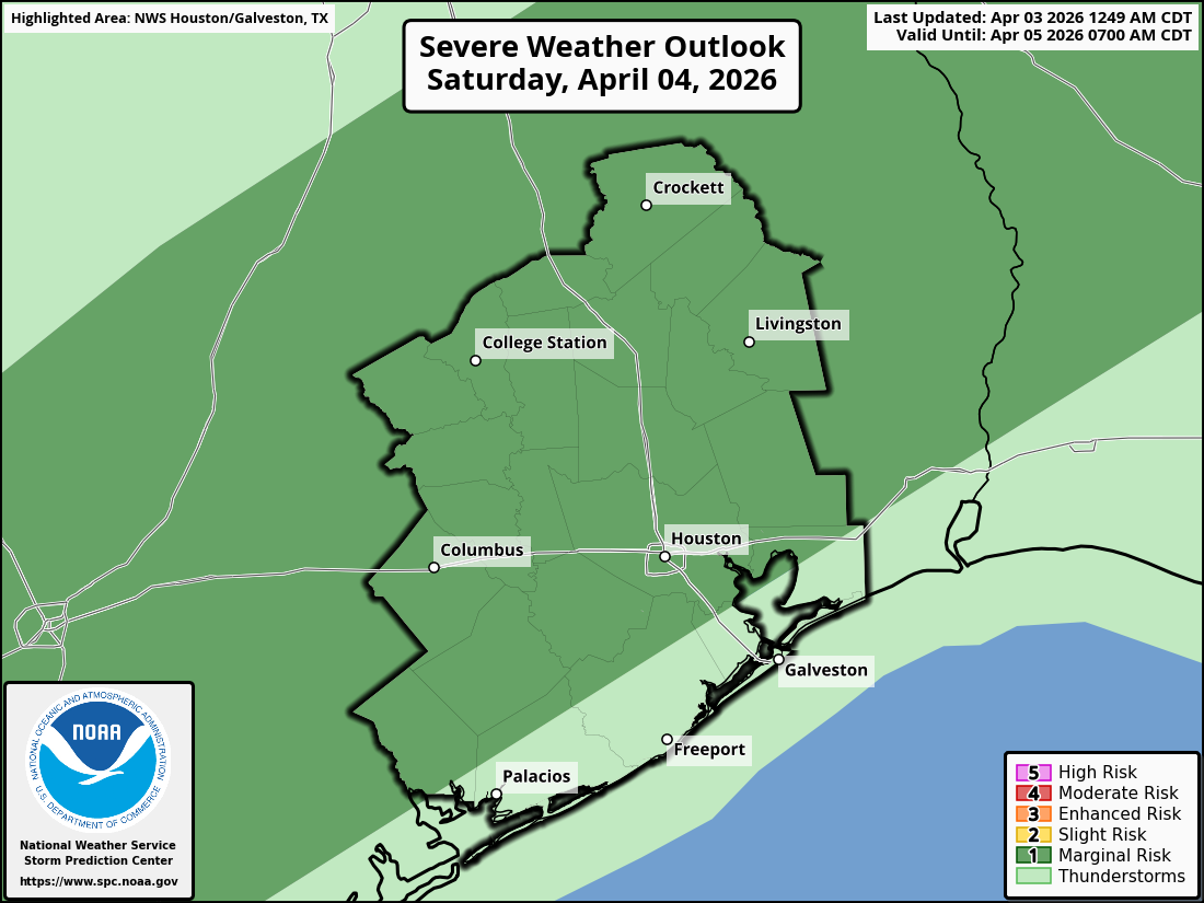
The front half of the day will probably much like Thursday and today across most of the area. We cannot rule out some passing showers, but primarily it will be cloudy with some sunny breaks, warm, and humid. A line of thunderstorms should begin developing near College Station in the early afternoon and drop south and east into the Houston area by late afternoon. Some of these storms could be on the stronger side, and the area is highlighted in a marginal risk (1/5) for severe weather tomorrow.
As the storms push toward Houston, we may see the line become a bit more scattered in nature. Areas west of I-45 and north I-10 still stand the best odds of seeing appreciable rainfall on the order of 1″ or more. There are some signs that the boundary may stall near Houston or just south and east. That could allow for some additional rain to fire up through Saturday evening and overnight. Rest assured, we have alerted the Easter Bunny to wipe his paws at the door.
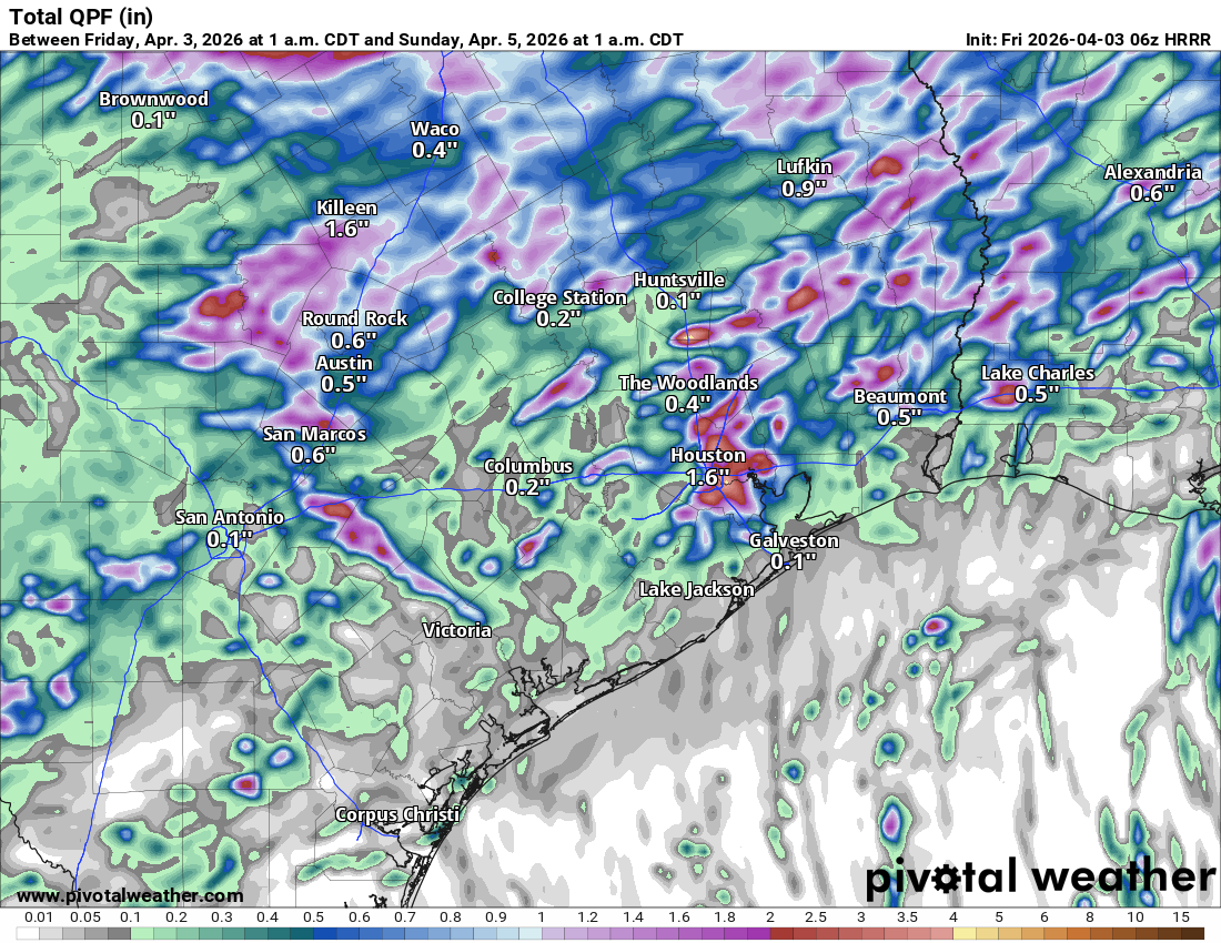
Don’t focus on the exact rainfall totals forecast from the HRRR model below, but you get the sense of how sporadic it may be, with some areas easily seeing 1 to 2 inches, while others see little to no rain at all.
Generally speaking though, we should see the rain trend toward less coverage and intensity from late evening to overnight.
Easter Sunday
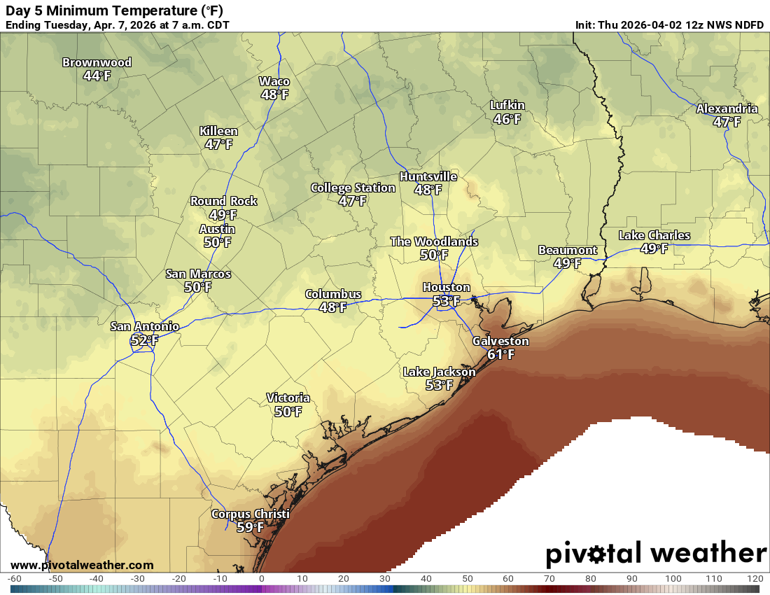
With the front stalled out near the coast or just inland, we should see at least some low clouds, drizzle, and rain showers around south and east of Houston. So, if you’ll be attending any sunrise services, you may need a poncho. Some steadier rain is possible on Easter morning south of the region, toward Matagorda Bay or Corpus Christi. Highs on Sunday will be held back due to cooler air and cloud cover and may not get out of the upper 60s in much of the area.
Monday
Clouds or a shower may even remain with us into Monday morning, but we should see brightening skies with highs in the low 70s. Morning lows will be in the 50s.
Tuesday and Wednesday
A generally nice pair of days is setting up for midweek with highs in the mid to upper 70s and some sunshine. We could see a few extra clouds on Wednesday, along with a chance of a shower. But for the most part it looks quiet. Our coolest morning will be Tuesday, with lows in the 40s and 50s.
Later next week
We look to get back to a more active spring pattern later next week with at least the mention of shower or thunderstorm chances each day. As of right now, nothing in particular is standing out, but hopefully we can get some parts of the area a little more rainfall. We shall see.