In brief: Drought conditions have begun to improve across Houston, and that should hopefully continue with more rain expected on Saturday and next week. It will also turn quite a bit cooler Sunday through Tuesday, with early spring type temperatures!
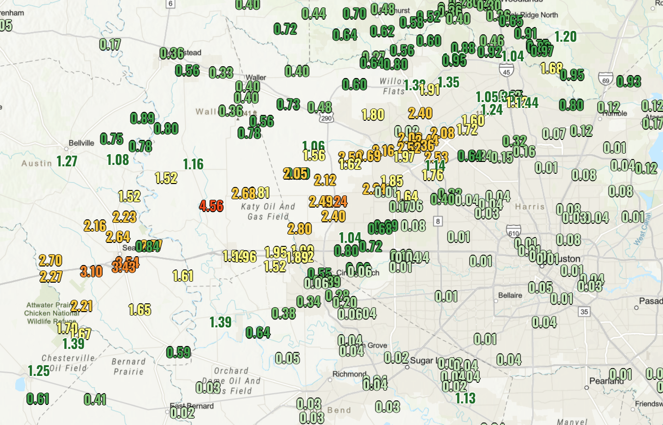
Let’s start with a drought update. The latest report dropped yesterday, and we saw notable improvement across the Houston area, as you’d expect after last weekend.
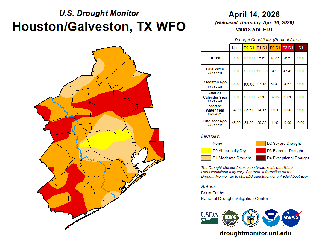
We should see additional improvement next week, assuming we get the forecast rain tomorrow.
Today
Watch for some patchy fog this morning in spots, but otherwise expect a mix of clouds and sun. We should push up into the mid-80s.
Saturday
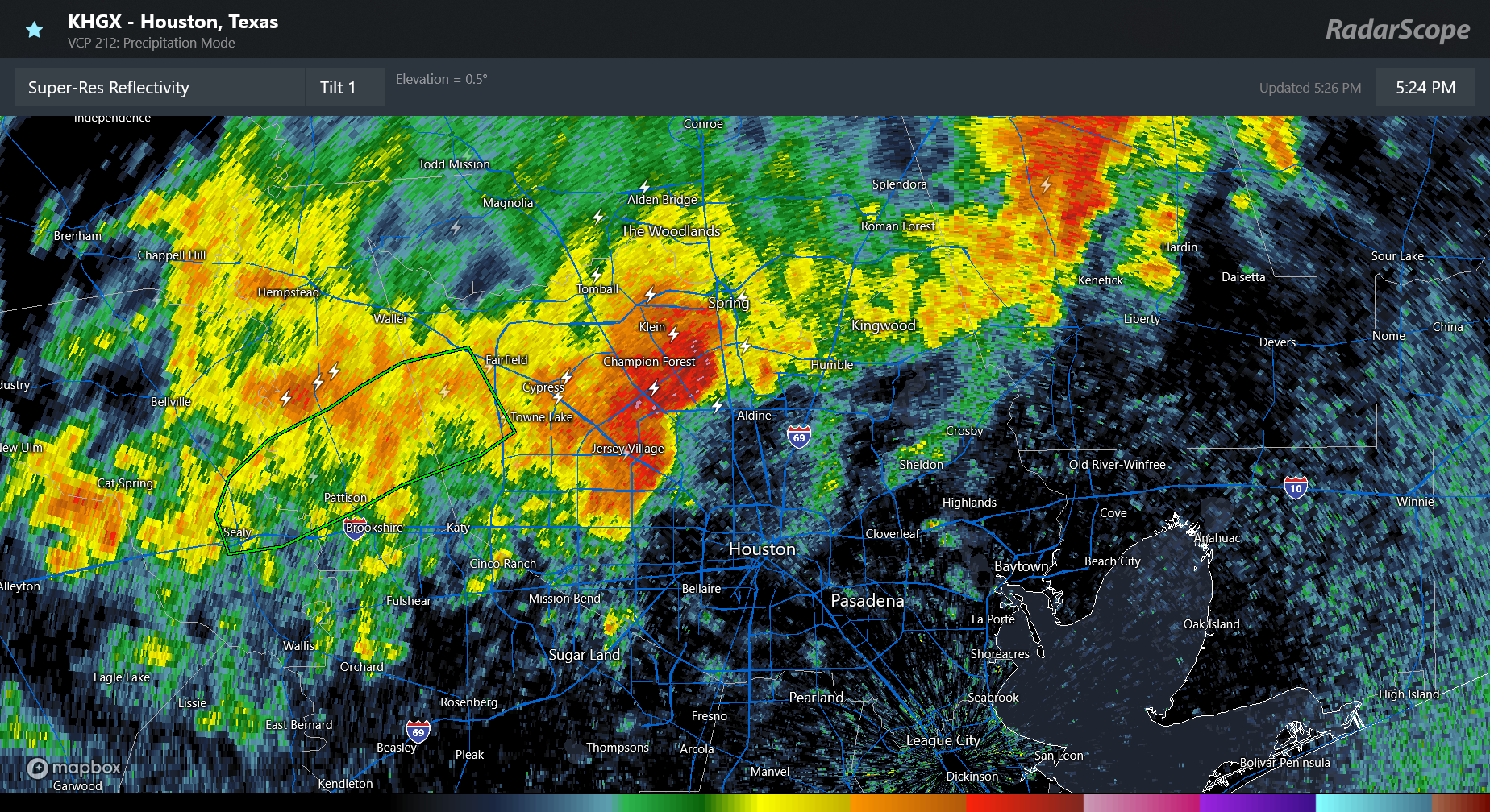
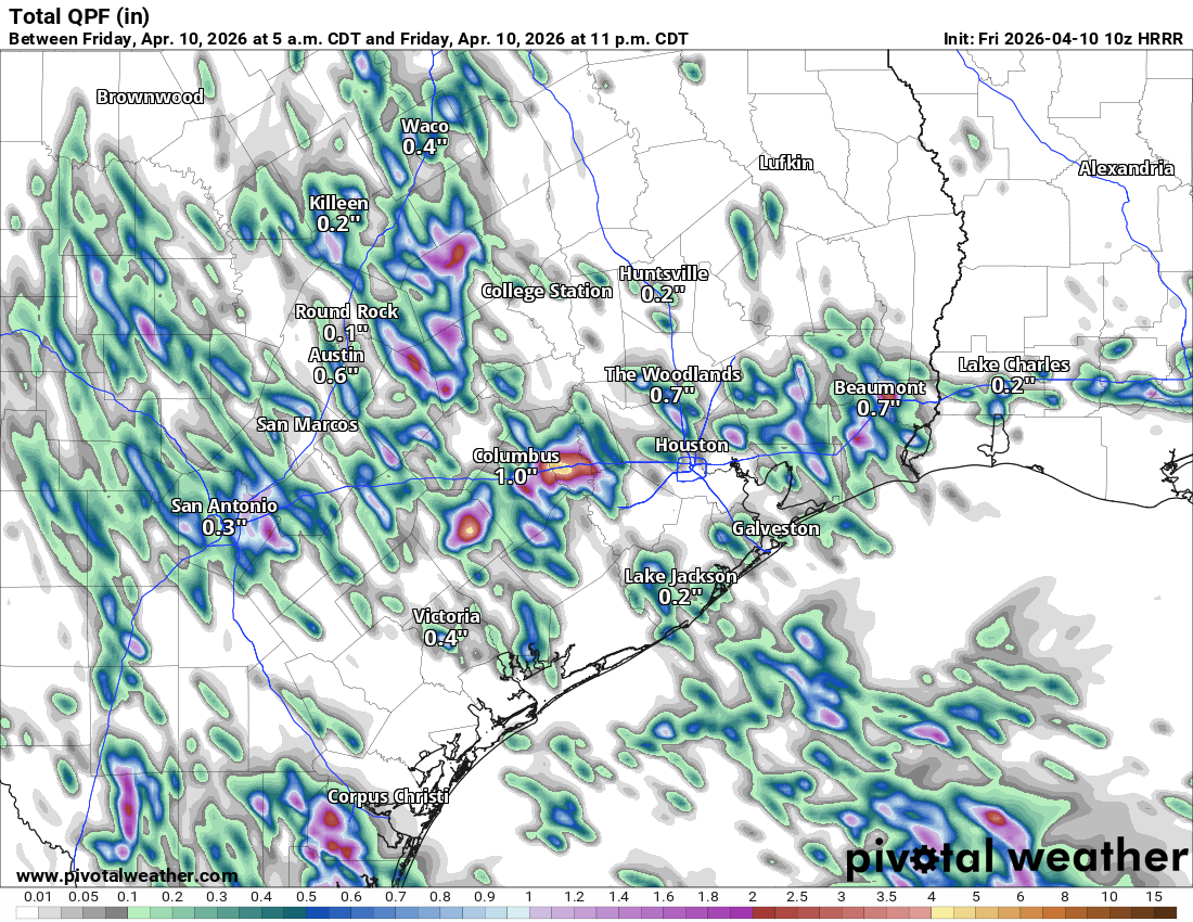
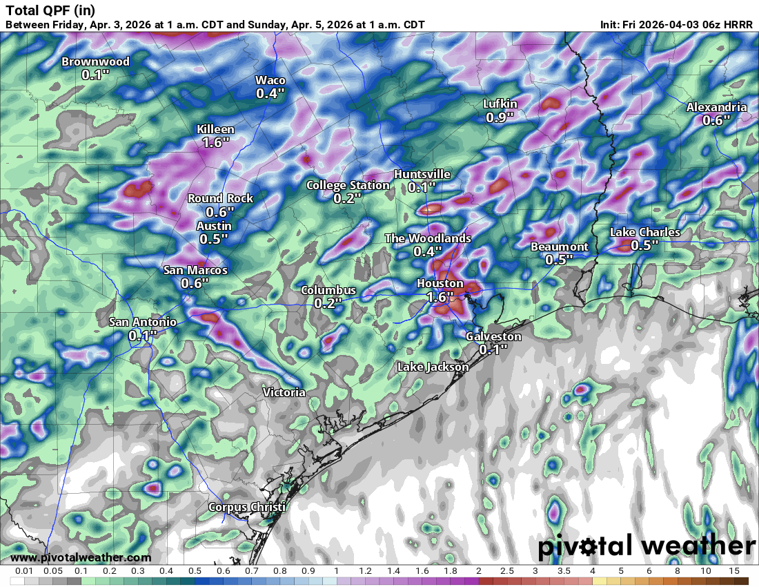
Alright, so tomorrow is the tricky forecast day all around. A couple showers are possible in the morning, but we aren’t currently expecting too much in the way of rain through midday. Showers will become a bit more numerous in the afternoon hours across the area. A few thunderstorms are also possible. Here’s a 4 PM forecast radar from the HRRR model just to set the mood a little in terms of what things could look like tomorrow afternoon.
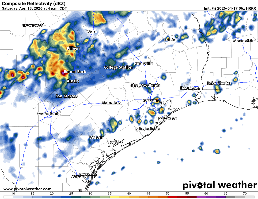
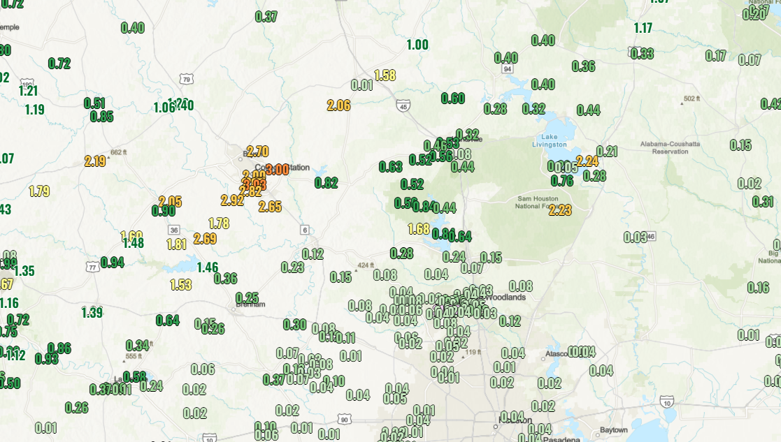
As the afternoon turns to evening, we should see more frequent periods of showers and rain across the area. The back edge of the rain will be slow to advance through Houston, probably not reaching the coast until Sunday morning. Generally speaking, we should see a quarter to three-quarters of an inch of rainfall across the area. Some isolated spots will get more, and it’s conceivable that a couple spots see less too. Any areas seeing more rain may also see localized street flooding.
For the Ironman Triathlon, Eric covered things in depth yesterday. There’s no real change in expectations in terms of temperatures and rather unpleasant humidity. I am hopeful that most adverse weather will hold off til the evening hours in The Woodlands, but the reality is that we cannot entirely rule out some showers or even a thunderstorm through the afternoon. The race organizers will be plugged in and act accordingly. We wish everyone participating, the best of luck!!
Temperatures, as noted will be kind of humid. At some point in the 4 to 7 PM timeframe, there’s going to be a significant drop in temperatures from the 80s into the 70s and eventually 60s. We may drop all the way into the 50s by Sunday morning.
Sunday
Showers will end through the morning. We may not see complete clearing on Sunday, but I will hold out hope for some sunny breaks. Wind gusts will be up on Sunday, around 20 mph inland and near 30 mph at the coast. It will feel like early spring!
Monday and Tuesday
We will quickly lose that slightly more refreshing air mass and transition back to more typical mid to late spring type weather conditions with onshore flow and a return to a shower or storm chance later Monday and especially Tuesday. Temperatures will remain cool with highs only near 70 Monday and mid-70s Tuesday.
Rest of next week
We warm back into the 80s by Wednesday and Thursday. With that will come additional unsettled weather. Shower or storm chances will persist across the area. However, many spots will remain dry I would assume; the storm chances will be more isolated than scattered or widespread.