The Atlantic continues to lie dormant as August begins, which is good news for those hoping to avoid hurricanes. While the quiet is almost certainly going to break eventually, each day that goes by in August and September without a storm is a good day.
Tropical outlook in a sentence
Things remain quiet in the Atlantic basin with no real development expected over the next week.
Where to watch in August
As the calendar flips to August, we get into the heart of hurricane season. Basically, mid-August through late September is our marathon stretch. For Houston, our risks in August are still mostly close to home.
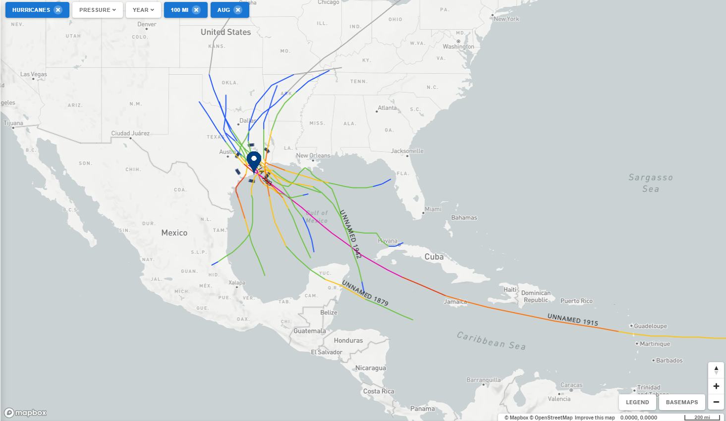
Using NOAA’s fantastic historic hurricane tool, we can get a sense of where to watch specific to Houston. Since the 1800s, Houston has had 10 hurricanes pass within 100 miles of downtown in the month of August. If you expand this to include tropical storms, the number increases to 17. With the exception of the 1915 storm (one that is worthy of a blog post of its own one day), all of August’s hurricanes in Houston formed in either the far western Caribbean or Gulf. In other words, while we watch the deep Atlantic and often discuss long-tracking hurricanes, they typically don’t impact us in August. That doesn’t mean they can’t, as 1915 proves, but our attention should be primarily focused close to home this month.
Yes, we’re talking tropical waves that struggle across the Atlantic, but hold together enough to ultimately develop in the Gulf. But we’re also looking for thunderstorm complexes that roll off the Gulf Coast into the open water. Or early season (weak) cold fronts that die off in the Gulf.
Notably, of the 17 total hurricanes and tropical storms (including Harvey) to pass within 100 miles of Houston in August, 15 formed in the Gulf or far western Caribbean. Again, closer to home is where the meat of our risk lies in August. This also means storms can form quickly, so it’s important to have a plan and preparations in place should something form.
Anything to watch now?
If we take a look across the Atlantic Ocean, there’s honestly not much happening at the moment.
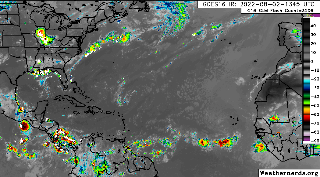
We have a couple waves that are disorganized out in the open Atlantic, but none that is currently expected to develop as it comes west. There are a handful of model ensemble members trying to sort of develop one of the next couple waves that emerges off Africa. But as of today at least, no reliable model guidance shows anything in the Gulf over the next 7-10 days or more. That said, with fairly frequent storm clusters hovering near the northern Gulf over the next week or so, I wouldn’t entirely rule out something trying to weakly organize, though I think it would stay east of Texas.
But for August 2nd, this is about as good as it gets. The Atlantic remains stuck on 3 named storms and is now beginning to run below average for the season in terms of storm intensity. Still, using that metric, 92 percent of the season lies in front of us. It’s still far too early to declare the season a “bust,” and it’s critically important to remember that one storm can spoil the whole season for any given place. Alicia did just that to Houston in 1983, the 5th quietest hurricane season on record. So be wary of making bold declarations on August 2nd.