Good morning! We really hope you enjoyed yesterday’s weather. It was truly sublime, though if you’re a seasonal allergy sufferer like me, it was not quite as nice as it could have been. Yesterday was the highest tree pollen value I’ve seen in Houston this year, and as you’d expect it seems to be following a fairly typical pattern for spring. Below is a chart of total tree pollen in Houston from January 1 through April 30 over the last 5 years, plus 2022 so far. Keep in mind that there is no data for weekends or holidays, and there are currently multiple missing days in March unfortunately.
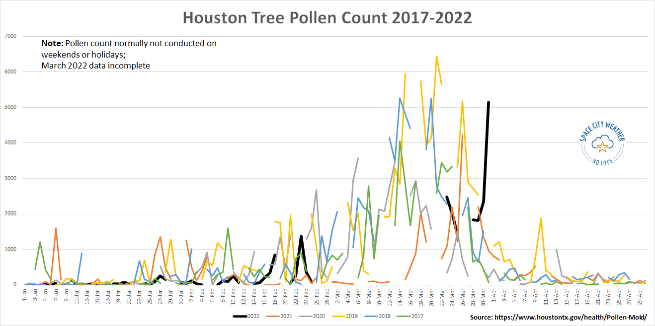
Where the pattern may be breaking down is on which date the “peak” of tree pollen occurs. I will confirm this once March’s archive is published, but if we go by what data we do have, the peak of tree pollen occurred like this in Houston:
| Year | Peak Date of Pollen |
| 2022 (so far) | March 31 |
| 2021 | March 26 |
| 2020 | March 6 |
| 2019 | March 21 |
| 2018 | March 14 |
| 2017 | March 14 |
Assuming yesterday was our peak day for pollen, it came rather late. Data in Houston goes back to 2013, and this year would be the latest peak since at least then. That peak date is contingent on numerous things like rain, temperatures, wind, etc. So each year will be different, obviously, but this year does indeed seem to be peaking late. Based on previous seasons, we likely have about 10 to 14 more days of really high pollen before things begin to fall off steadily. There is hope for us.
Today
On to the weather, and today should be another good one. We will likely see some clouds at times, but for the most part today will be classified as mostly sunny. Look for highs around 80, give or take a few degrees. Winds will be mainly light, but up just a notch over yesterday.
Weekend
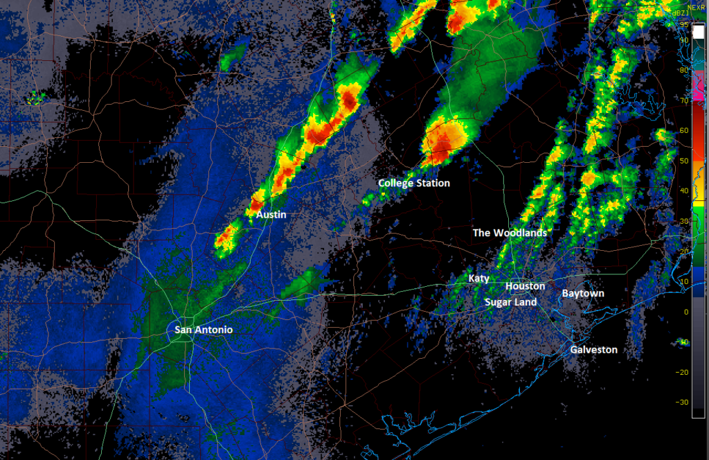
Saturday should be a fair day for most folks, with a decent amount of sunshine around. There will likely be some showers with a passing disturbance and approaching weak front, but many or most of you may not see much of anything come from that tomorrow. I’m guessing the clouds and shower chance will be highest in the morning hours, followed by clearing for the afternoon.
Sunday should be just fine with plentiful sunshine with daytime highs in the low-80s and morning lows around 60 or so each day (a few degrees cooler outside the city). Winds will be variable but generally 5 to 15 mph.
Early next week
Monday should begin fine with a mix of clouds and sun. We should be able to make the low-80s after a mild mid-60s start to the day. You will notice a bit more of an onshore breeze Monday, with 15 mph winds, and a bit gustier at times near the coast. Additionally, it looks like we’ll see some showers and thunderstorms develop on Monday afternoon.
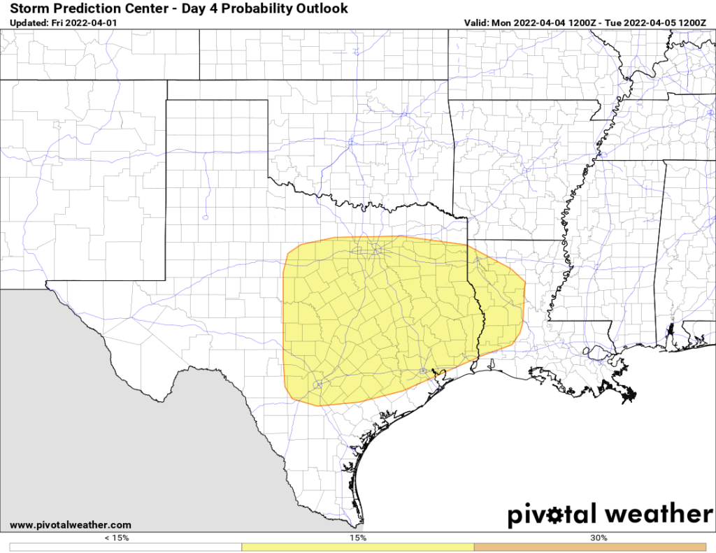
The SPC has published their day 4 severe outlook and included the Houston area, primarily north of I-10 as having a chance for severe thunderstorms. We will likely be dealing with some “capping” in the atmosphere, as we normally do down here in spring. This increase in temperatures with altitude normally helps limit our severe weather risk near the Gulf, as opposed to what is normally seen to our north. For now, while severe storms are possible on Monday, we are comfortable saying the highest odds may be north of the Houston metro area. We’ll obviously have an update on this Monday.
Tuesday and beyond
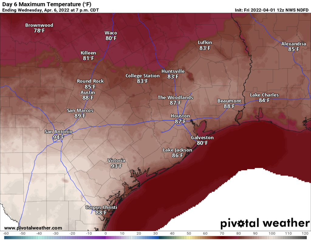
Any storms on Monday will occur well ahead of a cold front. That front won’t actually get here until Wednesday. So we may see lingering showers on Tuesday morning, followed by clearing and warm weather Tuesday, with low to mid-80s. Wednesday could be quite warm with slightly less humidity and sunshine. Wednesday’s high temperatures are forecast to be in the mid to upper-80s right now.
For those that want more pleasant weather, it should arrive for a couple days behind Wednesday’s front. We will see lower humidity and sunshine, along with slightly cooler temperatures. More on that next week!