Good morning. Our weather remains one of a battle between cool fronts and the onshore flow, and as a result we’ll see intermittent periods of nice weather broken by the possibility of storms.
Thursday
It’s a bit chilly across the Houston area this morning, with most of the region having fallen into the 50s. However, winds are swinging back around to the southeast, and this will allow moisture levels to creep back up today. Although skies should remain partly sunny, some light, scattered showers may move into Houston from the southwest later this afternoon. Highs should remain pleasant, in the low 70s. Overnight temperatures tonight should be about 10 degrees warmer with the renewed onshore flow.
Friday and Saturday
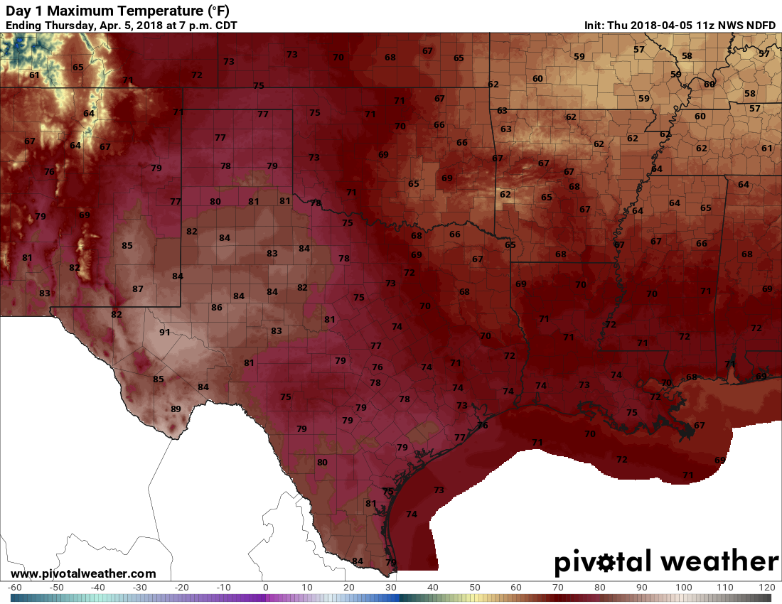
A warmer, muggier day with high temperatures probably reaching about 80 degrees. Rain chances, and later thunderstorm chances, will be on the rise during the afternoon and evening hours as a cold front approaches the area. However, a fairly strong capping inversion should set up over the area, and this may limit any precipitation until after the front moves into the region.

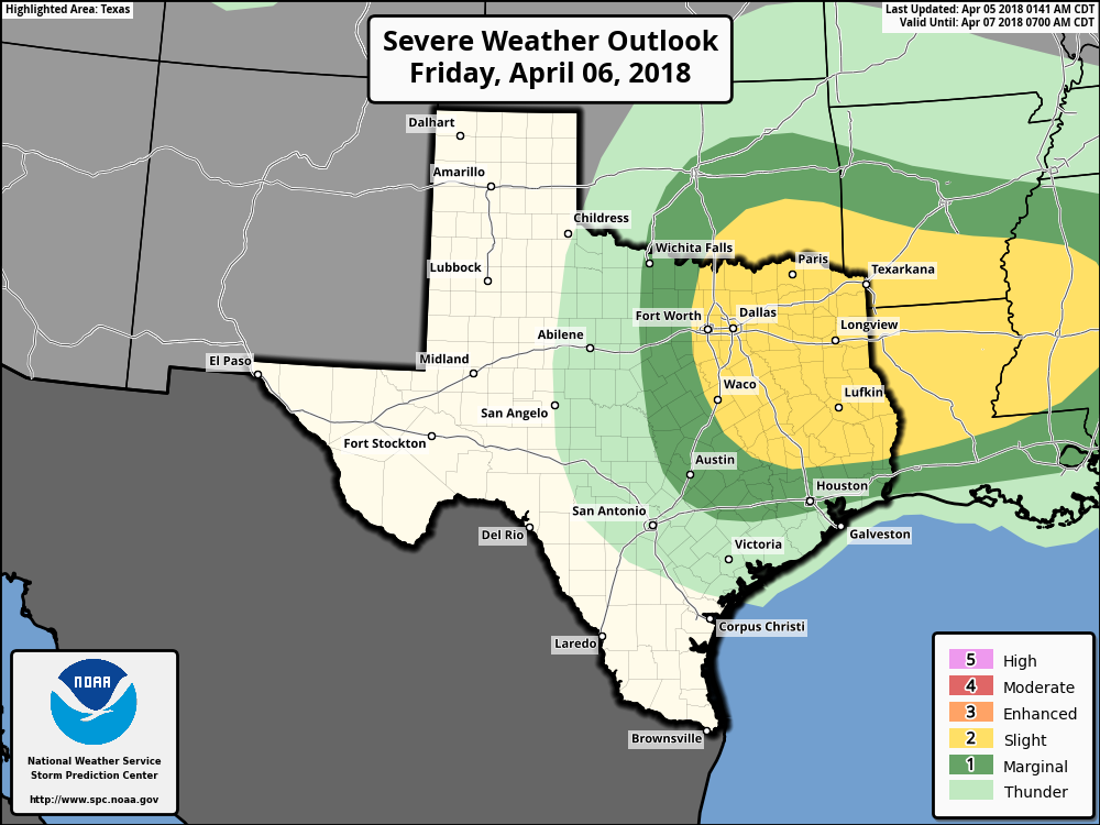
Timing remains a bit uncertain, but right now my best guess is that a line of thunderstorms (possibly severe, probably not for most) will move through the region between midnight Friday and sunrise Saturday morning—probably weakening as it moves toward the coast. I don’t expect significant accumulations, perhaps a few tenths of an inch of rain for most, with higher isolated totals. Showers should end on Saturday morning for most, leaving mostly cloudy skies behind, with a brisk northerly wind and highs of around 70 degrees.
Sunday
A nice spring day for the region, with highs in the mid- to upper-70s, and partly sunny skies. Definitely the better half of the weekend!
Next week
Temperatures should rebound on Monday, rising to around 80 degrees, before another cool front moves into the area. Right now there doesn’t appear to be that much moisture, because the return flow won’t have established itself fully yet. Therefore, I only expect a few, scattered showers with this frontal passage. Most of next week looks seasonal in the wake of this front, with highs in the upper 70s and low 80s, and lows in the 50s and 60s, and probably a lot of sunshine. We probably will see a warming trend by Thursday and Friday, heading into the weekend, with the possibility of storms returning.
Thank you for the continued updates!!
I saw today that the National Weather Service is predicting another difficult hurricane season for 2018. At this point, how accurate are these predictions when you’re looking at incoming data? I know that weather services hype up the drama to promote readership, but I would be interested to hear your opinion on this matter. Thanks so much!
What’s hurricane season look like, do I need to buy more sandbags. Maybe after the 4th time flooding. I’ll get out Dodge.