Skies will be sunny today and part of Wednesday, but after that our pattern will change as a slow-moving front approaches the area and brings widespread rain showers on Thursday in addition to the potential for storms. Some rain chances will linger through the weekend, which will see a mix of sunshine, clouds, and rain chances to go along with highs in the 60s.
Tuesday
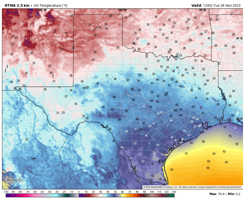
As high pressure holds sway today, we’re going to see mostly sunny skies. With a cool, light northeasterly flow in place, highs will max out at about 60 degrees for most of the area. As winds shift to come from the southeast overnight we’ll see a slightly warmer night, although most of the region is still likely to drop into the mid-40s, or even a bit cooler for areas further inland. This should be our last night in the 40s for several days.
Wednesday
If your skin has been feeling drier, fret not, as dewpoints start rising on Wednesday in response to an onshore flow. We’ll also see that atmospheric moisture in the form of some clouds, which will pretty much blanket the sky by the afternoon hours. Look for highs in the upper 60s. Rain chances should hold off during the daytime and evening, but we may start to see some scattered showers by around midnight or shortly after. Lows on Wednesday night will only drop to around 60 degrees.
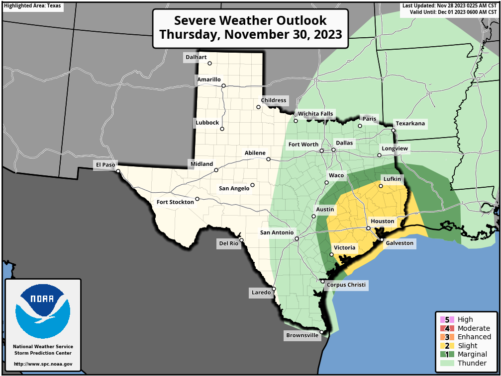
Thursday
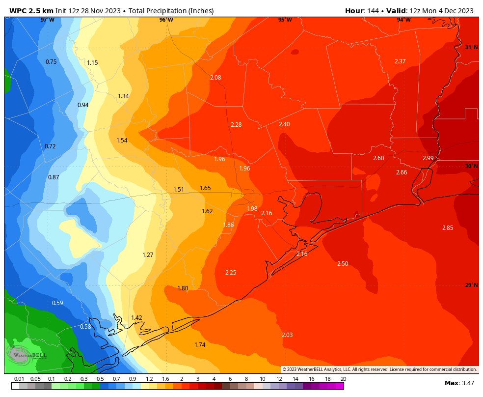
On Thursday the ingredients—increasing atmospheric moisture, an advancing cold front, as well as other factors—should come together to produce rainfall and potentially some storms. The best chance of heavy rainfall and storms will probably come on late Thursday morning into the afternoon hours, so that’s something to think about in regard to a potentially messy commute home. In addition to 1 to 2 inches of rainfall, we will also see decidedly gusty winds, perhaps above 30 mph. Rain chances start to slacken a bit by Thursday evening, and overnight lows will drop to about 60 degrees.
Friday
The front should move just offshore on Friday, and that may allow for a bit of clearing during the daytime on Friday. Right now my expectation is for partly sunny skies, highs in the mid-60s, and somewhat lower humidity. Lows on Friday night will drop to around 60 degrees or a bit warmer.
Saturday and Sunday
The weekend forecast remains a bit uncertain due to the proximity of the front to the coast, which may provoke some additional showers. For now let’s go with partly to mostly cloudy skies on Saturday, with perhaps a bit more sunshine on Sunday. Both days will likely see highs in the upper 60s and lows in the 50s. Each day will also have a decent chance of light to moderate rainfall, especially areas nearer the coast and to the east of Houston.
Next week
A reinforcing push of drier air should arrive later on Sunday or Monday, and this probably will give us a few days next week with highs in the 60s, lows in the 40s, and low- to non-existent rain chances. That will feel pretty much like December in Houston feels. Speaking of December, look for our official winter forecast later this morning.
Fundraiser
Don’t forget that we’re still selling merchandise and taking donations for our annual fundraiser to support Space City Weather. It ends this week so that all items can ship in time for Christmas. Thank you!


We’ve been burned over and over by the models for widespread decent rainfall amounts. Don’t expect much rain folks.
Yea, similar outcome(s) here in Magnolia area. Not long ago, the prediction was 2(+-) days of rain … ended up getting a mild 30 minute trickle on one day only.
Here’s the prediction as posted at Weather Underground – we shall see …
Thursday 11/30 – 100% / 0.99 in
Thunderstorms. Potential for severe thunderstorms. High 72F. Winds SSE at 10 to 20 mph. Chance of rain 100%. Rainfall may reach one inch.
Thursday Night – 71% / 0.08 in
Thunderstorms during the evening, then mainly cloudy overnight. Storms may contain strong gusty winds. Low 56F. Winds WSW at 5 to 10 mph. Chance of rain 70%.