In brief: In today’s post we discuss the potential for some scattered showers on Friday, which will then give way to an extended period of hot and sunny weather that will persist through next week. At least.
A surge of moisture?
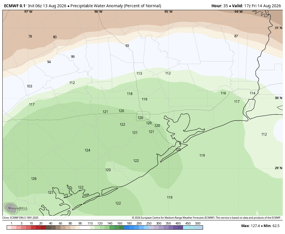
Houston remains more or less locked into a pattern of hot and sunny weather for the foreseeable future with one exception. On Friday we may see a burst of tropical moisture move inland from the Gulf, and this could bring some coastal showers into the region, especially for areas south of Interstate 10. Would I guarantee rain? No, I certainly would not. But with a very hot and dry pattern upcoming, it does represent a decent shot of precipitation before high pressure really asserts control.
Thursday
Expect hot and sunny conditions, with high temperatures in the mid-90s in Houston, with higher temperatures possible for inland areas, and weather a few degrees cooler near the coast. There is perhaps a 10 percent possibility of some showers briefly popping up. We will again see windy conditions this afternoon, with gusts picking up to 20 or 25 mph from the south. Lows tonight will only drop to about 80 degrees.
Friday
This is the day when conditions may align for some shower activity. If so we will likely see some precipitation develop offshore around sunrise, and then move inland into coastal areas during the morning hours. The questions are: How widespread will the showers be, and how far will they penetrate inland? And I’m not sure. My sense is that a few areas will see on the order of 0.5 inch of rain, and most of us less. With a few more clouds, highs on Friday may be 1 to 3 degrees cooler than Thursday, which isn’t saying much.
Saturday and Sunday
This weekend is going to be hot, sunny, and humid. Rain chances are likely 10 percent or less. Expect highs in the mid- to upper 90s across the region, with only the coast remaining slightly cooler.
Next week
I honestly don’t expect much to change next week. If anything our daily highs will tick up a degree or two higher. This kind of relentless pattern is why I wrote this post about August a couple of weeks ago.
The Atlantic tropics
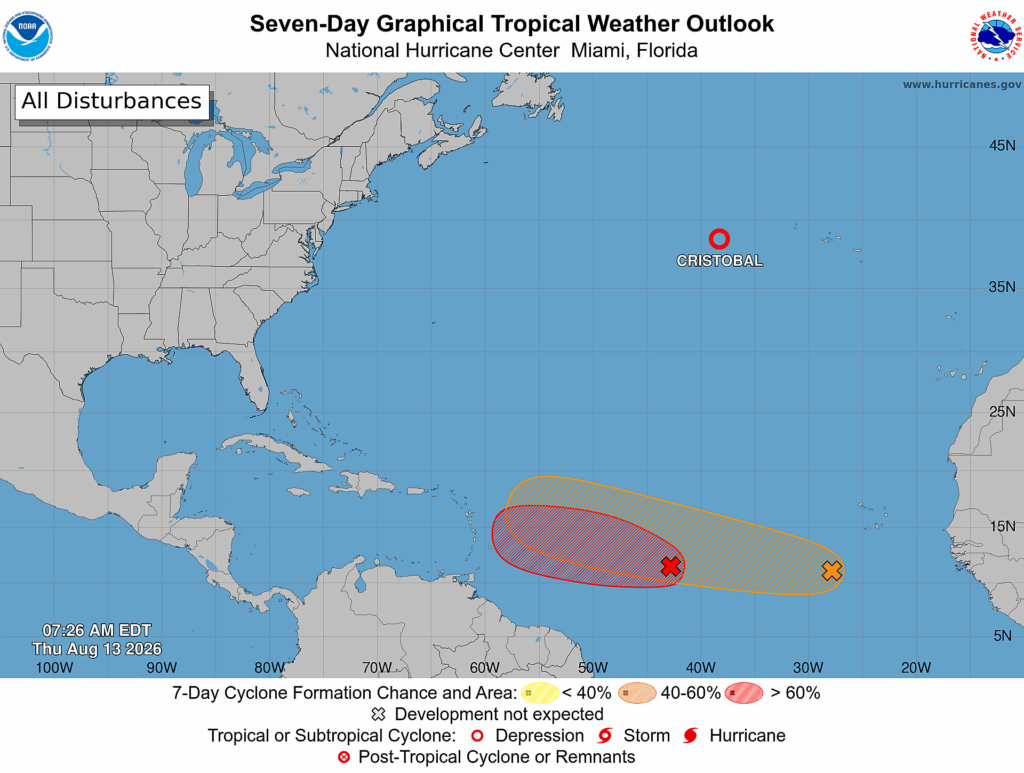
Did you know a tropical storm formed on Wednesday? Cristobal developed briefly in the middle of nowhere in the Atlantic, and then it promptly weakened. Not an issue. There are also a couple of waves in the “main development region” of the Central Atlantic Ocean, but honestly neither of them looks bound for the Gulf. If you want the full details on all of this, be sure and check our sister site The Eyewall. But the bottom line for Texas is that things look good for at least the next 10 days, if not longer.
