In brief: Houston’s last decent chance for rain showers for a bit will occur today with some isolated downpours likely later this afternoon. After that? Rain chances scrape the bottom of the barrel, as high heat persists across the region into most, if not all of next week.
Making lemonade. Maybe.
Do you ever squeeze an orange or a lemon and get to that point where you need just a little bit more juice but you don’t want to use a fraction of another? That’s today in weird metaphors that only Matt could come up with. We are attempting to squeeze out a little extra moisture and get some cooling downpours for the Houston area before August does its thing.
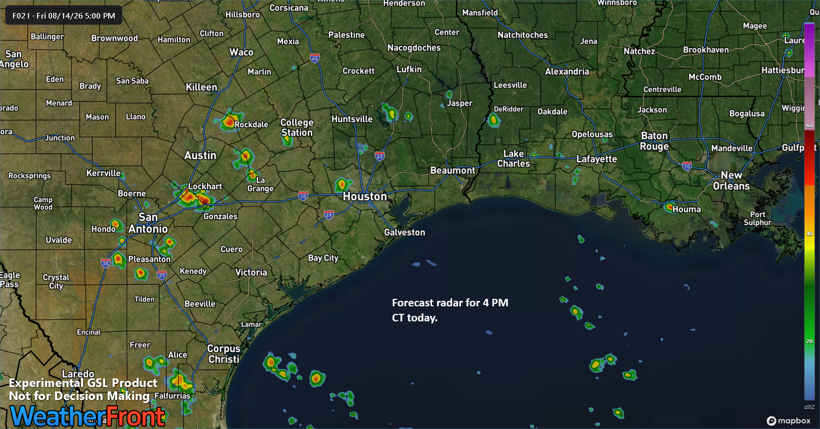
A small “blob” of moisture will enter Texas off the Gulf this afternoon and evening. As this happens, when combined with daytime heating and the daily sea breeze, we could begin to see a few pop-up downpours or thunderstorms develop. Given this little surge of moisture, it’s possible that some of these downpours could be rather heavy. So my advice is to carry an umbrella today, hope you get drenched for a little bit, and then settle in for the highest of high summer. Most places will see little to no rain but a handful of you may pick up a quick inch or two.
Summer, summer, summertime, time to sit back and unwind
The forecast through early to mid-next week is brought to you by the numbers 97, 98, and 99. Maybe 100. Those will most likely be the temperatures we see at IAH each day between now and then. The forecast is also brought to you by the number “zero,” which is roughly how much rain most of us will see after today and into next week. And it’s brought to you by the letter “H,” for hazy, hot, and humid.
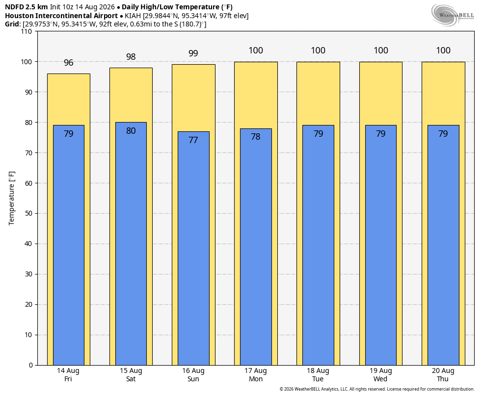
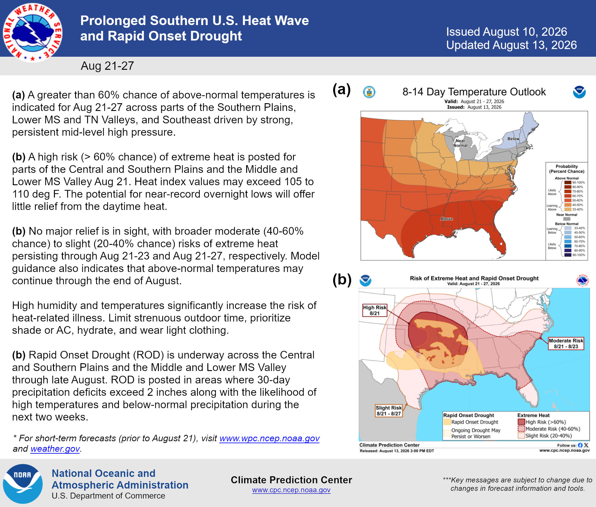
I won’t entirely rule out a few stray showers next Tuesday or Wednesday and again next weekend, but for the most part it looks pretty standard August over the next week. Obviously, it’s too soon to think about cold fronts, but in general it also looks like this basic pattern is going to continue beyond next week as well. Watch for emerging drought to the north of Houston also. The Houston area should be in mostly fine shape for a bit longer with regard to drought. The situation is such to our north that the NWS actually issued a summary on social media this week about emerging “rapid onset drought” in places like North Texas and the Piney Woods as heat persists into next weekend.
Bottom line: We’re stuck for a bit. Let’s hope some rain gets squeezed out later today.
