Quick note: If you missed Eric’s post yesterday, we’re excited to be selling t-shirts so you can rep the site around Houston. We’re also accepting monthly sponsorships for 2017. Thank you to those who have pitched in. We’re so very grateful for your continued support and loyal readership!
On to the forecast.
It’s Cold Front Day! Today is also apparently Mickey Mouse Day. And Push-button Phone Day. So why not make it Cold Front Day too? Who’s with me? Anyway, I digress. Let’s talk about how this unfolds.
Today & Saturday
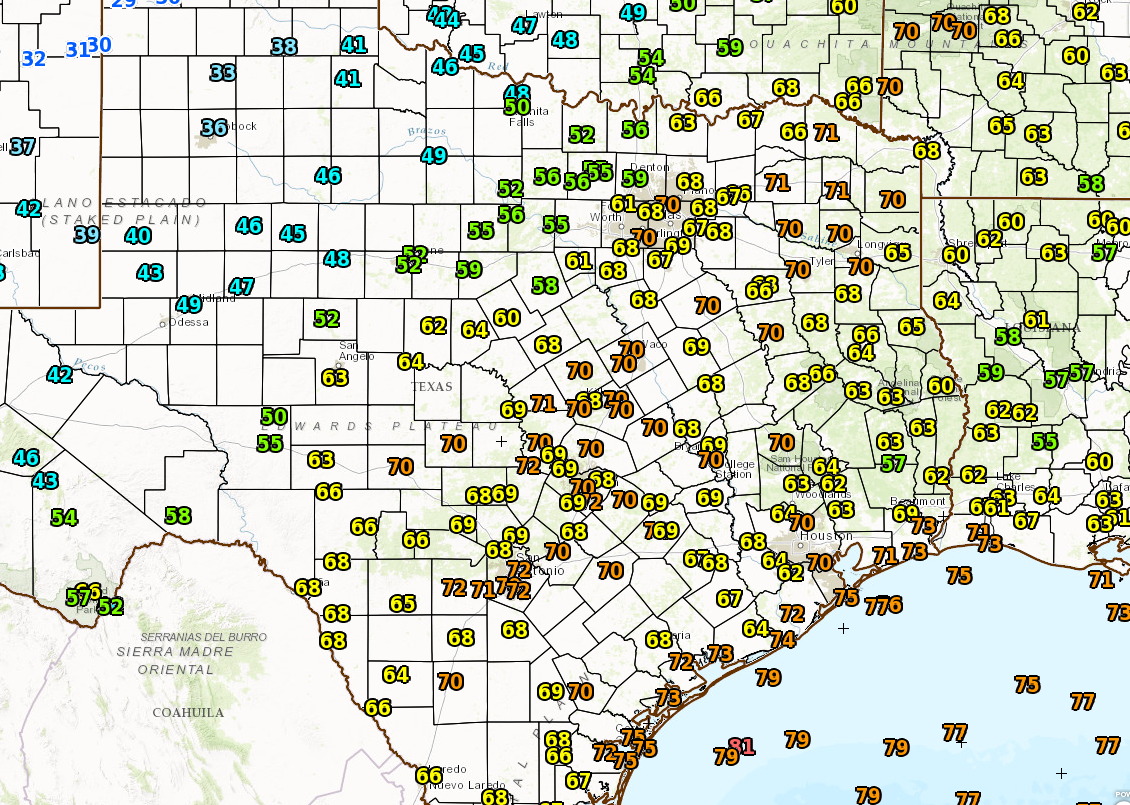
Starting this morning, no serious issues in our area, but it is warm. Temperatures are in the mid to upper 60s to near 70 in spots, with mid 70s at the coast! But look north and west. The front is moving through the DFW Metroplex as of 6:30 AM.
As we go into the afternoon, the front should approach our area from the north and west. We’ll probably see a patchwork area of scattered downpours and thunderstorms along the front as it moves through from northwest to southeast. There could be some sprinkles or brief showers around this morning, but steady shower chances should begin to increase for areas north of Houston by 11 AM or so.
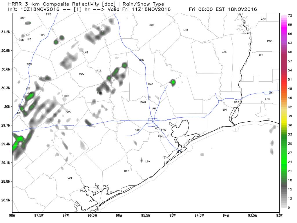
That shower & storm chance will arrive in Houston by about 1-2 PM I think. The front should get to the coast by about 3-4 PM. Most people should see some rain today, though there may be a handful of spots that somehow avoid it. Totals will be mediocre for most (about 0.2″ to 0.4″ on average), but a few spots could receive up to 0.75″ or 1″ with some persistent downpours.
Once the front is through, dewpoints and temperatures will begin to plunge. By Saturday morning, we’ll see temperatures in the mid 40s northwest to low 50s southeast and dewpoint temperatures in the low 30s.
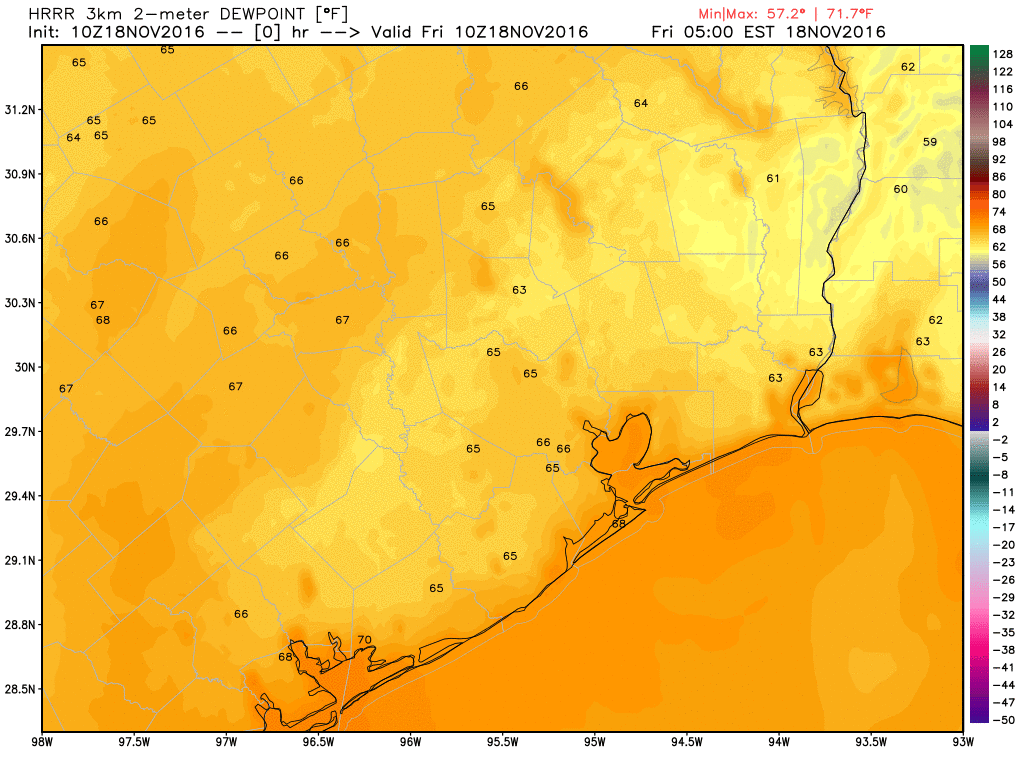
That’s some super dry air building in. In addition, winds will be blustery. Unlike other fronts we’ve had this autumn, this one will be our first true “norther” of the season. Expect north winds of 10-20 mph, gusting to 25-30 mph at times, particularly near the coast, where wind advisories may get hoisted later.
During the day Saturday, any lingering high clouds should quickly dissipate and it will be sunny, breezy, and it will feel like fall. High temps should top off in the low to mid 60s.
Sunday Into Next Week
Our coldest morning of autumn will be Sunday, when temperatures should drop into the 30s and 40s everywhere. Officially, Houston should hit 39-42 degrees or so at IAH Airport. Some northern and rural spots could hit the mid 30s. Raw model guidance for Conroe indicates that even low 30s are possible. For those that have been craving some sign of autumn and winter, it’s coming.
We’ll have another nice day Sunday with widespread low or mid 60s and another cool night into Monday morning, though warmer than Sunday morning. Temps warm back up Monday and Tuesday, perhaps well into the 70s or near 80° before our next front on track for Wednesday. This next front will have a little less muscle behind it than today’s front. Thus, I expect we’ll see pleasant temperatures for Thanksgiving weekend, but perhaps not as cool as we’ll see this weekend.
Space City Rewind
Just a quick note: We’re excited to unveil the first in what will hopefully be an interesting, enlightening, and fun series on weather history in Southeast Texas next week. Look for our first installment of the Space City Rewind on Monday. I think this is going to be a cool project and it’s a fun one I look forward to spending time working on and sharing with all of you in the weeks and months ahead.
Can’t wait for that cooler air!! I get to wear my hoodies!!! YEA!!
I hope it sticks around till thanksgiving. A hot humid thanksgiving is unpleasant.
I know others say it, but really, thank you for this site. You guys make any weather interesting and informative. I always look forward to your posts!
Thank you!
Thanks, Hunter!
Always great information, thank you. Can I ask about what your seeing for Tuesday, specifically around wind near the cost……….I have seen a few forecasts showing winds out of the south up to 20 MPH, seem strange for November and may cause me to have to cancel plans. What your opinion? Do you see these high winds happening?
Hi Brad. We’re going to see a resumption of onshore winds by Tuesday, and like we saw on Wednesday evening, they could be brisk at times given the pressure differential. With that said, I’d guess at most we’re looking at sustained winds of 15 mph on Tuesday, with gusts approaching 20 mph. Winds likely highest during late morning and afternoon.
Remember, wind forecasts are challenging so that’s a best guess.
Temperatures and dew points in the 30s? BRING IT ON!!!!!
I love northers! 🙂
And as others have said – thanks so much for your continued calm, measured approach to weather forecasting. I am interested in the history series.
Is it possible to support the site without buying a t-shirt? I wouldn’t mind doing that but I’m not a business so don’t need the advertising, and I can’t afford that level of support anyway. But I could definitely do something smaller…
There is a way to make donations without buying a t-shirt through Booster.
https://www.booster.com/spacecityweather
It’s a blue norther! you have to respect and carry on these Texas cultural terms, they’re part of what makes Texas a place apart. There a chinook in Alberta, and a scirocco in North Africa, and a mistral in France. The Blue Norther is ours!
Because I’m slow ;), why do these fronts always seem to come in with a wallop of rain? I feel bad for my yard wildlife and foliage because now I have standing water and the temperature will be dropping 30+ degrees…we needed the rain, just not at the same time as a temp drop.
Is there such a thing as a dry cold front?