Tropical Storm Cristobal formed earlier today, but Matt and I wanted to wait until after the 12z model runs came in before posting an update. Now that these forecasts are in (I promise I’m only going to do this once, but I can’t help myself) we’re going to look into our …
C R I S T O B A L C R Y S T A L B A L L
(If you hate that pun please direct your ire to a former colleague of mine). On to the forecast!
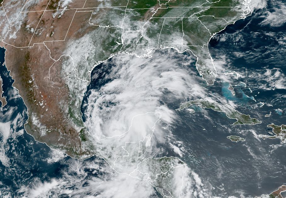
Anyway, the big picture story with Cristobal remains the same: It’s going to wobble around the Southern Gulf of Mexico for the next three or four days. In the process, it is going to drench parts of Mexico and Central America already hard hit by Tropical Storm Amanda’s crossing of the area this past weekend. And then some kind of system—still hard to say what, because we don’t know how much the center of Cristobal will interact with the Mexican coast—is going to get pulled north by Friday or Saturday.
The trend today has been a continued shift in the models bringing the center of Cristobal not into Texas, but Louisiana. This is evident in all of the major global models, including the European and GFS ensembles. Overall confidence is still very low, given that we’re not quite sure what sort of system is going to eject out of the Southern Gulf of Mexico later this week. But the models seem to be finding a more pronounced weakness in the high pressure over the southern United States allowing Cristobal to take a more northern path. Things could easily shift back toward Texas, but we wanted to confirm that that model this trend is legitimate in both operational and ensemble forecasts.
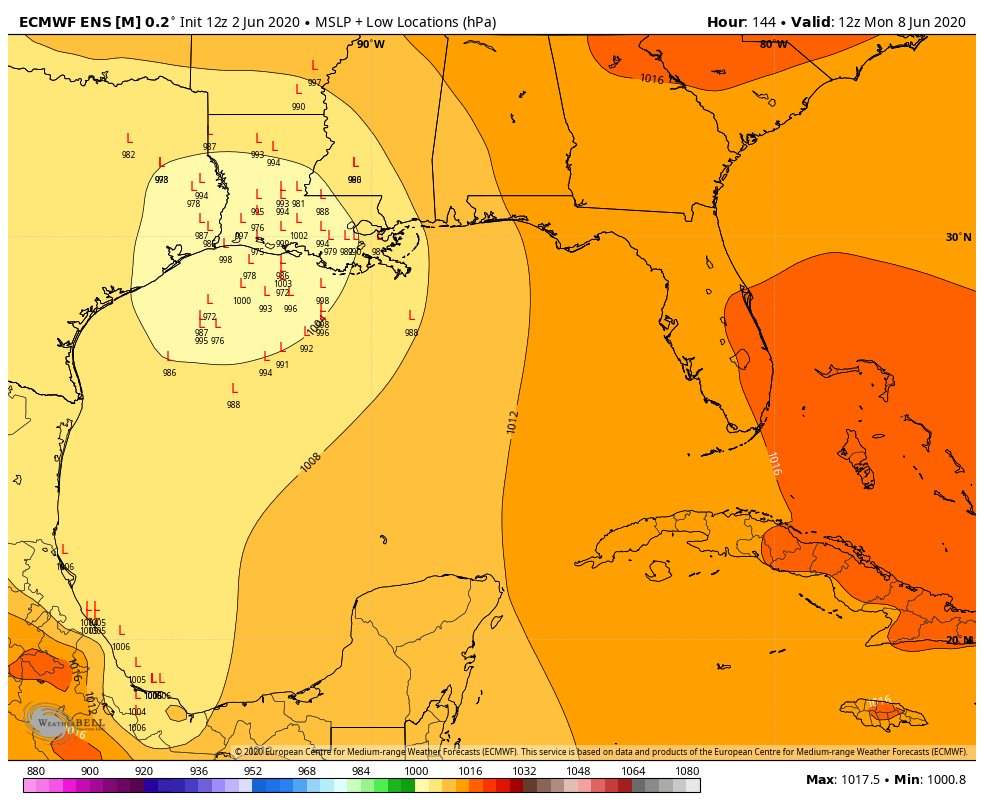
The global models seem to be less bullish on hurricane development as well, as a lot of the ensembles are now predicting a tropical storm, or a loosely organized storm moving toward the Gulf coast. Again lots of uncertainty here. But in this kind of scenario we would expect most of the rain and winds to be on the “wet” or right side of the storm. Effectively, this means that if Cristobal were to make landfall at the border between Texas and Louisiana, Houston may not see much of an impact.
The bottom line is that many different scenarios are still in play, but for Texas the trends are good. We all need to keep watching, however, and especially closely if you live in Louisiana or points immediately east of there.

I love the pun, and think about it…when are you going to be able to use it again? lol
I hope he has several opportunities due to the name not being retired.
Thank you for the thoughtful and considered information here! I always appreciate your warnings that sometimes we just don’t know what will happen yet.
Eric, I live in Beaumont. what might this forecast mean for Beaumont? Lots of rain but still west of this projected path or?
If it hits in Louisiana, you will be on the clean side of the storm. You won’t get much of anything if anything at all.
Thanks for the update Eric!
I don’t “tweet.” Regarding the pun, “AAAAARRRRGGGGHHHHH”
Forgot, thanks much for the update! Keep us posted
Thanks! Still following, puns and all!
What, if anything, is the potential impact of this storm on the heat potential of the Gulf? After Cristobal passes, I would think that the Gulf’s heat potential would be less, though of course in the heat of June, it would probably replenish rather quickly? I really don’t know, and am just guessing here.
Cristobal crystal ball..love it!😁
Bwa ha ha ha ha!!!! We LOVE puns in this house. Thanks for continuing to sprinkle your clever in with your insight!
Cristobal Crystal Ball! Hilarious! I love it! 🤣🤣🤣
As a writer, I LOVE puns!