As expected in the wake of Monday night’s cold front, it is a chilly and windy morning, with temperatures ranging from the mid-30s inland to around 40 degrees along the coast. Winds will make it feel much colder, with recent gusts of 25mph recorded near downtown Houston, and 39mph in Galveston. Please bundle up this morning!
Tuesday
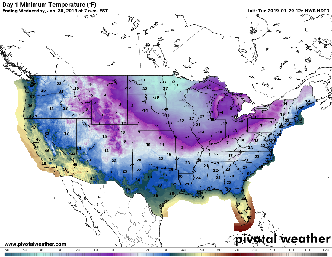
Drier air will continue to blow in today, making for a clear and sunny day with a high near 50 degrees. With persistent northerly winds, however, it will feel quite chilly all day long. If you think this is cold, however, be glad we only received a glancing blow of the cold air moving down into the Midwestern, Eastern, and Southeastern United States. Check out these minimum temperatures for Tuesday night and Wednesday morning—when most all of the Houston metro area should remain just above freezing.
Wednesday
As high pressure slides to the east on Tuesday night, an easterly flow on Wednesday should begin to bring some clouds into the area, and these will initially blunt a warm-up of the region to some extent. Expect high temperatures in the 50s on Wednesday, and only the 40s on Wednesday night under mostly cloudy skies.

Thursday and Friday
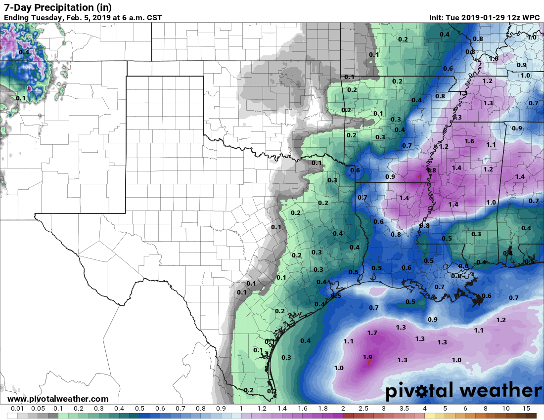
From Thursday onward, Houston’s forecast will mostly be one of warmer, humid, gray and on-and-off wet conditions. But not too wet. This pattern will result from a combination of a strengthening onshore flow, which will pump up atmospheric moisture levels, and a series of weak disturbances moving through the upper atmosphere.
For Thursday and Friday, this means highs ranging from the mid-60s to 70 degrees, and overnight lows generally in the 50s. Both days will have moderate rain chances, in the range of 30 to 40 percent, but accumulations should range on the order of a tenth or two of an inch of rain.
Saturday and Sunday
This pattern will persist into the weekend, it appears. We may see some sunshine peeking through on Saturday, but rain chances will remain in the 30 to 40 percent range on both Saturday and Sunday. Again, the forecast models aren’t too bullish on accumulations, so most people shouldn’t see more than a couple of tenths of inch of rain, if that.
As highs climb into the lower 70s, we’re really going to feel the warmer weather at nighttime. Lows by Saturday and Sunday nights should be at or above 60 degrees, which is nearly 20 degrees warmer than normal for this time of year—which is usually the dead of winter.
Next week
For now, it appears this warmer, grayer, and slightly wet pattern will stick through Tuesday or Wednesday of next week, before a cold front comes in to clear us out and cool us down. The timing on that remains iffy.
Ugh.
I just need to hardscape our property. I had to jump start the mower Sunday just to let it run for a bit. 🤣
#blameitontherain
Is that a -39 I see in northeastern SD (Aberdeen?)???
I noticed in the Berkeley Earth map of world surface temperatures, one of the few places on Earth that was colder than “normal” in 2018 was the area of western Canada and nearby U.S. states like Montana and North Dakota. I wonder if this is because the change in climate is allowing more of these pushes of arctic air into these areas.
http://berkeleyearth.org/2018-temperatures/
🙂 Fairbanks, AK was at a “sultry” 3 F ABOVE zero this morning. Go figure. :-). Glad I’m here!
🙂 And Winnipeg was absolutely “sizzling” at -32 F with a “dangerous cold warning” due to a wind chill approaching -50 F 🙂
Note that it’s REALLY cold when deg F = deg C at 40 below zero
That’s why the locals call it “Winterpeg”.
Eric, I’ve noticed practically all the storms (especially the squall lines) in the past three months have come during the night. Is this typical for late fall and winter?
I’ve read about the earth’s magnetic poles reversing several times over the eons. Is the polar vortex related to this?
Nope
That’s very much a long-term thing. We’re not sure how fast it happens (and geologically ‘fast’ is not necessarily fast to people), but there’s evidence that it’s preceded by a period of low magnetic field strength. Right now, Earth’s magnetic field shows no signs of weakening, so I wouldn’t worry.
That said, the magnetic field has little interaction with meteorological weather. I’d be much more concerned with the loss of protection from solar storms and electromagnetic radiation, since I’m pretty sure that would screw up electronic communications something awful.