Houston will see peak heating the next couple of days—with nearly all of the region experiencing triple digit temperatures away from the immediate coast—before a dominant high pressure system starts to progress eastward. This should slowly start a return to somewhat more normal weather, which is to say by the middle of next week we could be in the mid-90s, with decent rain chances.
Wednesday
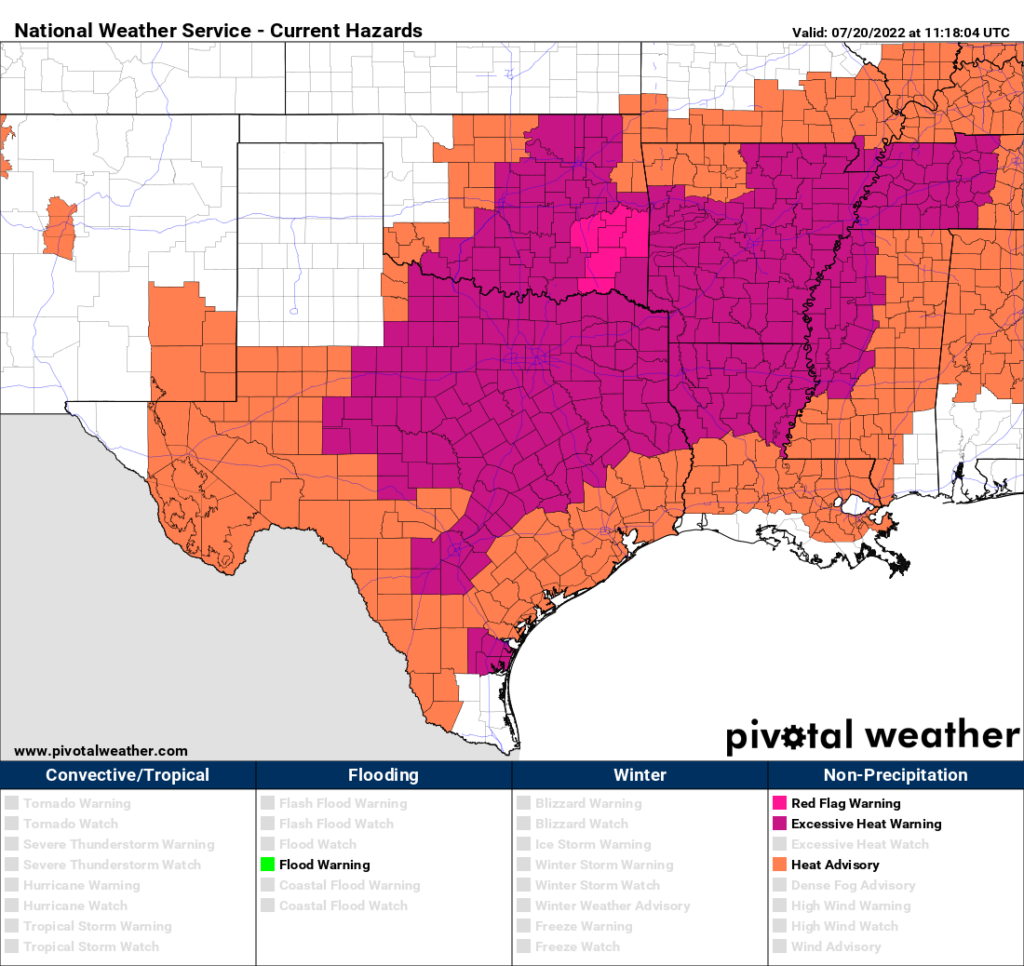
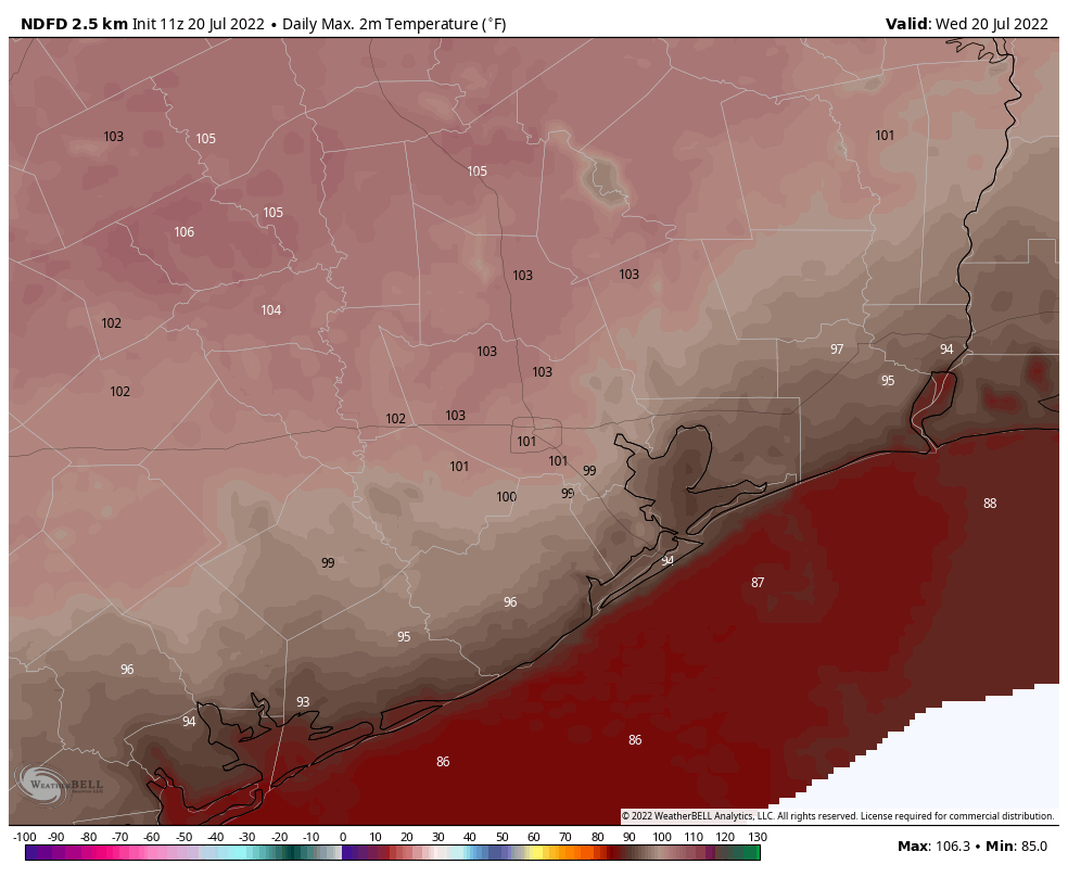
An excessive heat warning is in effect for inland counties today, including the cities of Crockett, Madisonville, Huntsville, Caldwell, College Station, Bryan, Brenham, and Navasota. This means these areas could see high temperatures of 105 degrees or above, with dangerous heat levels due to humidity. The rest of the region should see highs of around 100 degrees, or a bit higher, with only the coast remaining in the 90s. Skies will be sunny, with southerly winds at 5 to 10 mph, and higher gusts. Lows tonight will not drop below 80 degrees.
Thursday
Another brutally hot day, similar to Wednesday.
Friday
By Friday the high pressure system should start to back off a little bit, and this should open up the potential for a few isolated to scattered coastal showers. However, I don’t expect these rains to make it past Interstate 10. Most of the region should otherwise see mostly sunny skies, with highs in the upper 90s.
Saturday and Sunday
The weekend should bring highs in the upper-90s for much of the region, with mostly sunny skies and only slight 10 to 20 percent rain chances.
Next week
After starting in the upper 90s, temperatures will be slow to come down next week. But by Wednesday or Thursday we could start to drop back toward the mid-90s, and with a few more clouds begin to see the more widespread development of showers and thunderstorms. For now I’d guess rain chances most days will be in the 30 percent range, but there’s just no way to tell with much precision at this point. The bottom line is that the next six or seven days look pretty dry, in terms of rainfall, but there is least some potential for change after that point.
Hoping this ridge will move soon so we can get some different weather. Everyone gets depressed in the winter from clouds, but constant sun and heat really bum me out. Usually we get some nice summer pop up storms to mitigate the constant sun, but this year is terrible. Maybe next month will bring us variety and some desperately needed rain. Been a little hard on us who like to grow our own food.
44-year Houston resident and I have never in my life felt sad during a cloudy winter. It feels joyful, especially compared to the misery that is June through September. Can’t wait for gray overcast days in the 40s. Best time of year.
I feel miserable in winter for sure. Which is why I moved further south. Cold weather and cloudy days make me depressed. This heat is terrible but Im not depressed.
At least it’s almost August. We’ll be talking about the first front before you know it.
Also discussion of tropical systems developing in August
Driving a 18 wheeler at night is best the heat is on in Texas plus fires and smoke heating up thing’s still have to be in that day Time run tho
Am seeing slot of snakes out over 5ft Long crossing that highway day and night in Texas highways