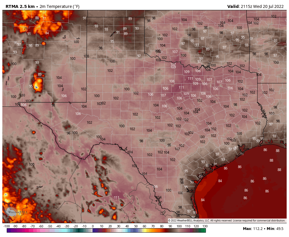
Good morning. The month of July is now two-thirds over, and if the month ended today Houston’s average temperature of 88.6 degrees would rank as the warmest July on record by nearly a full degree. I’m now confident we’ll set this record for July.
Alas, there is not much good news I can offer today except this: We’re now reaching the historically warmest part of the summer—from about July 20 to August 20. Why is this good news? For the optimist in me, this means we can at least begin to dream of fall.
Thursday
With high pressure more or less overhead we’re going to see another sweltering day, similar to Wednesday. Expect highs in the low 100s for inland locations, and upper 90s along the coast. Skies will be mostly sunny, with a less than 10 percent chance of rain. Winds will be out of the south at 5 to 10 mph.
Friday
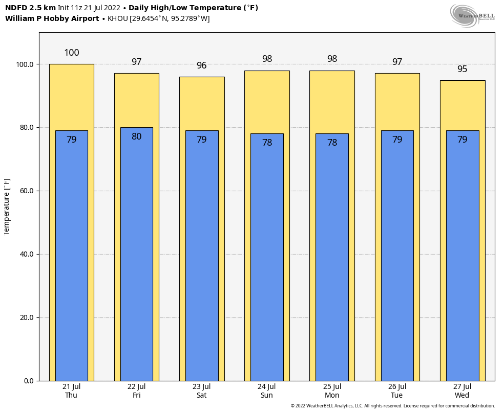
As the high starts to back off slightly, a disturbance may approach the area from the east on Friday. This will have modest effect on temperatures, perhaps limiting highs to the upper 90s. It will also produce a 20 to 30 percent chance of rain from a passing shower. Good luck!
Saturday and Sunday
The weekend is going to be hot, with mostly sunny skies and highs in the upper 90s to 100 degrees for most of the area. Rain chances are probably in the 10 to 20 percent range for coastal areas, with lesser chances further inland.
Next week
As we get deeper into next week I’m still anticipating a slight moderation in temperatures as the high pressure system slowly moves eastward. I expect much of the region to see highs in the mid- to upper-90s, with a slight 20 to 30 percent chance of afternoon showers or thunderstorms. It won’t be much relief, but it will beat what we’ve been experiencing.
You guys are fantastic. Thank you for everything you do.
Kindest regards,
Daniel B. Weber
Late July, early August, may be technically the hottest, but I can’t stand September. School’s back in session. It’s one of the “ber” months; September, October, November, December. Football, a Fall sport, is underway. I’m just DONE with Summer come September.
I’ll take the other side of the coin – I love the “ber” months, including September. September means that all the kids across the country are back in school (a great thing).
It means smaller crowds at the airport, vacation prices are softening, and tourist spots are less jammed. Cooler weather in other parts of the country also means a better experience being outside. It is still hot here in September but that’s why I go on vacation.
Thanks for the unbiased info, guys! Really appreciate the effort and research you put into every post.
How do you determine “average temperature for July” to be 88 degrees? Is that the overall temp (low + high average for each day), or the average HIGH temps for the month? Am I making any sense?
Monthly mean of the daily value of midpoints between the daily lows and highs.
You add the daily highs and lows, then divide the number by 2. For example: if the average high for a month is 95 and the average low is 76, you add them up to get 171. You then divide by 2. The result is 85.2 for the average mean temperature.
There were days it was in the 100’s and any other day is in the high 90’s. The average is 90. IMHO. That’s what I’m saying that’s what I’ve determined and you’re not going to change my mind. Screw Texas weather we are looking to move ASAP.
Don’t know why you won’t accept Eric’s calculation for avg temp since he is using the official way of calculating?